Sentinel-1D delivers stunning images just two days after launch
A satellite called Sentinel-1D lifted off on November 4, 2025, riding an Ariane 6 rocket from French Guiana. Within two days it was capturing high-resolution radar snapshots of Antarctica, South America, and even the city of Bremen in northern Germany.
This early performance matters because the world is keeping a close watch on glaciers, sea ice, and coastlines.

Radar satellites help track these changes in any weather, day or night. That makes them crucial tools as warming trends speed up and sea levels continue to rise.
Early images from Sentinel-1D
Sentinel-1D carries a synthetic aperture radar instrument that stretches about 40 feet (12 meters) long.
Two days after launch, the satellite recorded images across the Antarctic Peninsula, Tierra del Fuego, and the Thwaites Glacier. Hours later, it scanned Bremen during a morning pass.
All of this data was sent to a ground station in Matera, Italy, and processed in less than 50 hours after launch.
Sentinel-1D also carries an Automatic Identification System that helps detect ships and signs of sea pollution, and this system picked up vessels near Antarctica during its early passes.
Satellite captures data in record time
According to Nuno Miranda, European Space Agency’s (ESA) Sentinel-1 mission manager, the images are of unprecedented data quality for a first-light acquisition.
“These images have been downlinked and processed within an exceptionally short timeframe. Some of us remember that when Sentinel-1B was launched, it delivered its first radar images within two hours of activation,” said Miranda.
“Sentinel-1D achieved this in an even faster time, setting what we believe is a new record for space radar. This remarkable performance reflects the dedication and exceptional preparation of all the teams involved,” he added.
Radar instruments see through clouds, storms, and polar darkness. That allows them to keep watch on regions where traditional optical satellites often fall short.
Who’s behind the Sentinel-1D images
Only after the excitement of the satellite’s first pictures did ESA leaders step forward to talk about what the moment meant for them.
“This is a great achievement and I am so pleased to see these results from Sentinel-1D,” said Simonetta Cheli, Director of ESA’s Earth Observation Programs. “It really places the data we receive from our innovative missions in the spotlight – it is data that we, as a society, rely upon as we continue to discuss and take action on climate change.”
She added that the data is also needed in applications for understanding and studying Earth. She thanked the team across ESA, industry, and European institutions for delivering work of such high quality.
ESA’s Sentinel-1 project manager, Ramón Torres, also spoke about what the milestone meant to the engineers and scientists who built the satellite.
“Unveiling the first images from Sentinel-1D is an incredibly emotional milestone for all of us,” he said. “The sense of awe and fulfillment goes beyond the thrill of liftoff itself, because seeing those breathtaking images from the SAR instrument brings our hard work to life.”
Closer look at fragile ice
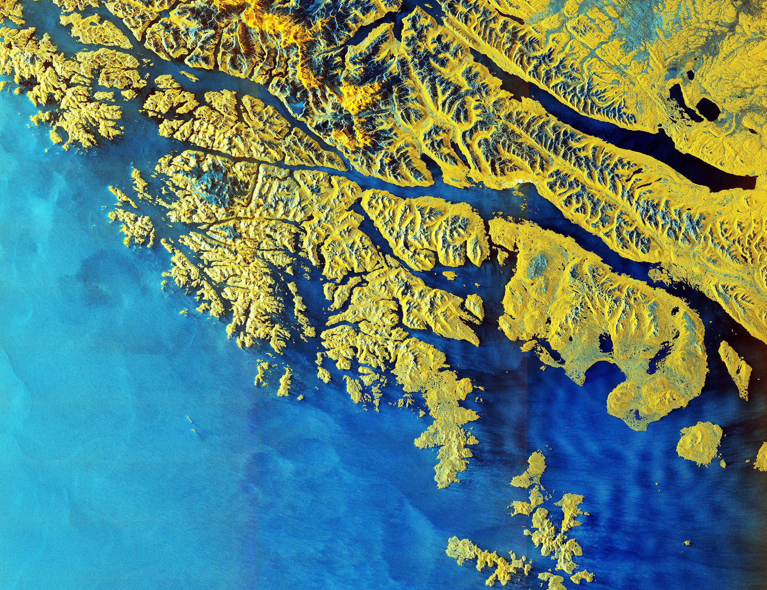
The Antarctic Peninsula stretches about 800 miles (1,300 kilometers) and sticks out from West Antarctica like a long, icy arm. Its ice sheet rests on a chain of rocky islands, and its small, fast-changing glaciers make it especially sensitive to warming.
The radar image shows a stark boundary between the ocean and the frozen landscape.
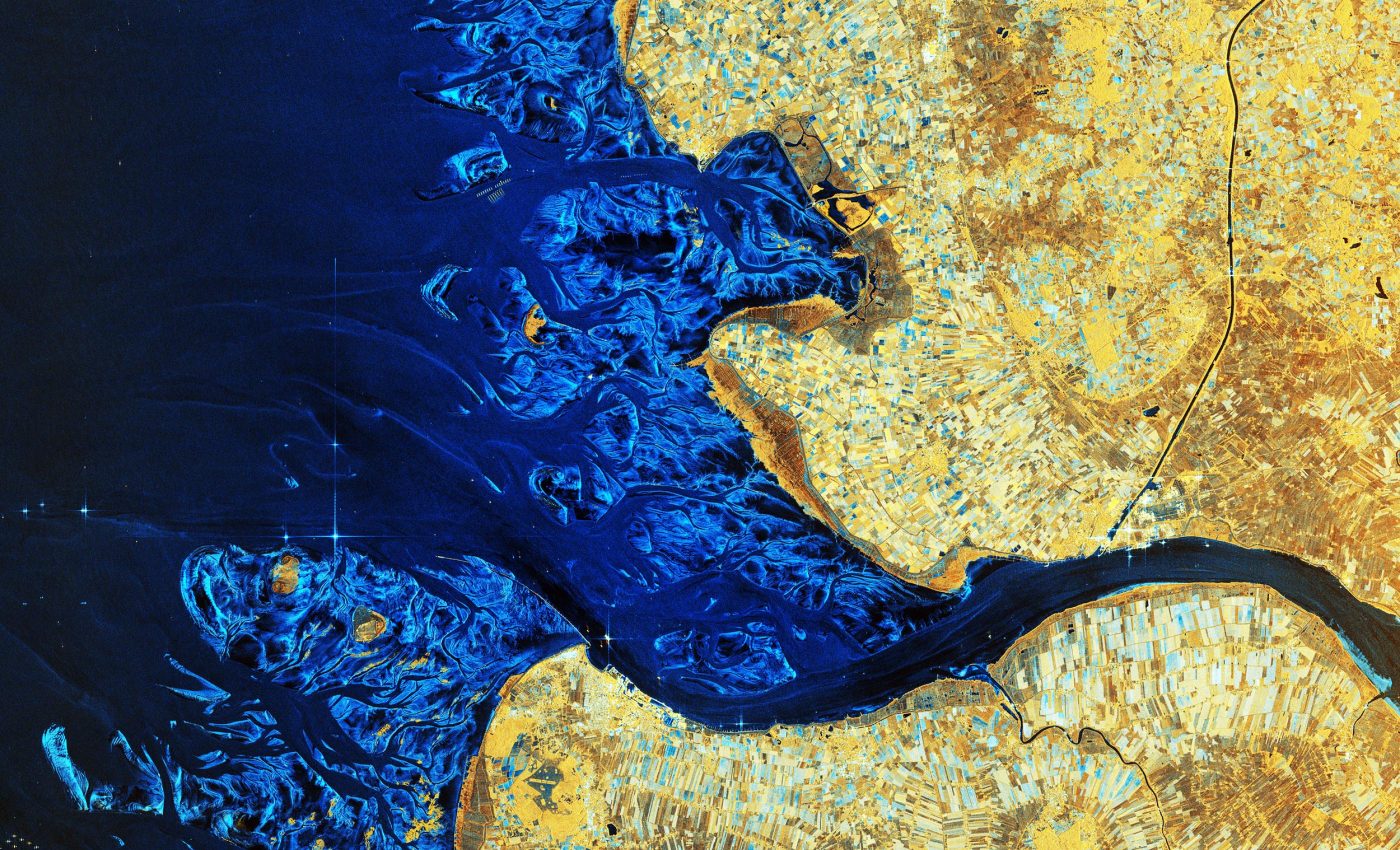
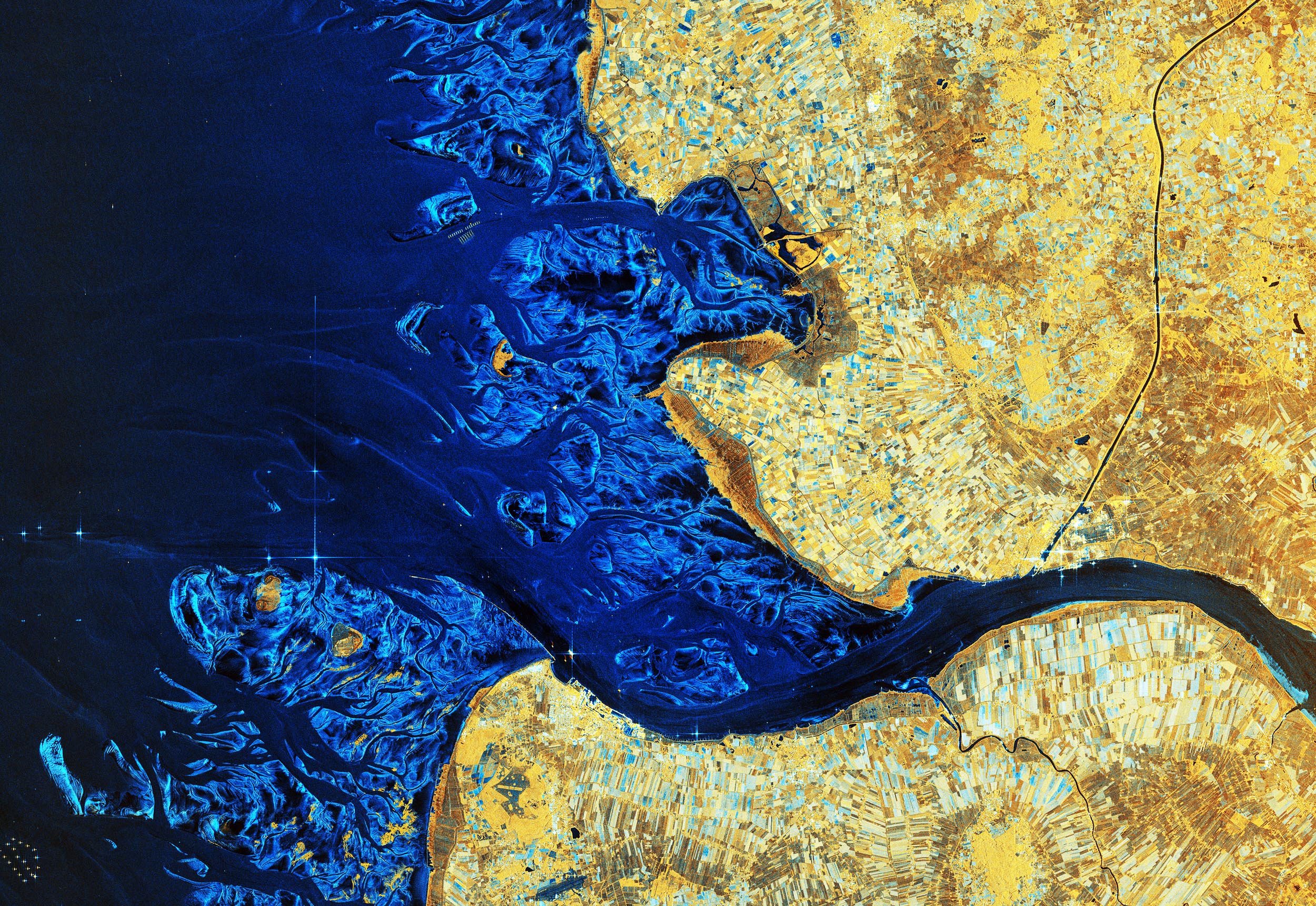
Tierra del Fuego sits roughly 620 miles (1,000 kilometers) north of the peninsula’s tip. Radar waves were used in different polarizations to show parts of the islands and surrounding waters in contrasting colors.
Snowy peaks and the ocean were mapped in shades of blue, while the land showed up in yellow tones.
The image of the Thwaites Glacier carries even more weight. Thwaites sits west of the Antarctic Peninsula and is one of the most unstable glaciers in Antarctica. Sentinel-1D’s view shows its structure in sharp detail using multiple polarizations.
In this image, sea ice appears in purple and violet. The glacier shows up bright white. The timing is notable because 2025 is the United Nations’ International Year of Glacier Preservation.
Why the world is watching
The new images come just after the 30th meeting of the Conference of the Parties, where countries continued to negotiate climate actions.
The World Meteorological Organization’s latest update noted that glaciers lost the largest amount of ice on record between October 2023 and September 2024, equal to 0.047 inches (1.2 millimeters) of global sea-level rise.
The organization also reported that Antarctic sea ice reached its third lowest extent on record on February 24, 2025, with the lowest measured in 2023.
Sentinel-1D will help monitor these shifts with more consistency and detail. Radar satellites track glacier flow, thinning ice, and changing coastlines. They also support ship safety and environmental monitoring in regions where weather often blocks ordinary cameras.
Viewing a planet that’s changing fast
As the satellite moves into its commissioning phase, scientists will test and fine-tune its instruments. Its partner satellite, Sentinel-1C, is already operating, and together they will provide steady coverage for the Copernicus Program.
These radar satellites help everyone from climate researchers to emergency responders. They spot floods, track land movement, and create reliable maps for countries planning how to protect their coastlines.
With satellite technology improving at this pace, the world will have more frequent and more precise views of a planet that is changing fast.
Sentinel-1D’s early success shows what careful planning and teamwork can deliver in just a couple of days in orbit.
Information from an ESA press release.
Image: Antarctic Peninsula image by Sentinel-1D; ESA
—–
Like what you read? Subscribe to our newsletter for engaging articles, exclusive content, and the latest updates.
Check us out on EarthSnap, a free app brought to you by Eric Ralls and Earth.com.
—–


