Aqua satellite sees an almost symmetrical Tropical Storm Estelle
Aqua satellite sees an almost symmetrical Tropical Storm Estelle. NASA’s Aqua satellite saw an almost well-rounded Tropical Storm Estelle and identified the locations of the strongest convection in the developing eyewall.
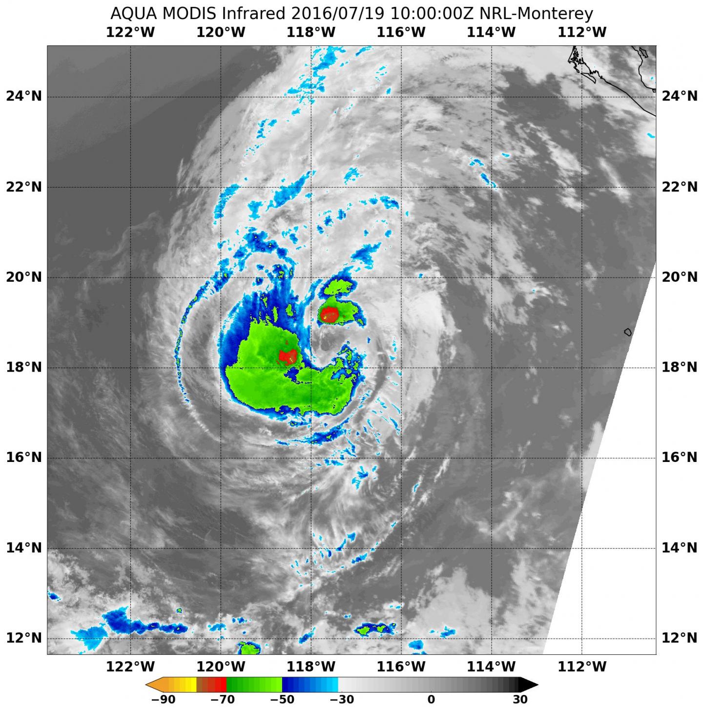
At 10:00 UTC (6 a.m. EDT) today, July 19, NASA’s Aqua satellite passed over Tropical Storm Estelle from space and gathered infrared data on the storm. The MODIS instrument, or Moderate Resolution Imaging Spectroradiometer, collected the infrared data that showed a circular storm with two areas of strongest convection (rising air that forms the thunderstorms that make up the storm) where cloud top temperatures were as cold as minus 70 degrees Fahrenheit (minus 56.6 degrees Celsius). Those strongest storms were located around the developing eye northeast and southwest of the center. Aqua satellite sees an almost symmetrical Tropical Storm Estelle

Satellite imagery shows that Estelle is strong and almost symmetrical, but periodically dry air has crept into the mid-levels of the tropical storm and prevented further intensification and development of a closed eyewall.
An eyewall is located just outside of the eye and often consists of a vertical wall of clouds. This is the location within a hurricane where the most damaging winds and intense rainfall is found. The eye is a clear area where air sinks and lowest surface pressure can be found. The eye is the point from which the rest of the storm rotates.
At 5 a.m. EDT (0900 UTC) on July 19, 2016 the center of Tropical Storm Estelle was located near 18.5 north latitude and 117.6 west longitude. That’s about 585 miles (940 km) west-southwest of the southern tip of Baja California, Mexico.
Estelle was moving toward the west-northwest near 10 mph (17 kph) and the National Hurricane Center (NHC) said that a motion toward the west or west-northwest with some increase in forward speed is expected over the next couple of days. The estimated minimum central pressure is 993 millibars.
Maximum sustained winds are near 65 mph (100 kph) and NHC said some strengthening is possible during the next day or so, and Estelle could still become a hurricane later today. For the latest updates on Estelle, visit the NHC website: http://www.
NHC forecaster Stewart said that gradual weakening is expected to begin on Wednesday when Estelle is forecast to move over cooler sea surface temperatures. Those temperatures are cooler than the 26.6 degrees Celsius (80 degrees Fahrenheit) needed to sustain a tropical cyclone. Estelle will also be moving into a drier and more stable air mass which will also sap the tropical cyclone’s strength.


