Newly formed Tropical Depression 08W
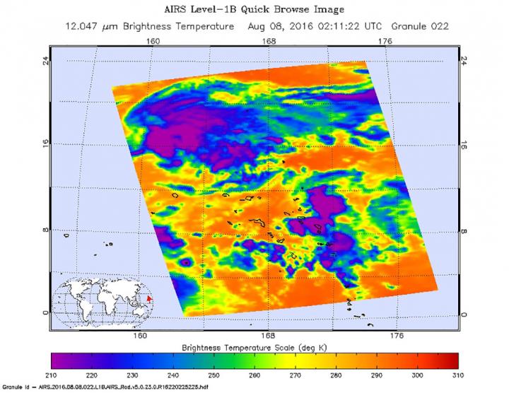
The Atmospheric Infrared Sounder or AIRS instrument aboard NASA’s Aqua satellite used infrared data to look at cloud top temperatures within Tropical Depression 08W on Aug. 7 at 10:11 p.m. EDT (Aug. 8 at 2:11 a.m. UTC). Forecasters at the Joint Typhoon Warning Center (JTWC) noted that animated enhanced infrared imagery “showed continued improvement in the convective structure (where thunderstorms are forming) with deep formative banding [of thunderstorms] wrapping into the low level circulation center.”
At 11 a.m. EDT (3 p.m. UTC) on Aug. 8, 2016, Tropical Depression 08W’s maximum sustained winds were near 34.5 mph (30 knots/55.5 kph). It was centered about 364 nautical miles west-southwest of Wake Island, near 17.9 degrees north latitude and 160.1 degrees east longitude. The depression was moving to the west-northwest at 4.6 mph (4 knots/7.4 kph). Newly formed Tropical Depression 08W has also made this massive amount of destruction to the area. Also the surrounding areas were hit pretty badly as well.

The JTWC forecast calls for this storm to continue to intensify as it turns to the northwest through open waters of the Northwestern Pacific Ocean. The storm is expected to reach typhoon strength by Aug. 11.


