Tropical Storm 12W forms over the Northwestern Pacific Ocean
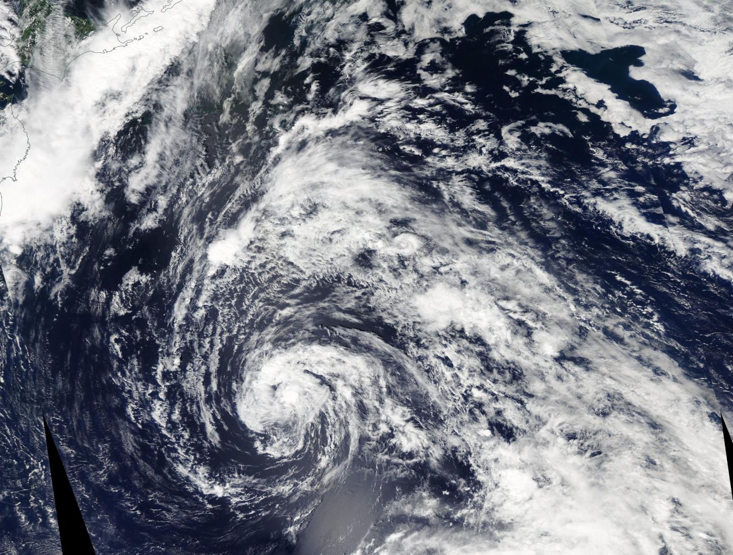
Tropical Storm 12W (12W) was spotted by the Moderate Resolution Imaging Spectroradiometer or MODIS instrument aboard NASA’s Aqua satellite on Aug. 18. 12W appeared symmetrical. Animated enhanced infrared satellite imagery revealed a broad low-level circulation center with the bulk of the deep convection (and developing thunderstorms) persisting over the northern quadrant. Tropical Storm 12W forms over the Northwestern Pacific Ocean. Also the storm has caused so much damage due to strong and high winds and flooding.
At 11 a.m. EDT (1500 UTC) on August 18, 2016 Tropical Storm 12W was centered near 31.1 degrees north latitude and 147.7 degrees east longitude, about 522 nautical miles east-southeast of Yokosuka, Japan. 12W has tracked northwestward at 16.1 mph (14 knots/25.9 kph) and is expected to continue moving in that direction. Maximum sustained winds were near 46.0 mph (40 knots/74.0 kph).

The Joint Typhoon Warning Center forecast calls for Tropical Storm 12W to move in a generally westerly direction over the next several days and intensify into a typhoon by Aug. 23 as it nears the southern islands of Japan.


