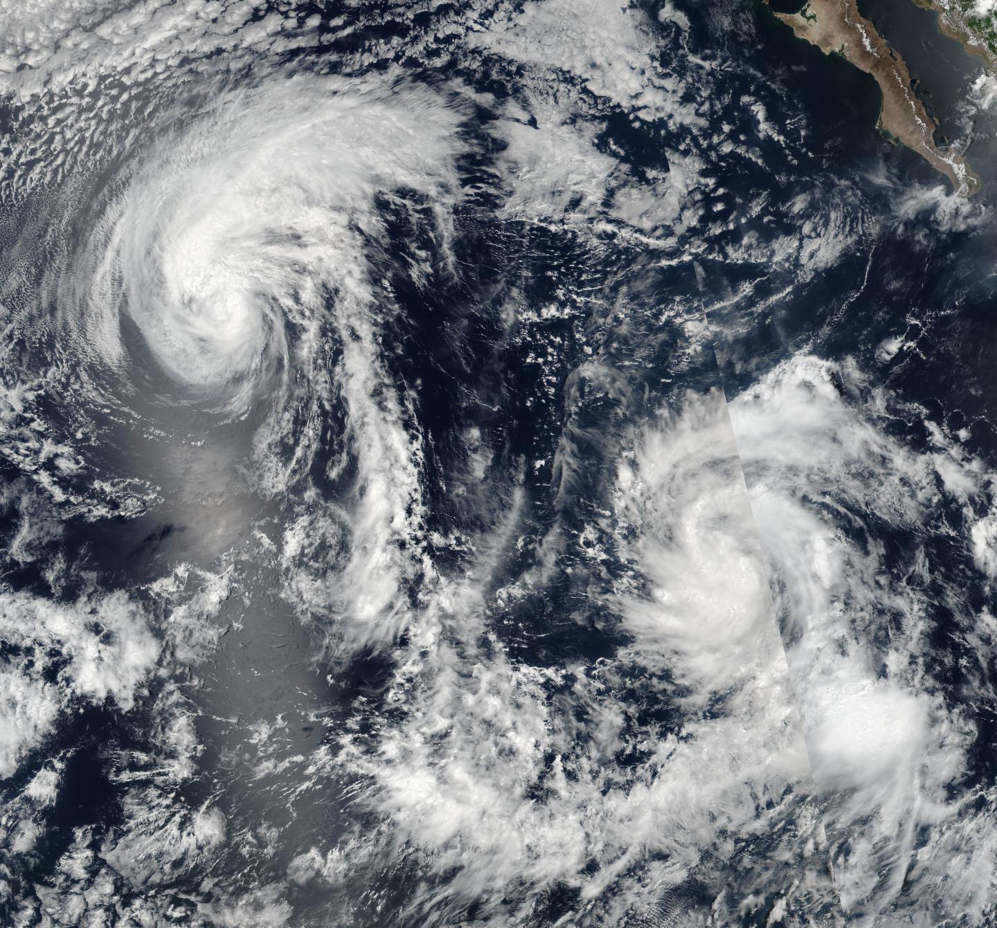
Tropical Storm Howard and Tropical Depression Ivette
On Aug. 3 at 2:35 a.m. EDT (6:35 a.m. UTC) the Moderate Resolution Imaging Spectroradiometer, or MODIS, instrument that flies aboard NASA’s Terra satellite provided infrared data on Howard. The image showed that strong thunderstorms and deep convection (rising air that forms them) continued to decrease and were limited to northwest and south of the center. The National Hurricane Center (NHC) reported that the strongest storms had become separated from the low-level center of the storm overnight. Tropical Storm Howard and Tropical Depression Ivette
At 5 a.m. EDT (9 a.m. UTC) on Aug. 3, the center of Tropical Storm Howard was located near 20.3 degrees north latitude and 132.6 degrees west longitude. That’s about 1,465 miles (2,360 km) west of the southern tip of Baja California, Mexico. Howard was moving toward the west-northwest near 15 mph (24 kph), and this motion should continue through today. A turn toward the west is expected by Thursday. Maximum sustained winds have decreased to near 45 mph (75 kph) and is forecast to continue weakening. The estimated minimum central pressure is 1,005 millibars.

In the Tropical Storm Howard Discussion online at 5 a.m. EDT, National Hurricane Center forecaster Daniel Brown said, “The tropical storm should continue to weaken during the next day or so while it moves over cool water and into a drier and more stable environment. Howard is forecast to become a remnant low in 24 to 36 hours, but this could occur sooner if organized deep convection does not redevelop later today.”


