Archaeologists unearth a Bronze Age city that was lost for 3,500 years
History on the treeless plains, called steppes, often gets boxed into a simple picture: herders on the move, small camps, few permanent homes. Then a place like Semiyarka comes into view and widens that picture.
This planned settlement in northeastern Kazakhstan took shape more than 3,500 years ago and was not temporary. Streets lined with enclosed houses and an industrial quarter for metalworking tell a different story about life on the grasslands.

Archaeologists date the settlement to around 1600 BCE, when some steppe communities began testing more settled ways of living.
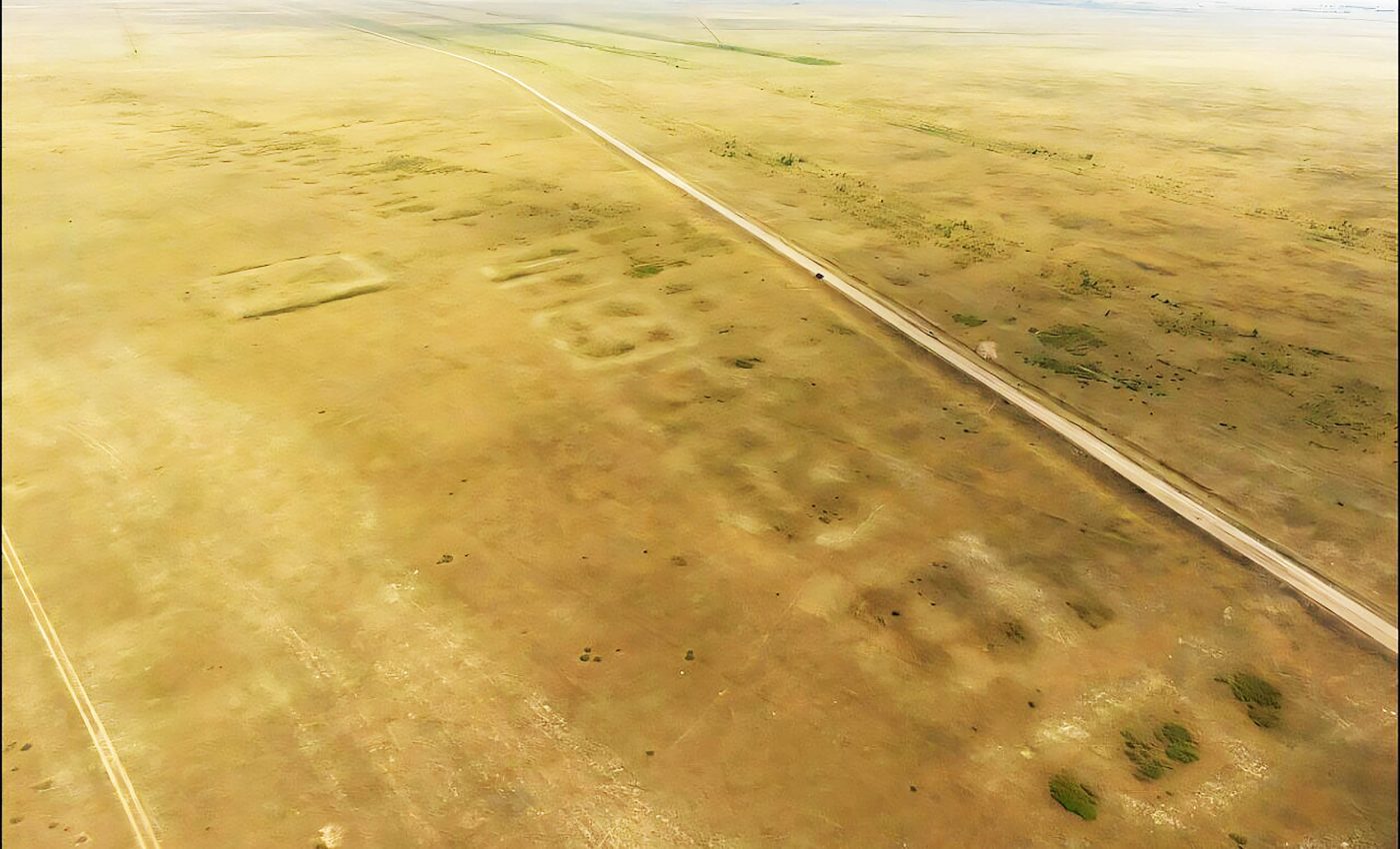
The site’s name translates to “Seven Ravines,” which suits its landscape of low ridges and shallow cuts. With its regular layout and industrial activity, Semiyarka looks less like a camp and more like a city built to last.
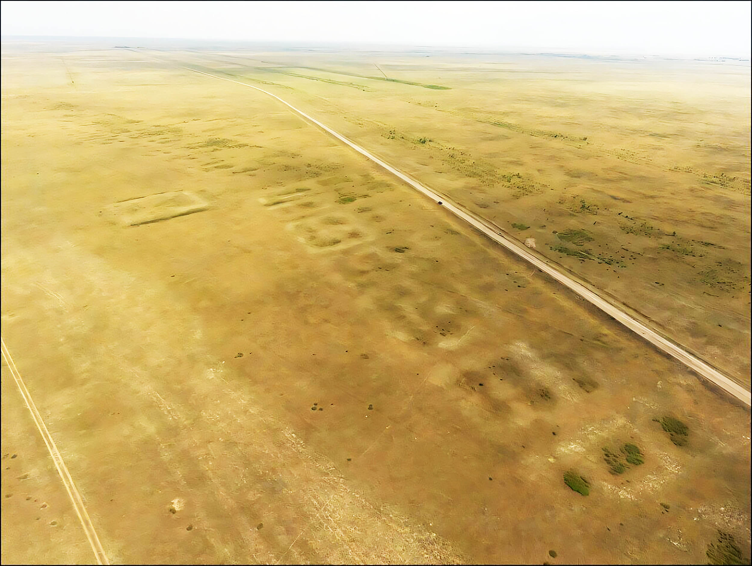
Lost city of Semiyarka
Scale is central to the case. Researchers mapped a footprint of about 346 acres (140 hectares), or 0.54 square miles. That is about 260 football fields, making it the largest site of its kind reported in the region so far.
Local scholars first noticed the settlement more than 20 years ago, but only now has it been surveyed in full detail and formally published.
Placement matters too. Semiyarka sits on a promontory above the Irtysh River, a high spot that gives clear views of traffic moving across the steppe and along the waterway.
That vantage point pairs with a planned interior – evidence that the builders organized where people lived and worked rather than scattering households at random.
Homes and central building
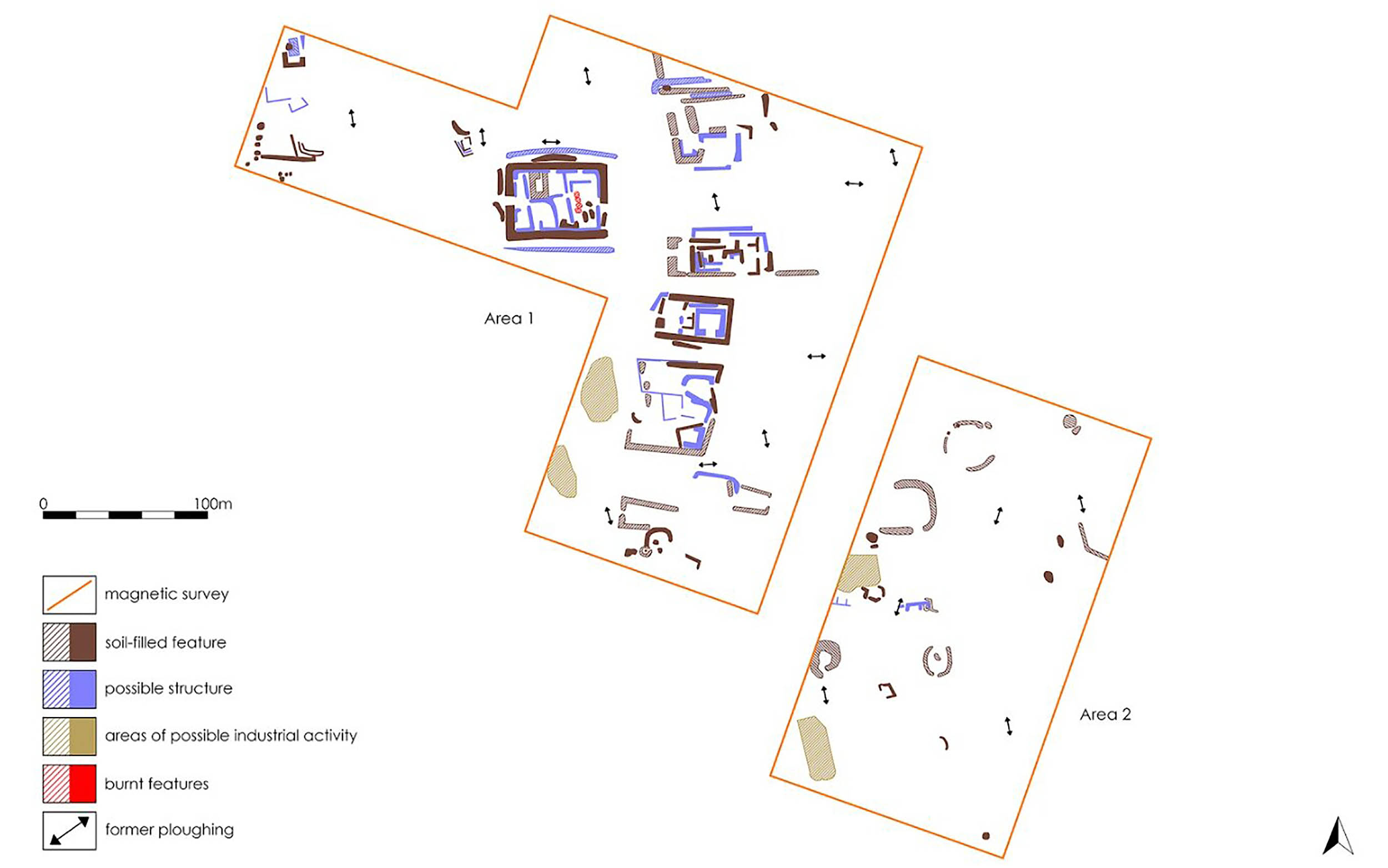
On the surface, the site shows two long rows of rectangular earthen mounds, each about one meter (3.3 feet) high.
These mark the foundations of enclosed houses with several rooms. People built walls and internal divisions – the kind of layout expected when families intend to stay put.
Near the center, the team documented a larger building roughly twice the size of the surrounding houses. Its purpose is unclear. It could have served as a ritual space, a gathering hall, or the home of a powerful family.
Whatever the role, the contrast between the house compounds and this central structure points to an intentional plan for streets and open areas.
Tin bronze workshops
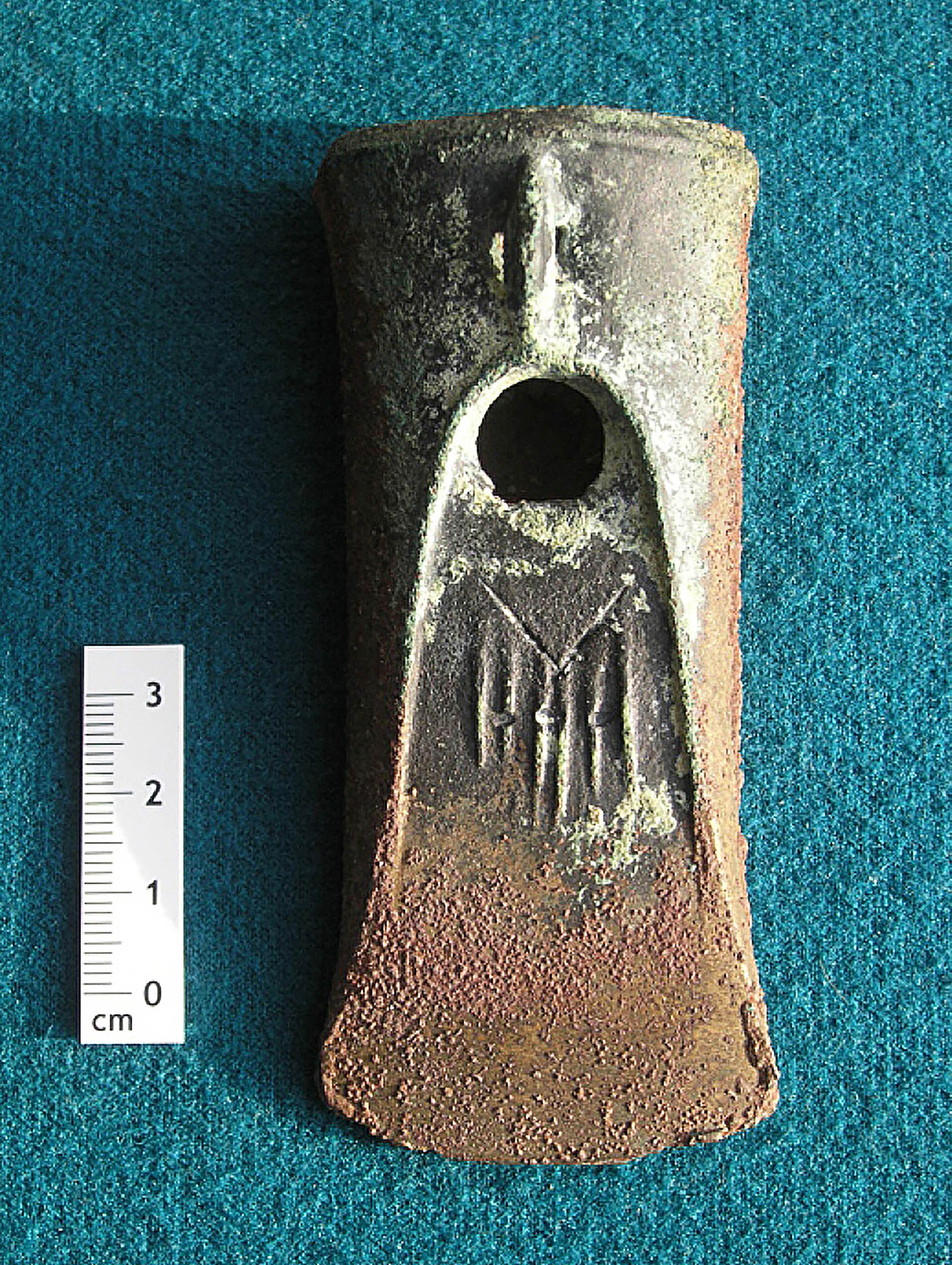
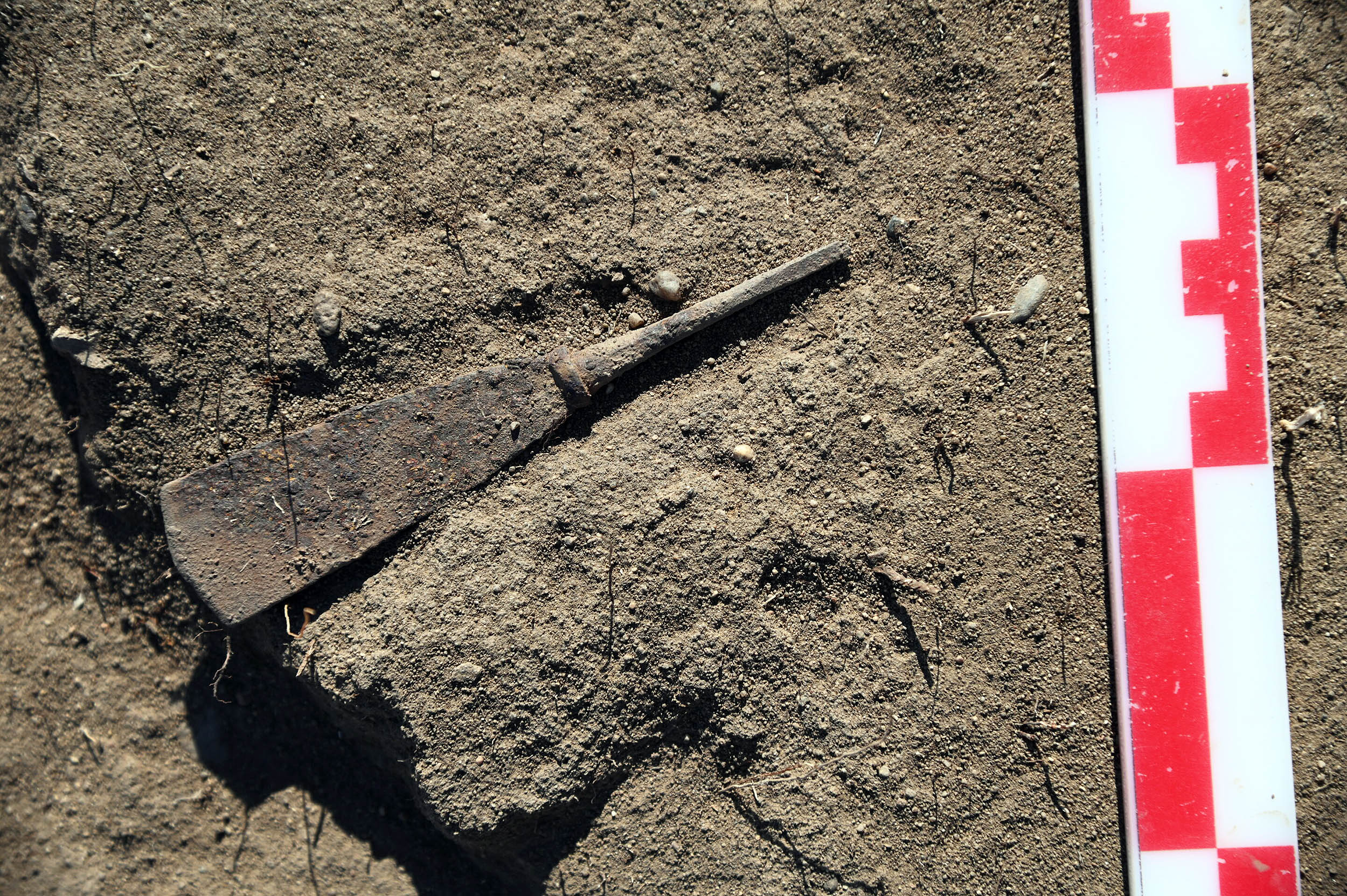
The southeast edge of the settlement holds the most striking find: an industrial zone dedicated to making tin bronze, the copper and tin alloy that defined the era.
Archaeologists recovered crucibles, slag, and finished objects there. The amount and concentration of debris show organized, intense production that likely ran for a long time rather than short bursts.
The pattern signals more than household tinkering. Semiyarka looks like a specialized center that produced tools, weapons, and ornaments for communities across the steppe.
That picture stands out in eastern Kazakhstan, where only one other settlement – a Late Bronze Age mining site – was clearly tied to tin bronze production. Semiyarka adds an earlier and much larger urban example to that regional puzzle.
Location of Semiyarka
Geography offers a straightforward answer. The site lies not far from copper and tin sources in the Altai Mountains, which supplied the ores needed for bronze.
Its perch above the Irtysh River connects it to routes that move people and goods along the water and across the open plains.
Ores could come down from the mountains, travelers could arrive by river or steppe trail, and skilled craftspeople could turn raw materials into valuable metalwork.
That mix of access and skill likely made Semiyarka a regional hub for both trade and production.
People at semiyarka
Artifacts point to the Alekseevka-Sargary people as the main inhabitants. They are among the earliest groups in this region to build permanent houses within formal settlements.
At the same time, some objects resemble pieces linked to the Cherkaskul tradition, which scholars usually associate with more mobile communities.
That combination suggests exchange and interaction, possibly even shared labor in the metalworking quarter.
The surrounding landscape adds context. Investigators noted nearby burial areas and short-term camps from the same period. Those finds sketch a broader cultural setting around the city rather than an isolated outpost.
Herding groups may have come to trade animals, raw materials, or labor in return for tools and ornaments made in the workshops.
Studying a buried city
The team combined targeted excavation with geophysical surveys, a suite of methods that detect buried features by measuring physical differences in the ground.
Readings of soil density and magnetism revealed outlines of walls, pits, and furnaces, along with the boundaries of the industrial area. Those maps helped guide excavation and reduce unnecessary digging.
Archaeometallurgical analysis completed the picture. Slag and tiny droplets of metal were examined under a microscope and tested chemically to reconstruct the steps of bronze production.
Researchers from several universities brought different skills – archaeology, metallurgy, and landscape studies – to assemble the timeline and the working layout of the site.
More questions about Semiyarka
Important parts of the story remain open. Investigators want to learn how production was organized.
Who controlled access to copper and tin? How did craftspeople get their fuel? How far did finished objects travel from the workshops at Semiyarka?
Environmental impact is another focus. Smelting consumes large amounts of fuel, usually wood or charcoal, and can leave chemical traces in the soil and surrounding vegetation.
Ongoing work aims to track those signatures and weigh how industry changed the local landscape.
The discovery of additional burial sites and short-term camps nearby may also clarify family life, beliefs, and how communities beyond the city were connected to this center.
Lessons from Semiyarka
Textbooks tend to spotlight walled capitals with temples and palaces. Semiyarka shows another path to urban life.
Here, a city was defined by planned housing and an industrial zone where craftspeople produced tin bronze. Its “downtown” was not a temple pyramid; it was a metalworking district.
In the wider picture, Semiyarka pushes scholars to rethink the Eurasian steppe. Rather than a gap between “real” civilizations, the grasslands supported their own forms of urban planning and industrial specialization.
Taken together, the evidence shows that steppe societies built cities shaped by grasslands, rivers, and metalwork – not by stone walls and towering monuments.
The full study was published in the journal Antiquity Project Gallery.
—–
Like what you read? Subscribe to our newsletter for engaging articles, exclusive content, and the latest updates.
Check us out on EarthSnap, a free app brought to you by Eric Ralls and Earth.com.
—–


