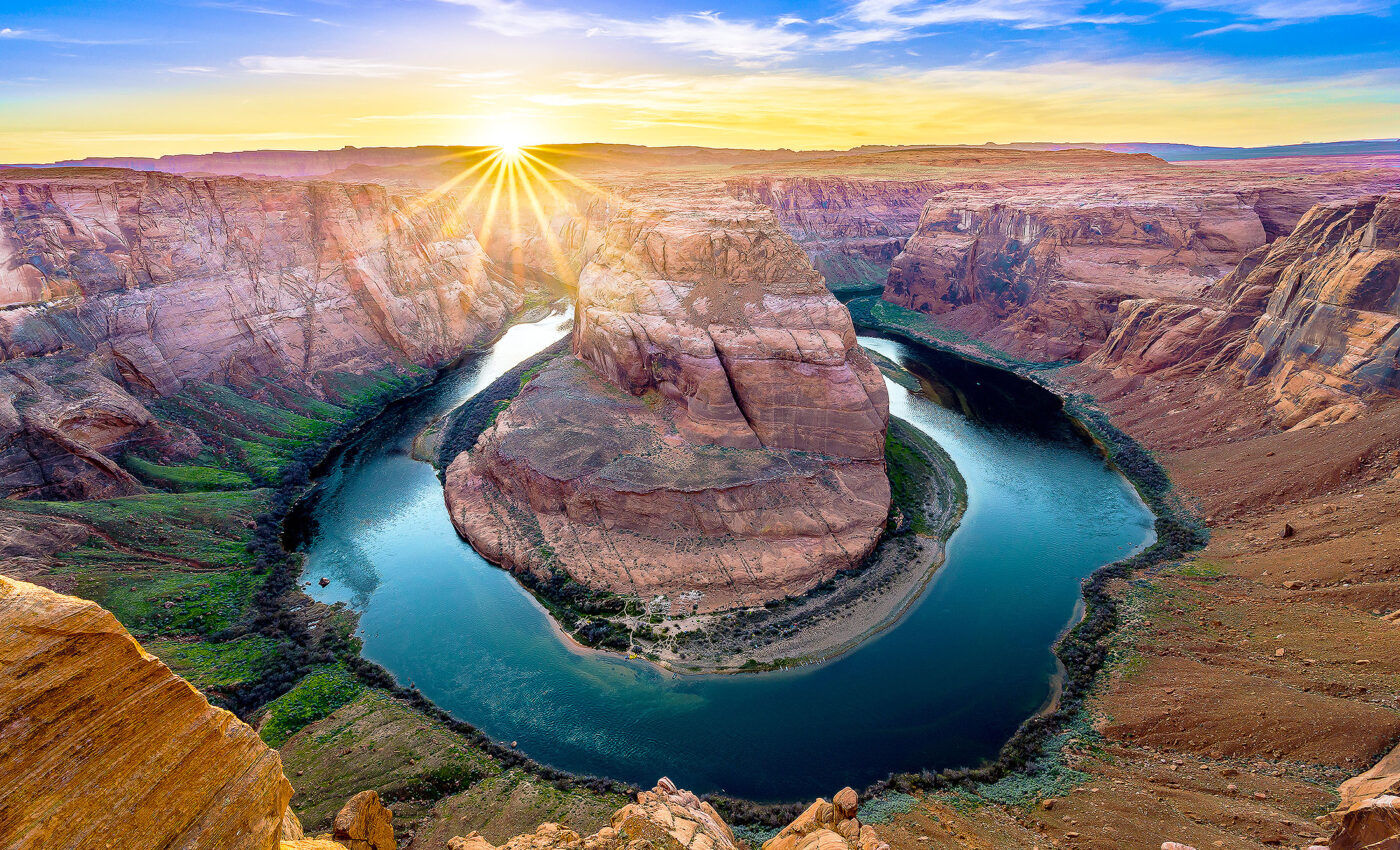
Colorado River Basin has lost enough water to fill Lake Mead
The Colorado River Basin – the area drained by the Colorado River and its tributaries – covers approximately 647,500 square kilometers (250,000 square miles) in seven states across western United States, supplying water to about 40 million people while supporting agriculture and natural ecosystems.
According to a new study conducted by the University of California, Los Angeles (UCLA), from 2000 to 2021, climate change caused the loss of over 40 trillion liters (10 trillion gallons) of water in this basin.

This is equal to the full storage capacity of Lake Mead, the largest reservoir on the Colorado River. The massive loss of water prompted supply cuts under the first federally declared water shortage in 2021.
The southwestern North American megadrought is an ongoing drought that began in 2000. This is the driest multi-decade period the region has seen in at least 1,200 years. It has significantly reduced river flow and shrunk reservoirs, leading to widespread concerns about water scarcity as the climate continues to warm.
Sensitivity of the Colorado River Basin
“While we knew warming was having an impact on the Colorado Basin’s water availability, we were surprised to find how sensitive the basin is to warming compared to other major basins across the western U.S., and how high this sensitivity is in the relatively small area of the basin’s crucial snowpack regions,” said lead author Benjamin Bass, a hydrological modeler at UCLA.
“The fact that warming removed as much water from the basin as the size of Lake Mead itself during the recent megadrought is a wakeup call to the climate change impacts we are living today.”
Studying the Colorado River
While previous investigations of water resources in this region have largely focused on the effects of climate change, the current study also took into account the impact of plants’ complex responses to increased atmospheric carbon dioxide.
Moreover, by comparing historical warming in the Colorado River Basin’s snowpack regions with that in the non-snowpack regions, the experts calculated the quantity of runoff changes per degree of warming. This helped them assess how anthropogenic climate change has dried out traditional snowpack regions and quickly reduced the runoff feeding the Colorado River.
The researchers used a land surface model capable of analyzing water, changes in vegetation, and vegetation’s response to rises in atmospheric CO2 to examine how the basin’s hydrology changed between 1880 and 2021.
They employed standard data sets to represent atmospheric conditions, streamflow gauges, and other records capturing the regional hydrology. They also used ground and satellite data to assess actual changes in vegetation.
What the research team learned
The analysis revealed that from 1880 to 2021, the temperature in the Colorado River Basin increased by nearly 1.5 degrees Celsius due to climate change. This resulted in a 10.3 percent reduction in runoff.
However, without including the effects of plants, current water loss would be closer to 13 percent. This discovery highlights the importance of including vegetation processes in water modeling.
In addition, the researchers discovered that the typically snow-covered parts of the basin are losing water twice as fast as the regions without snow. This finding suggests that the Rocky Mountain West is transitioning to a more arid climate rather than just undergoing periodic droughts.
Since snowpack makes an outsized contribution to the basin’s water supply – accounting for two-thirds of the basin’s total runoff – these changes should be of immediate concern to water managers.
Implications of the study
According to Bass, the 1922 Colorado River Compact governs the use of river water by the seven western U.S. states the Colorado River flows through. It was written with the assumption that the regional climate was stable.
When the representatives of these states signed the contract, “they expected 15 million acre-feet of water (about 18.5 trillion liters) would be provided from the basin, on average, each year.”
“If they were outlining the compact now, they would need to adjust that value due to the impact of warming. Going into the future, we may get some natural variability, wet or dry swings, but this study highlights that there’s been a decreasing trend in runoff. In the long run, that’s likely to continue if greenhouse gas emissions are not reduced,” he concluded.
The study is published in the journal Water Resources Research.
More about the Colorado River Basin
The Colorado River Basin is a vast, geographically diverse region in the western United States and northern Mexico. The basin encompasses the drainage areas of the Colorado River and its tributaries.
Covering approximately 246,000 square miles, it spreads across seven U.S. states (Wyoming, Colorado, Utah, New Mexico, Nevada, Arizona, and California) and two Mexican states (Baja California and Sonora).
Geography and geology
Originating from the Rocky Mountains in Colorado, the river flows over 1,450 miles, descending through a series of plateaus and gorges before emptying into the Gulf of California.
Notable geological features in the basin include the Grand Canyon, Glen Canyon, and Hoover Dam. The basin’s topography varies, featuring snow-capped peaks, arid desert land, and lush river valleys.
The Colorado River Basin displays a complex geological history, with rock layers revealing hundreds of millions of years of Earth’s evolution. Sedimentary rocks dominate the landscape, bearing testament to past periods of marine, lacustrine, and terrestrial deposition.
Climate in the Colorado River Basin
The climate in the Colorado River Basin ranges from cold alpine conditions in the headwaters to arid desert in the lower reaches.
The upper basin, particularly in the Rocky Mountains, heavily concentrates precipitation, largely in the form of snow. This causes significant seasonal flow variation, with peak river flows occurring during spring and early summer due to snowmelt.
Flora and fauna
The Colorado River Basin supports diverse ecosystems and a variety of wildlife. High mountain areas feature coniferous forests, while desert regions host species adapted to arid conditions, such as cacti and yucca.
The river itself and its riparian zones provide habitat for aquatic and semi-aquatic species. These include numerous types of fish, amphibians, birds, and mammals.
Human use and impact
Human activities profoundly affect the Colorado River Basin. It supplies water to approximately 40 million people and irrigates 5.5 million acres of land. Major cities, including Denver, Las Vegas, Phoenix, and Los Angeles, rely on the Colorado River for their water supply.
Numerous dams and reservoirs heavily manage the basin’s water, providing hydroelectric power, water storage, and flood control. The construction of the Hoover Dam in the 1930s formed Lake Mead, the largest of these reservoirs.
Water demands in the basin often exceed supply, leading to overallocation and environmental stress. The river frequently runs dry before reaching its delta, resulting in the loss of wetlands and riparian habitats. Climate change is exacerbating these issues, with reduced snowpack and increased evaporation diminishing water availability.
In summary, the Colorado River Basin is an integral component of the western United States and northern Mexico. It provides crucial water resources for humans and a diverse array of habitats for wildlife. Its geography and geology are incredibly varied, offering a snapshot into the planet’s geological past.
Despite its importance, the basin faces significant challenges due to climate change and human overuse. It has become crucial that scientists initiate sustainable management strategies to safeguard its future.
—-
By Andrei Ionescu, Earth.com Staff Writer
Check us out on EarthSnap, a free app brought to you by Eric Ralls and Earth.com.


