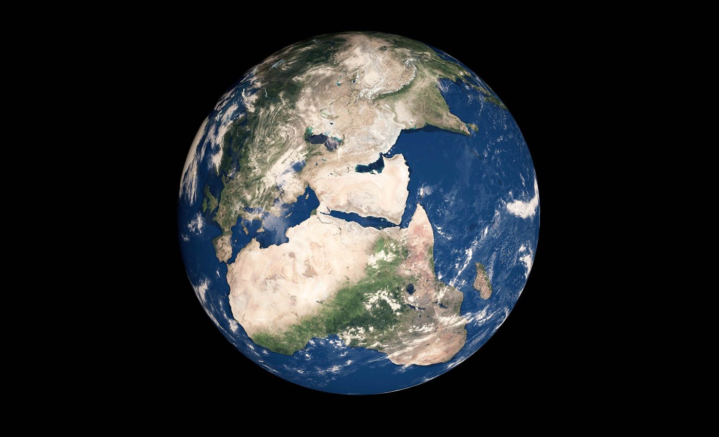
Early Earth’s magnetic field played a role in shaping the continents and oceans
A new analysis argues that Earth’s magnetic field during the Ediacaran had structure hiding inside its wild swings. The work points to a pattern that could finally let scientists place continents more reliably for around 565 million years ago.
The team centered its tests on volcanic layers in Morocco and paired them with precise dating. The approach shows rapid magnetic changes that still follow an unusual, ordered path.
Earth’s magnetic chaos

During most of Earth’s history, the magnetic field wobbled modestly and sometimes flipped. In the Ediacaran, the directions recorded in rocks look erratic, which made old continents hard to pin down.
Here is who pushed back on that idea and where the work happened. David Evans of Yale University led the effort with collaborators in Morocco, Europe, and the United States.
“We are proposing a new model for the Earth’s magnetic field that finds structure in its variability rather than simply dismissing it as randomly chaotic,” Evans explained.
“We have developed a new method of statistical analysis of Ediacaran paleomagnetic data that we think will hold the key to producing robust maps of the continents and oceans from that period.”
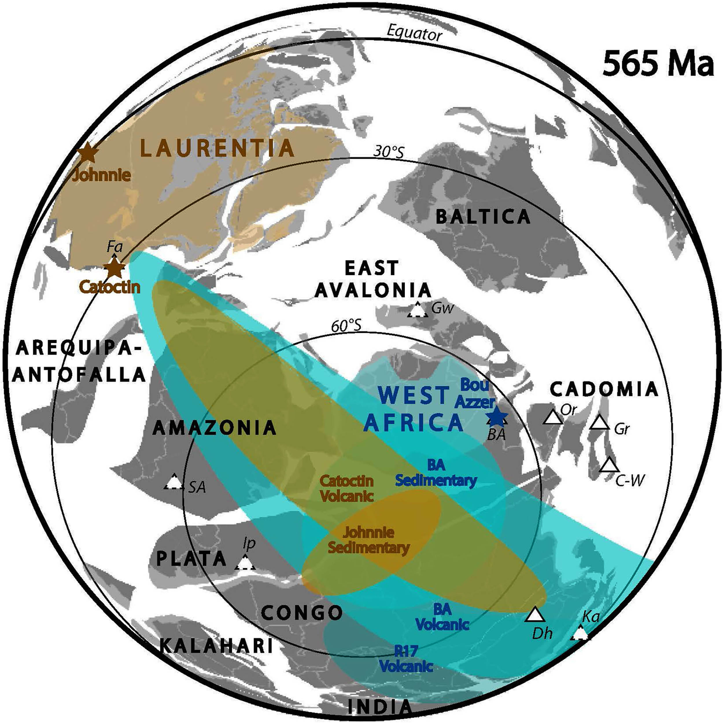
The group sampled lava flows and nearby sediments in the Anti-Atlas mountains, then measured the magnetism of each layer. They also used high precision uranium lead clocks to build a timeline across the stack.
“We took a fresh approach,” said James Pierce, a Ph.D. student at Yale and first author. He and colleagues like David Evans tied rapid field shifts to a coherent path of pole positions that circle the globe.
Rocks reveal magnetic story
The field direction frozen into cooling lava is one piece of the puzzle. That signal captures moments, not averages, so the record can look jumpy.
To smooth that jumpiness, the team added nearby red beds that acquire magnetism slowly over time. That let them compare momentary swings with longer term means that reflect a stable axis.
They call the layer by layer approach magnetostratigraphy, sampling rock sequences to track magnetic change through time.
Paired with precise ages, it revealed bursts of change that unfolded over thousands of years, rather than the formerly supposed millions.
The researchers also report high inclination directions consistent with near polar locations. That matches independent evidence for late Ediacaran glaciation in the same Moroccan ranges.
Testing other explanations
Some scientists once argued the data reflected fast moving plates. That idea struggles here because plate speeds cannot keep pace with the rates implied by the Moroccan rocks.
Others pointed to true polar wander (TPW), a shift of the solid Earth relative to the spin axis. But theoretical modeling caps its speed far below what the layer dated swings require.
If plates did not race and the planet did not lurch quickly, something inside the field itself must explain the pattern. The ordered path in these rocks points to that internal cause.
New tool for ancient mapping
The key step is a statistics tool suited to stretched directional data. The team used the Bingham distribution, a method for elongated clusters of directions on a sphere.
Volcanic units recorded many rapid snapshots which line up along a preferred band, while nearby sediments captured the time averaged axis.
Treating those sets differently lets researchers estimate both latitude and, with caution, relative longitude.
That longitude hint comes from aligning the long axis of the volcanic cluster between areas. It assumes the field’s wandering had a global preferred band, a testable idea as more sites accumulate.
The approach also respects limits. It avoids forcing modern field assumptions onto ancient rocks, and it treats uneven spreads with the right statistics rather than circular ones.
Why this period was so odd
Several lines of work suggest the geodynamo, the liquid outer core flow that makes the magnetic field, was unusually weak late in the Ediacaran. Single crystal paleointensity records show values about ten times lower than today.
Other teams argue the field strengthened sharply in the early Cambrian. New single crystal paleointensity data indicate a renewed, stronger field as Earth’s inner core began to solidify.
A weak field can also wander more, producing big directional scatter even without plate motion. That scatter is part of paleosecular variation, slow field changes over centuries to millennia, often shortened to PSV.
The Moroccan results fit that picture. They show enhanced PSV but with repeatable geometry, which opens a door to better maps.
Why Earth’s magnetic past matters
Reliable maps of continents and oceans near the dawn of animal life will reshape several debates. Where land sat controls climate, ocean chemistry, and the pathways for early ecosystems.
Better reconstructions also test links between field strength, atmospheric escape, and oxygen levels. Those links matter for understanding how Earth stayed habitable when its shield weakened.
The new framework brings discipline to a messy record. It lays out how to treat volcanic and sedimentary directions together without assuming the modern field.
Future work can apply the method to other cratons that have both rock types. Each new section will check whether the preferred band truly repeats across the globe.
The study is published in Science Advances.
—–
Like what you read? Subscribe to our newsletter for engaging articles, exclusive content, and the latest updates.
Check us out on EarthSnap, a free app brought to you by Eric Ralls and Earth.com.
—–


