Funnel-shaped traps the size of a stadium reveal a 7th century hunting strategy
Researchers using satellite images spotted 76 funnel shaped stone traps, used for hunting, high in northern Chile. The find points to organized vicuña hunting in the Camarones Basin and shows that mobile foragers stayed active into colonial times.
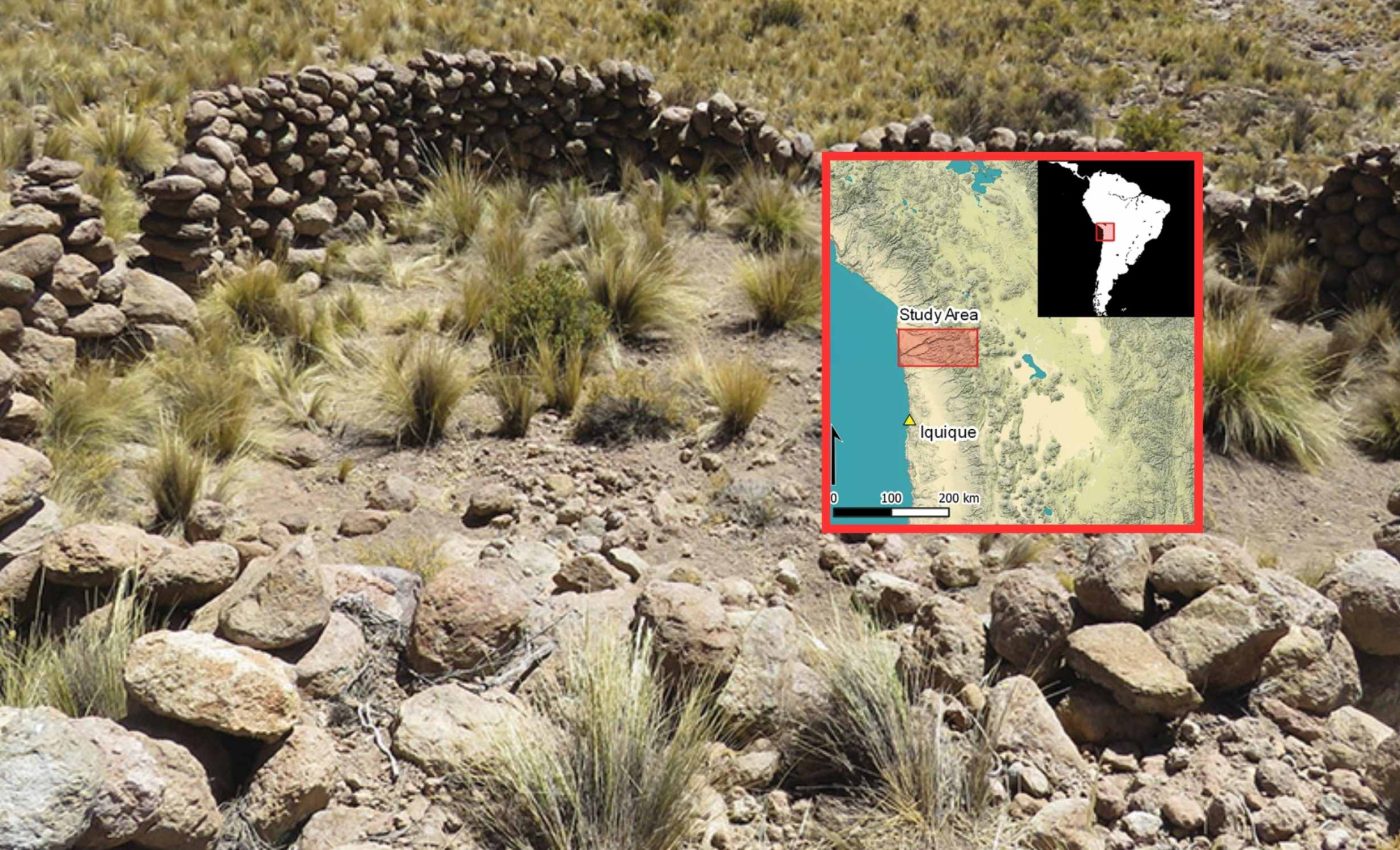
In a new study, the mapping covers about 1,776 square miles of uplands and records a dense network of stone features.

The team relied on remote sensing, analysis of landscapes using satellite or aerial data, to flag sites that field visits later confirmed.
Lead researcher Dr. Adrián Oyaneder of the University of Exeter led the work. His survey turned up a patterned system that ties traps to nearby camps in strategic clusters.
Trap hunting in the 7th century
Each trap narrows from long arms, roughly 490 feet in length and about 5 feet high, into a holding corral near 1,020 square feet in area and close to 6.6 feet deep.
These structures sit on steep slopes within the usual habitat of vicuñas, a wild ungulate, hoofed mammal adapted to open highlands.
The survey also logged nearly 800 small scale camps and outposts arranged within walking distance of the traps.
The clusters, modeled with density based clustering, a method that groups nearby points while ignoring outliers, suggest coordinated use of terrain during short seasonal stays.
At first, Oyaneder noticed long, continuous stone walls scattered across the highlands. Their purpose became clearer once he compared them with ethnohistoric accounts describing communal animal roundups in the Andes.
The work helps close a long standing gap between archaeological models that emphasize early farming and historical records that still list foraging groups in the Western Valleys. It argues for overlapping lifeways rather than a clean handoff from hunting to herding.
Stones, traps, and ancient hunting
Comparable installations appear across the Middle East, where research on desert kites shows walls used to funnel fast herding animals into enclosures or drops, and archaeological evidence supports that function. The Chilean traps share the same basic geometry and topographic placement.
Their altitude lines up with the vicuña’s known range between roughly 9,200 and 15,900 feet, and that helps explain why nearly all of the traps point downhill toward natural gullies.
Vicuñas thrive in the open puna grasslands found across this altitude range, where ancient hunters could plan roundups to coincide with the brief flush of seasonal pasture.
The trap and camp clusters point to a tethered mobility strategy, with people moving between short term outposts anchored to hunting grounds.
The landscape pattern implies coordination across family groups that shared access while tracking animals and water.
This picture also reframes the colonial period, when records classed some communities as foragers while others herded or farmed.
The material layout on the ground shows those categories coexisted for centuries, a point that fits the ethnohistorical, written sources from colonial era observers, record without forcing a single social script.
3D modeling of the stone traps
The hunting traps usually have one dominant arm near 594 feet and a secondary arm near 233 feet, and both converge on a corral built to match the slope. The height and length are enough to steer a running herd without requiring tall walls.
In survey work, the team paired satellite detection with targeted checks and three dimensional recording of select structures.
That includes photogrammetry, precise 3D modeling from many overlapping photos, which captures the drop from the arm tips into the corral.
Wider Andean and global context
The Chilean finds expand a sparse Andean record for communal hunting structures, which once counted fewer than a dozen confirmed examples. More sites in rugged basins may still be hidden by slope, shadow, or patchy imagery.
Similar solutions to herding wild game appear worldwide, including Jordan and Arabia. The pattern looks like technological convergence shaped by terrain and prey behavior, not by direct cultural contact.
Rémy Crassard, an archaeologist at CNRS who studies desert kites, noted that the research clearly demonstrates how remote sensing can uncover large scale hunting landscapes in the Andes.
He did, however, emphasize that further excavation will be needed before firm chronological conclusions can be drawn.
Open questions include the age of individual traps, how often they were used in a season, and how access was negotiated among neighboring groups.
New surveys and dating programs will test whether the network grew in pulses or through steady additions.
Where this research can go
The team is now building training data to scan wider areas with pattern recognition. That approach, a form of machine learning, algorithms that find patterns in data without explicit rules, could help map similar hunting landscapes across the Andes.
Ground teams will still need to verify finds and recover animal remains, charcoal, and tools for dating. That step will anchor the timeline and show how hunting overlapped with herding at specific sites.
The study is published in Antiquity.
—–
Like what you read? Subscribe to our newsletter for engaging articles, exclusive content, and the latest updates.
Check us out on EarthSnap, a free app brought to you by Eric Ralls and Earth.com.
—–


