New SWOT satellite can measure height and speed of river waves and flooding
Until now, tracking the speed and height of dangerous river flood waves was something scientists could only do from the ground.
A new study shows that this is changing. For the first time, satellite technology is giving researchers a better view of these powerful waves as they travel down U.S. rivers and move across the country.

Scientists from NASA and Virginia Tech used satellite data to measure the movement of flood waves traveling down rivers across Montana, Texas, and Georgia.
These waves, which stretched between 47 and 166 miles (76 and 267 kilometers), were triggered by heavy rainfall and a broken ice jam.
While there’s no central database for river flood wave data from space, this study shows how useful satellite observations could be – especially for communities without flood control systems like levees and gates.
Understanding river waves
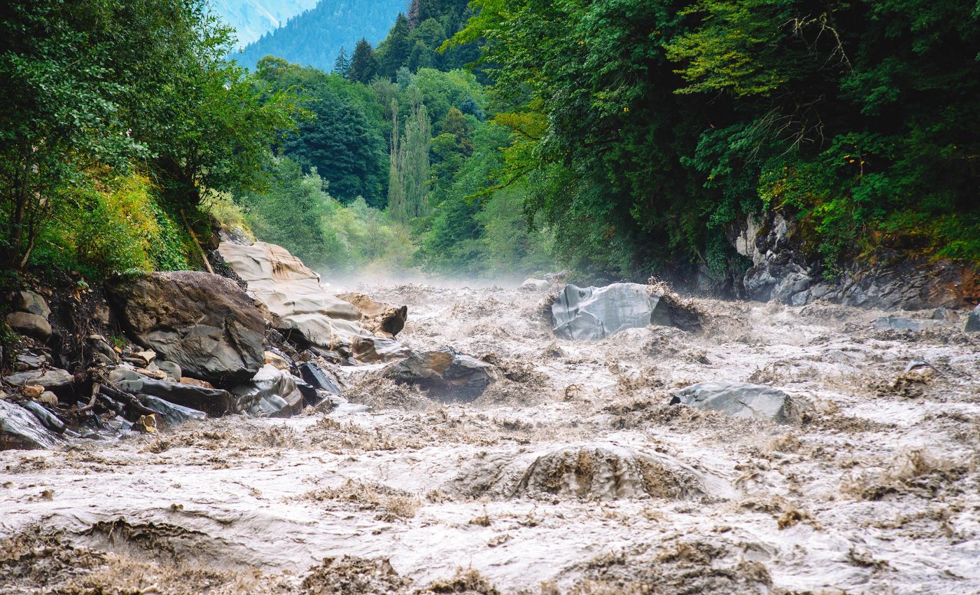
Unlike ocean waves, which move steadily to shore and are shaped by wind and tides, river waves are temporary. Also called flood or flow waves, they move in sudden surges and can stretch for hundreds of miles along a water course.
These waves help transport nutrients and wildlife downstream, but they can also turn dangerous during extreme weather or dam breaks.
“Ocean waves are well known from surfing and sailing, but rivers are the arteries of the planet. We want to understand their dynamics,” said Cedric David, a hydrologist at NASA’s Jet Propulsion Laboratory (JPL).
Tracking river flood waves from space
To track these river waves, doctoral researcher Hana Thurman at Virginia Tech used data from the SWOT satellite.
Short for Surface Water and Ocean Topography, SWOT was launched in 2022 through a collaboration between NASA and the French space agency CNES.
It surveys almost all of Earth’s surface water using a special radar instrument called Ka-band Radar Interferometer (KaRIn).

This technology measures the height and width of water bodies by bouncing microwave signals off the surface and timing how long they take to return.
“In addition to monitoring total storage of waters in lakes and rivers, we zoom in on dynamics and impacts of water movement and change,” explained Nadya Vinogradova Shiffer, SWOT program scientist at NASA Headquarters.
Thurman wanted to know if SWOT could also detect the changes in river height that signal a wave. The answer was yes. She identified three clear examples of river waves captured from orbit.
The Yellowstone crest
The first wave occurred on the Yellowstone River in Montana in April 2023. SWOT recorded a dramatic 9.1-foot-tall (2.8-meter-tall) crest racing toward the Missouri River.
The crest itself peaked for about 6.8 miles (11 kilometers), and was followed by a long, trailing tail. According to Thurman, these details were only visible thanks to KaRIn’s high spatial resolution.
She also used satellite images from Sentinel-2 to investigate the cause. Her research suggests the wave was triggered by a broken ice jam that suddenly released built-up water.
Heavy rain triggers massive river waves
The other two river waves were caused by runoff from heavy rains. One appeared on January 25, 2024, on the Colorado River near Austin, Texas.
This wave was linked to the area’s largest flood of the year. It measured over 30 feet (9 meters) tall and stretched 166 miles (267 kilometers). It traveled about 3.5 feet (1.1 meter) per second for 250 miles (402 kilometers) before reaching Matagorda Bay.
The third wave was spotted in March 2024 on the Ocmulgee River near Macon, Georgia.
It stood more than 20 feet (6 meters) high and extended over 100 miles (160 kilometers). It moved at about one foot (0.3 meters) per second for 124 miles (200 kilometers).
“We’re learning more about the shape and speed of flow waves, and how they change along long stretches of river,” Thurman said. “That could help us answer questions like, how fast could a flood get here and is infrastructure at risk?”
Satellite data enhances monitoring
Until now, engineers and water managers have mainly used stream gauges to track river waves. These devices measure water height and discharge at fixed spots.
The U.S. Geological Survey maintains most of them across the country. But many parts of the world don’t have this kind of coverage.
“Satellite data is complementary because it can help fill in the gaps,” said study supervisor George Allen, a hydrologist and remote sensing expert at Virginia Tech.
If a stream gauge is like a toll booth counting passing cars, SWOT is like a traffic helicopter watching the whole highway. And it works.
The speeds measured by SWOT matched those from ground-based stream gauges, proving the satellite’s accuracy.
This technology is especially useful in river basins with little to no gauge coverage. It can help researchers understand where and why flood waves form, and how they travel.
A new perspective on floods
SWOT orbits Earth multiple times a day. It’s expected to catch more than half of all major floods at some point in their life cycle. And that can make a real difference.
“If we see something in the data, we can say something,” David said of SWOT’s potential to flag dangerous floods in the making. “For a long time, we’ve stood on the banks of our rivers, but we’ve never seen them like we are now.”
—–
Like what you read? Subscribe to our newsletter for engaging articles, exclusive content, and the latest updates.
Check us out on EarthSnap, a free app brought to you by Eric Ralls and Earth.com.
—–


