Self-driving cars can now navigate back roads without 3D maps
A team at MIT’s Computer Science and Artificial Intelligence Laboratory (CSAIL) is developing technology that will allow self-driving cars to navigate new roads without 3D maps. The framework, which is called MapLite, uses GPS data along with sensors that monitor road conditions.
After a woman was struck and killed by a self-driving Uber vehicle in March, it seems clear that autonomous cars are not yet safe enough for widespread adoption. In addition, there are still few places where these vehicles can even operate.

Self-driving cars are being tested in major cities where exhaustive research has been done to meticulously map the exact 3D positions of lanes, curbs, off-ramps, and stop signs.
On the other hand, roads that are unpaved or not very well-lit can be extremely difficult to map, so it could be a long time before 3D maps are designed for them. MapLite may be advanced enough to eliminate this problem.
“The reason this kind of ‘map-less’ approach hasn’t really been done before is because it is generally much harder to reach the same accuracy and reliability as with detailed maps,” explained CSAIL graduate student Teddy Ort.
“A system like this that can navigate just with on-board sensors shows the potential of self-driving cars being able to actually handle roads beyond the small number that tech companies have mapped.”
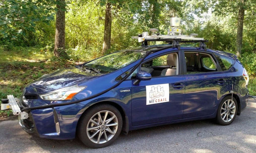
The MapLite team collaborated with the Toyota Research Institute and equipped a Prius with a range of LIDAR and IMU sensors. These sensors are used for all aspects of navigation – the GPS data is only used to obtain a rough estimate of the car’s location.
A path is generated by the car’s perception sensors to a preset “local navigation goal,” which must be in view of the vehicle, and a final destination. LIDAR is used to detect the road’s edges.
“Our minimalist approach to mapping enables autonomous driving on country roads using local appearance and semantic features such as the presence of a parking spot or a side road,” said study co-author Professor Daniela Rus.
Next, the researchers will expand upon the types of roads MapLite can navigate. For example, the technology is not yet optimized for mountain roads because it is not programmed to account for changes in elevation.
“I imagine that the self-driving cars of the future will always make some use of 3D maps in urban areas,” said Ort. “But when called upon to take a trip off the beaten path, these vehicles will need to be as good as humans at driving on unfamiliar roads they have never seen before. We hope our work is a step in that direction.”
The research will be presented this month at the International Conference on Robotics and Automation (ICRA) in Brisbane, Australia.
—
By Chrissy Sexton, Earth.com Staff Writer
Image Credit: MIT CSAIL


