Small mountain ponds play an outsized role in global warming
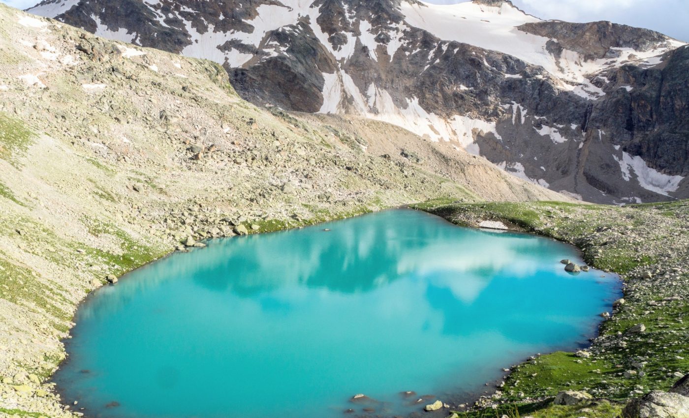
High in Ecuador’s Andes, ponds smaller than about 1.25 acres are releasing more carbon dioxide and methane than many larger waters nearby.
A new field campaign shows that these small basins, tucked into windswept grasslands, can punch far above their size in the climate story.

The work centers on Ecuador’s páramo, high elevation tropical grasslands shaped by cold, wet conditions. The team mapped ponds, sampled gases, and tracked temperature and water levels across a tight cluster of sites.
Carbon cycling in mountain ponds
The work was led by Keridwen Whitmore, Ph.D., at the University of North Carolina at Chapel Hill (UNC). Her research focuses on carbon cycling in high mountain waters and soils.
The researchers surveyed 11 ponds and one wetland and found that the smallest basins often released more carbon than larger waters only yards away.
“Our study shows that the smallest ponds can make a big difference, emitting more carbon than larger waters just meters away. These results highlight the need for increased research focused on small aquatic systems,” said Whitmore.
Temperature and elevation emerged as key levers on methane and carbon dioxide. The team also saw a strong role for soil water connectivity, how easily water and dissolved carbon move from surrounding soils into the pond.
Mountain ponds and the carbon cycle
Very small ponds occupy a tiny slice of global lake area but can dominate emissions. A global analysis reported that such ponds account for about 15 percent of lake and pond carbon dioxide emissions and more than 40 percent of diffusive methane releases.
Fresh waters are not a footnote in the carbon cycle. A foundational paper estimated that inland waters release about 2.1 billion tons of carbon per year as carbon dioxide.
That context matters for building a reliable carbon budget, an accounting of carbon entering and leaving Earth’s systems. Small, numerous ponds can change totals in ways that large lakes alone would miss.
Heat, height, and hidden plumbing
Warming water sped methane release across sites. Higher spots tended to be cooler, while lower basins were warmer and more carbon rich.
A recent synthesis emphasizes how temperature, hydrology, and landscape setting shape inland water greenhouse gases worldwide.
The Andean results fit that bigger picture, but they also sharpen it by adding data from an understudied tropical mountain belt.
The team’s focus on páramo ponds fills a geographic gap. Most measurements in global datasets come from temperate or boreal regions, not tropical highlands.
The role of methane bubbles
The study tracked dissolved gases and carbon dioxide flux, but it did not include methane released as bubbles. That process, known as ebullition, methane escaping as bubbles from pond sediments, can matter a lot.
A meta review found that ebullition can range from 0 percent to 99.6 percent of total methane flux, depending on the system. That wide spread hints at even higher totals in some small, warm ponds during calm, low pressure spells.
Skipping ebullition likely makes the Andean numbers conservative. Adding bubble fluxes would tighten the carbon math for these sites.
Why the Andes peat matters
Beneath many ponds lies peat, an organic sponge built over centuries. These high basins sit inside peatland, waterlogged soil made of partially decayed plants that stores dense carbon.
Mapping work shows Ecuador’s páramo peatlands may hold a large share of the nation’s soil carbon while covering a small fraction of land. That storehouse sits beside the very ponds that are venting gases to the air.
When warm water touches carbon rich soils, microbes rev up. The Andean pattern, where low elevation ponds run warmer, makes biogeochemical sense.
Filling a gap in climate models
Two controls explain much of what the team saw. Heat speeds biology, and water links soils to open water where gases escape.
Because small ponds have big per area emissions and are abundant, ignoring them can bias regional budgets. Adding them, even with simple rules keyed to temperature and elevation, can improve model totals.
Diego Riveros-Iregui is the study’s principal investigator and professor of geography and environment at UNC.
“These areas have long been blind spots in global climate models. By uncovering what drives carbon emissions in these remote, high-elevation ecosystems, we are filling a major gap in global climate science,” said Riveros-Iregui.
Scaling up will require better maps of small waters and year round measurements. It will also require attention to greenhouse gases, heat trapping gases in Earth’s air that include carbon dioxide and methane.
The Andean dataset offers both a warning and a path forward. Ponds that look minor on a satellite image can be major in a carbon ledger.
How mountain ponds become significant
The team worked in a compact landscape, which sharpened comparisons across sites. Some ponds only a few dozen yards across outpaced larger neighbors, even when surface area was considered.
Counts matter too. Tiny basins are far more common than big lakes in mountain valleys, so their totals add up across a region.
Water managers, park staff, and climate modelers can use simple cues here. Warmer, lower ponds with strong soil connections are likely emission hot spots.
Future surveys should pair dissolved gas sampling with ebullition measurements. Doing both will capture bursts that chambers and sensors can miss on windy or stormy days.
The study is published in the journal Limnology and Oceanography.
—–
Like what you read? Subscribe to our newsletter for engaging articles, exclusive content, and the latest updates.
Check us out on EarthSnap, a free app brought to you by Eric Ralls and Earth.com.
—–


