Tropical Storm Georgette and Hurricane Frank see-saw in strength
Infrared satellite imagery from NASA’s Aqua satellite showed colder cloud top temperatures in Frank today as it became a hurricane and warming temperatures in Georgette as it weakened from a hurricane to a tropical storm. The infrared data, taken July 26 at 0959 UTC (5:59 a.m. EDT) showed a much smaller Tropical Storm Georgette in comparison to the now hurricane, Frank.
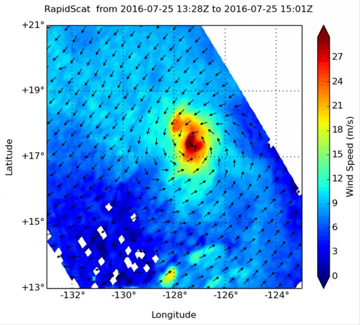
At 11 a.m. EDT (1500 UTC) on July 26, 2016, the center of Tropical Storm Georgette was located near latitude 18.4 North, longitude 128.6 West. Georgette is moving toward the northwest near 3 mph (6 kph). A motion toward the northwest with some increase in forward speed is expected during the next couple of days. Maximum sustained winds have decreased to near 70 mph (110 kph) with higher gusts.

The National Hurricane Center noted that additional weakening is forecast during the next 48 hours, and Georgette could degenerate to a remnant low pressure area by Thursday, July 28. Tropical Storm Georgette and Hurricane Frank see-saw in strength
###
For updates on Georgette, visit the NHC website: http://www.


