New map tracks location of tunas, sharks, and ships in the Pacific
Overfishing has become a major cause for concern, especially in the unregulated and historically challenging to monitor tracks of open ocean that host a high volume of shipping and fishing traffic.
Efforts to map and monitor fishing vessels in recent years have created better pathways to manage and conserve threatened and at-risk fishing populations.

In a new study, researchers from Stanford University created a map that identifies intersections between shark and tuna populations and fishing vessels.
The ability to target areas where fishing vessels travel in shark and tuna habitats could help ensure that fishing operations keep fish hauls within sustainable limits and protect vulnerable species.
“The high seas are the global commons of the oceans,” said Timothy White, the lead author of a study detailing the research. Analyses like this open the door to conversations about whether we think that the current mode of operation in the high seas is most equitable, most effective and most desirable.”
The study was published in the journal Science Advances.
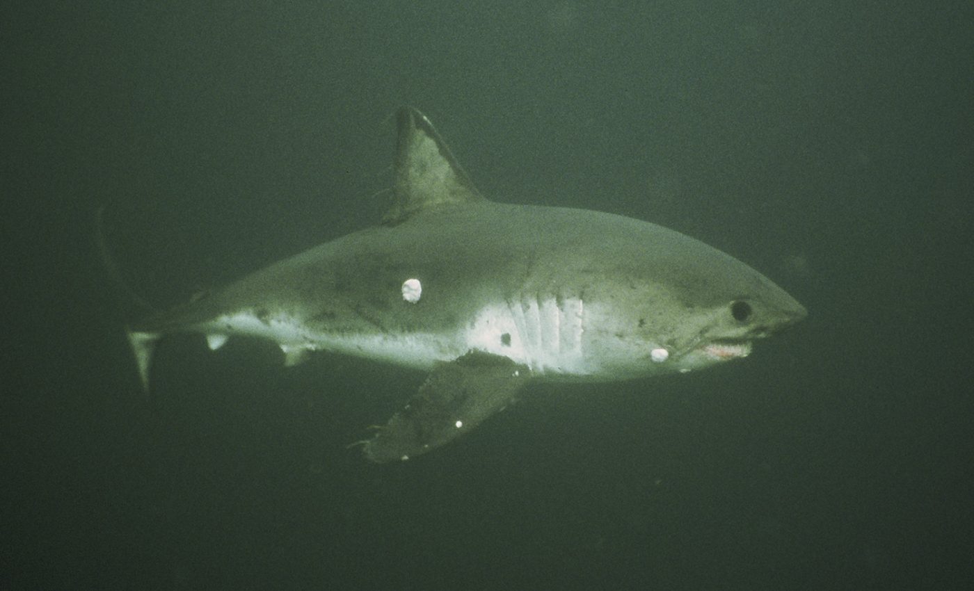
To create the highly specified map, the researchers analyzed marine habitats of 800 sharks and tunas.
The researchers drew on a 2018 study that used satellite tracking data to create a machine learning algorithm that mapped 70,000 fishing vessels around the world including details about fishing methods.
With this study, the researchers focused on 900 vessels from 12 countries that fish in the northeast Pacific Ocean to map the overlap of fishing vessels and tuna and shark populations.
The team combined the data on fishing vessel locations with ocean habitat data from the Tagging of Pacific Predators (TOPP) tracking program which tagged and tracked 876 individual sharks and tunas.
“The biggest challenge was in combining these very different datasets,” said White. “By adding the latest vessel tracking and machine learning techniques to the toolboxes of marine scientists, we were able to paint a clearer picture of how fish and fisheries interact, and this information can inform how our management strategies should reflect this.”
The results of the map showed that ships from Taiwan, China, Japan, the United States, and Mexico were responsible for 90 percent of fishing of seven shark and tuna species.
“These analyses have given us the chance to look more deeply into the dynamics of this ocean and see where managers and stakeholders should focus their attention,” said Francesco Ferretti, a co-author of the study. “We need to push harder to preserve this corner of the planet because these are some of the best ocean environments in the world.”
—
By Kay Vandette, Earth.com Staff Writer
Image Credit: Scot Anderson, TOPP


