Black carbon from wildfires carried east by jet stream
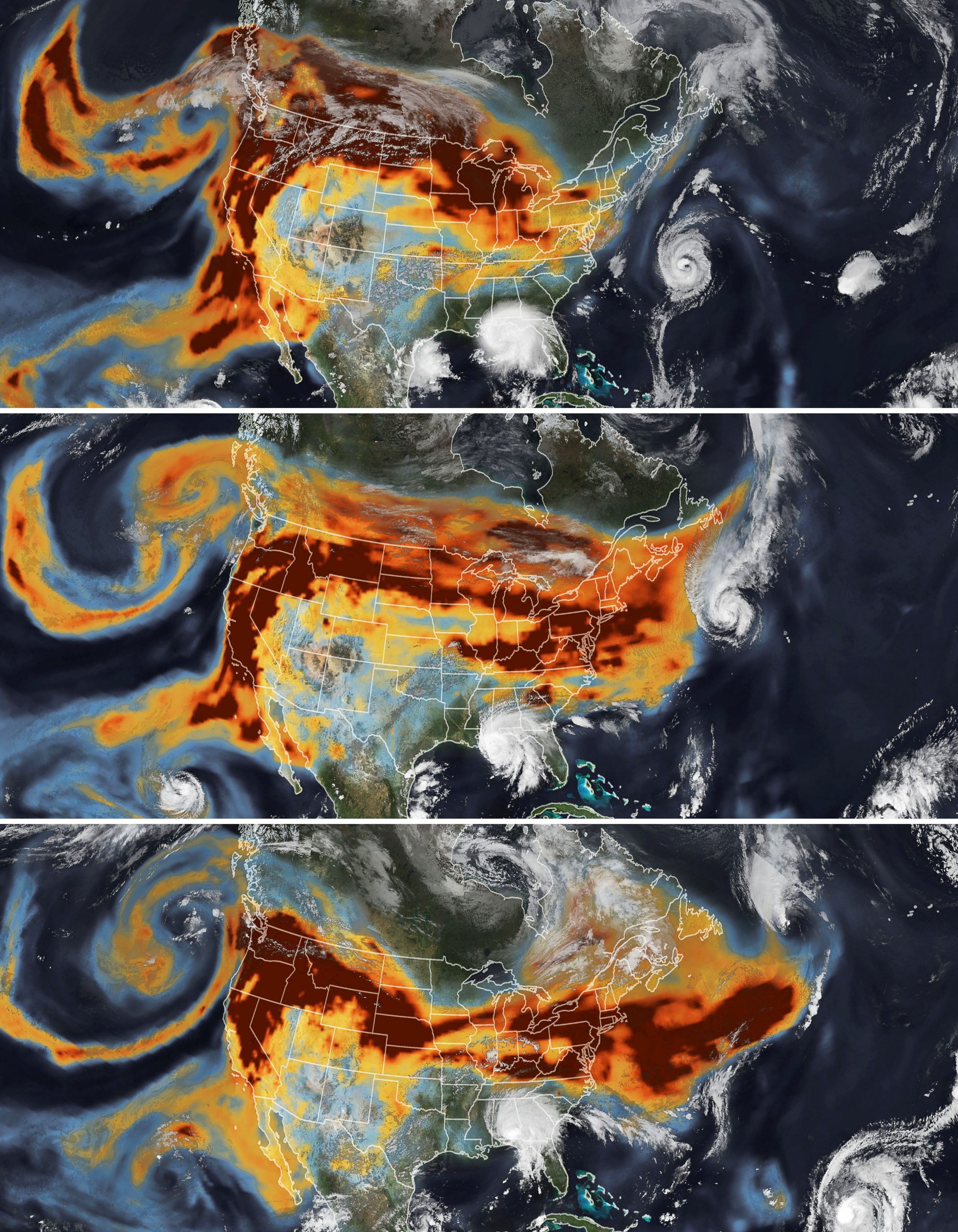

Black carbon from wildfires carried east by jet stream . Today’s Image of the Day from NASA Earth Observatory features a series of satellite maps of black carbon streaming across the United States as a result of the devastating wildfires in the West. Massive smoke plumes from dozens of fires were carried east by jet stream winds and manipulated by tropical cyclones in the Atlantic.
The black carbon data comes from the GEOS forward processing (GEOS-FP) model, which combines data from satellite, aircraft, and ground-based observing systems. The images of the storms were captured by the Visible Infrared Imaging Radiometer Suite (VIIRS) on the NOAA-NASA Suomi NPP satellite. Black carbon from wildfires carried east by jet stream
Even though the maps show that the smoke covers the entire United States, the effects on air quality are not the same at ground level. From September 14-16, the air quality near the fires in California and Oregon was very unhealthy and hazardous, yet air quality in the eastern U.S. remained largely unaffected.Chemically, black carbon (BC) is a component of fine particulate matter (PM ≤ 2.5 µm in aerodynamic diameter). Black carbon consists of pure carbon in several linked forms. It is formed through the incomplete combustion of fossil fuels, biofuel, and biomass, and is one of the main types of particle in both anthropogenic and naturally occurring soot. Black carbon causes human morbidity and premature mortality. Because of these human health impacts, many countries have worked to reduce their emissions, making it an easy pollutant to abate in anthropogenic sources.
Image Credit: NASA Earth Observatory
—
By Chrissy Sexton, Earth.com Staff Writer


News coming your way
