Glacier Bay in southeast Alaska

Glacier Bay in southeast Alaska. Today’s Image of the Day from NASA Earth Observatory features Glacier Bay in southeast Alaska.
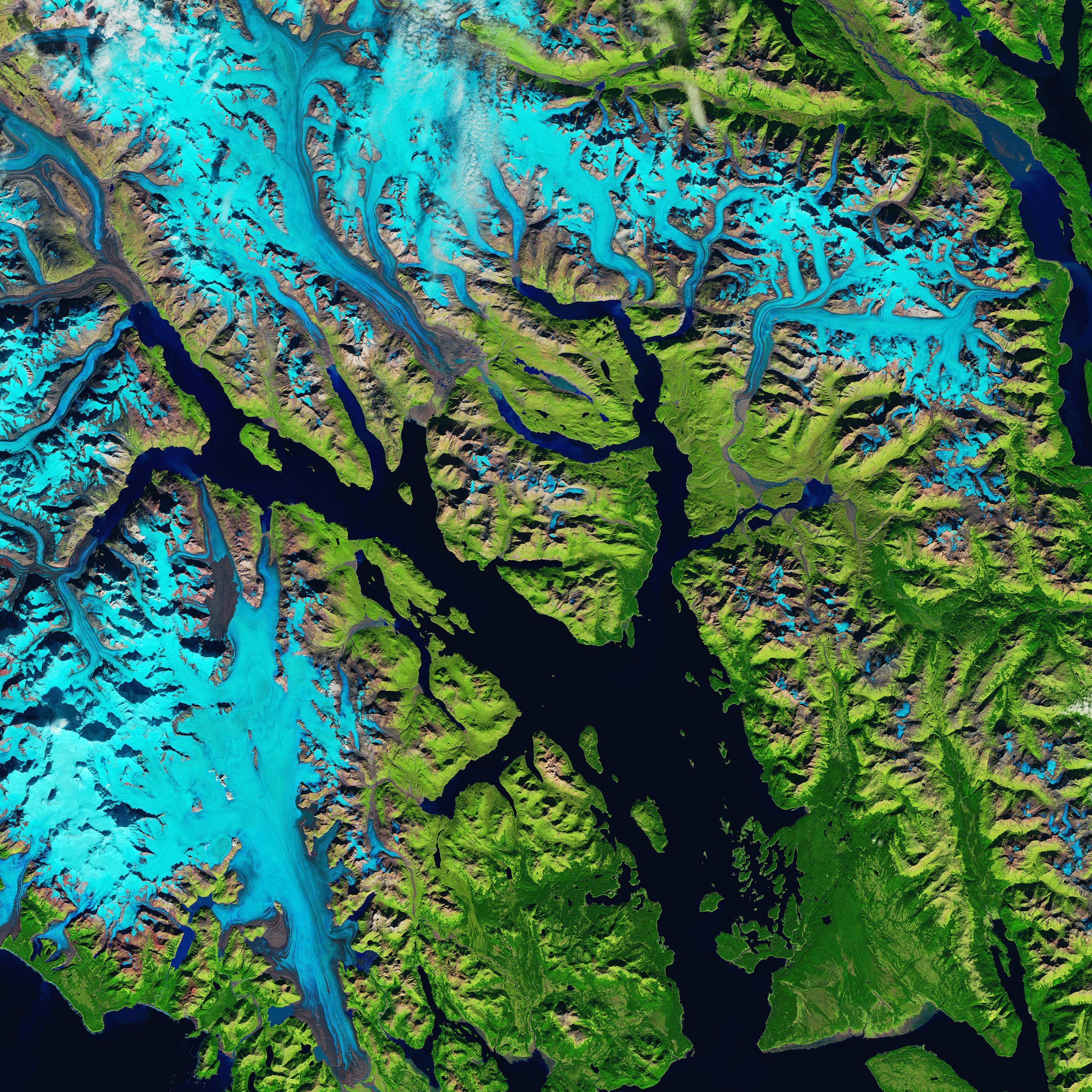
The false-color photograph makes it easier to distinguish between areas of ice, rock, and vegetation.
The ice in Glacier Bay has retreated by about 60 miles since the last time it reached its maximum extent in 1750.
“Recent retreat has been influenced by rapidly warming air and water temperatures,” said Andrew Bliss, a glaciologist with the National Park Service.
“In the East Arm, all of the glaciers are retreating; in the West Arm, a few glaciers are stable or advancing slightly.” Alaska is by far the largest U.S. state by area, comprising more total area than the next three largest states Texas, California, and Montana combined, and the seventh-largest subnational division in the world. It is the third-least populous and the most sparsely populated state, but by far the continent’s most populous territory located mostly north of the 60th parallel, with an estimated population of 738,432 as of 2015—more than quadruple the combined populations of Northern Canada and Greenland.[3] Approximately half of Alaska’s residents live within the Anchorage metropolitan area. The state capital of Juneau is the second-largest city in the United States by area, comprising more territory than the states of Rhode Island and Delaware.
The photo was captured on September 17, 2019 by Landsat 8.
Image Credit: NASA Earth Observatory
—
By Chrissy Sexton, Earth.com Staff Writer


News coming your way
