Gobi Dust Storm
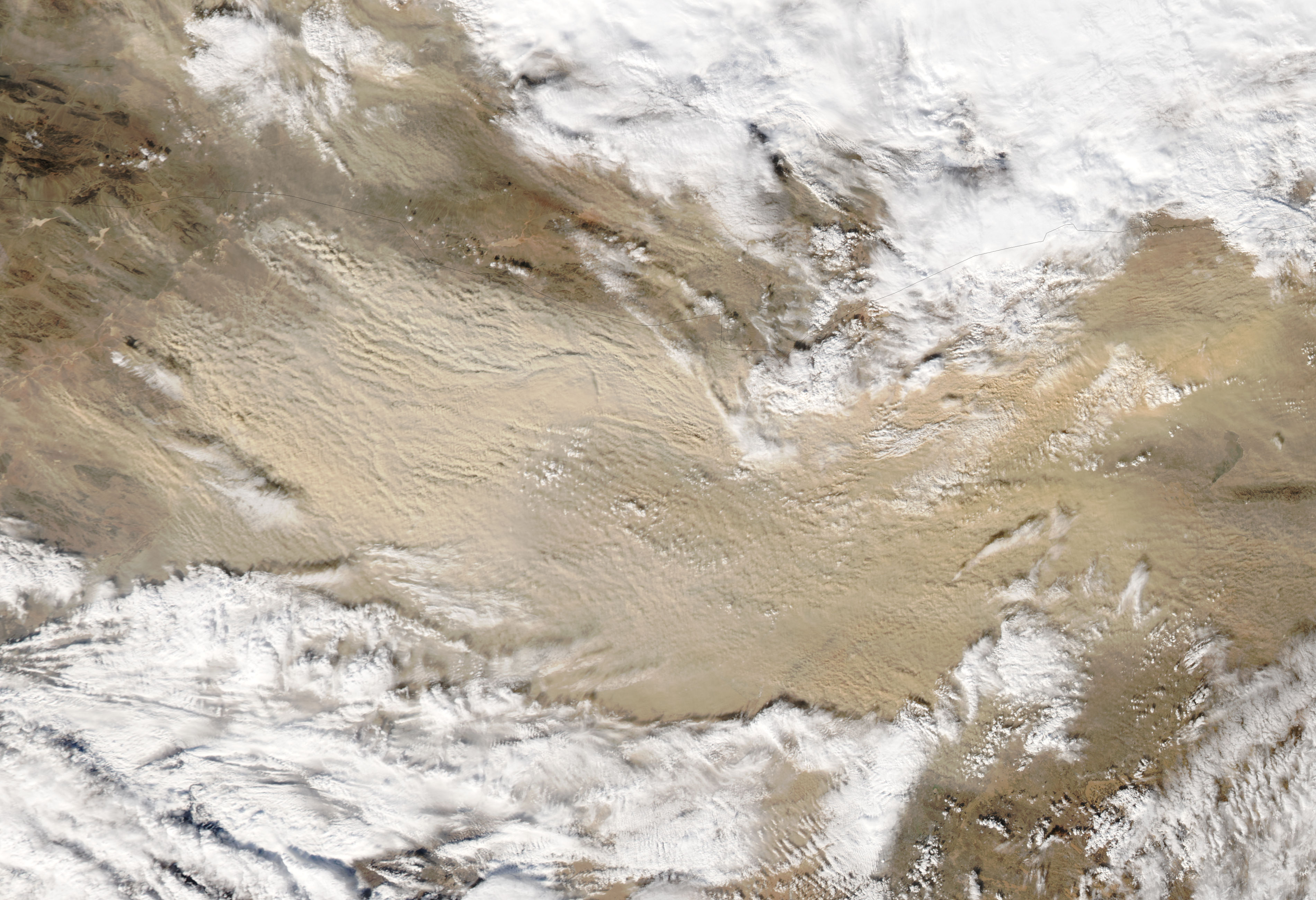

A dust storm that blew through Asia’s Gobi Desert on November 10, 2010, quickly intensified as the day wore on. When the Moderate Resolution Imaging Spectroradiometer (MODIS) on NASA’s Aqua satellite captured this image at 1:50 p.m. Beijing time (5:50 UTC), the dust plumes were considerably thicker than they had been just two hours earlier. Smaller dust plumes also appeared north of the Mongolia-China border.
The dust forms an arc that curves to the southeast and then northeast and occupies an area of clear sky between two cloudbanks. The clouds could be related to the weather system that stirred the dust.
A sand sea in north-central China provides plentiful material for dust storms. Although the Gobi has long ranked as one of the world’s top dust-producing regions, its dust storms have historically occurred most often in March and April, according to the University Corporation for Atmospheric Research.
A large dust storm can be seen blowing across the Gobi Desert in Mongolia in this true-color Terra MODIS image from November 10, 2002. The dust storm appears as a lighter tan with horizontal-running streaks against the darker tan-orange of the desert. The dust storm is mostly in Mongolia (top), but also has a streak running on the other side of the border in the Inner Mongolia region of China.
The Gobi Desert is one of the world’s largest deserts, covering almost 1.3 million square kilometers (around 0.5 million square miles). It sits on a high plateau (from 910 to 1,520 meters), and is a region of extreme weather conditions with bitterly cold winters and short hot summers.
Credit: NASA image by Jeff Schmaltz, MODIS Rapid Response Team at NASA GSFC. Caption by Michon Scott.


News coming your way
