Laura will strengthen into major hurricane as it reaches Gulf Coast
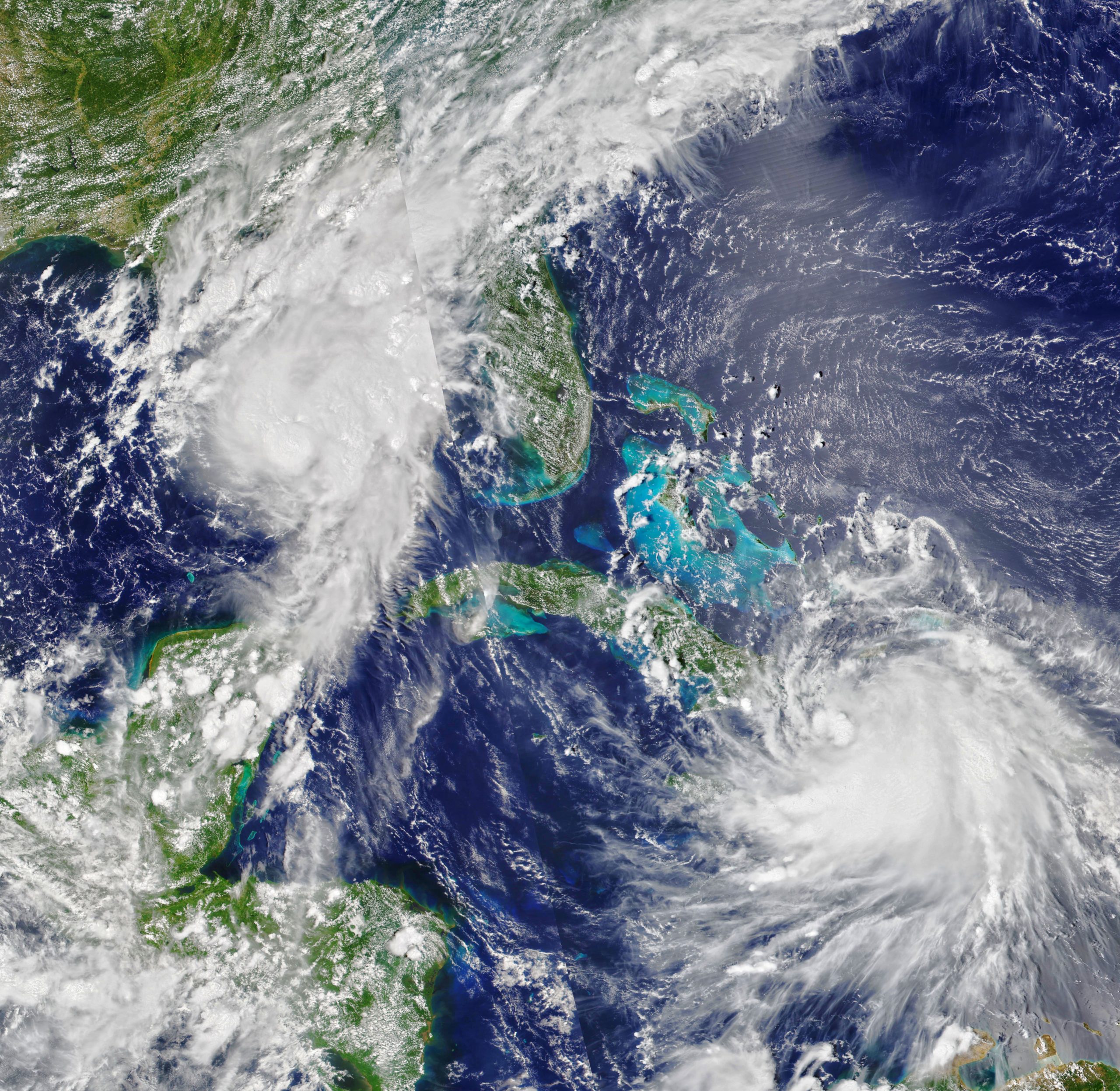

Laura will strengthen into major hurricane as it reaches Gulf Coast. Today’s Image of the Day from NASA Earth Observatory shows Tropical Storm Marco and Tropical Storm Laura racing toward the Gulf Coast on August 23, 2020.
Tropical.Storm Laura is set to become the first major hurricane of the year by the time it makes landfall somewhere in Texas or Louisiana. The impacts of the hurricane will be felt far inland – potentially several hundred miles – over many states.
Life-threatening storm surge is a serious concern across much of the Gulf Coast, with warnings in place from San Luis Pass, Texas to Ocean Springs, Mississippi.
Louisiana Governor John Bel Edward said that today will be the last full day to prepare for this “very large, very powerful storm,” which is expected to gain strength up until it makes landfall early Thursday.
After being downgraded to a tropical depression, Marco made landfall on Monday near the mouth of the Mississippi River. Laura will strengthen into major hurricane as it reaches Gulf Coast. Today’s Image of the Day from NASA Earth Observatory shows Tropical Storm Marco and Tropical Storm Laura racing toward the Gulf Coast on August 23, 2020.
The image was captured by the Visible Infrared Imaging Radiometer Suite (VIIRS) on NOAA-20.
Image Credit: NASA Earth Observatory
—
By Chrissy Sexton, Earth.com Staff Writer


News coming your way
