NPP- VIIRS integration
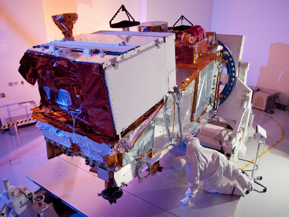

Engineers begin integration of the Medium resolution Visible and Infra-red Imager or VIIRS into the NPOESS Preparatory Project (NPP) satellite. NPP is the bridge mission between the Earth Observing System and the National Polar-orbiting Operational Environmental Satellite System (NPOESS) earth and weather observing fleet of satellites. Credit: NASA/Ball Aerospace
The Geostationary Operational Environmental Satellite system (GOES). Therefore operated by the United States’ National Oceanic and Atmospheric Administration (NOAA)’s National Environmental Satellite, Data, and Information Service division, supports weather forecasting, severe storm tracking, and meteorology research. Spacecraft and ground-based elements of the system work together to provide a continuous stream of environmental data. The National Weather Service (NWS) and the Meteorological Service of Canada use the GOES system for their North American weather monitoring and forecasting operations, and scientific researchers use the data to better understand land, atmosphere, ocean, and climate interactions.


News coming your way
