Sunglint lights up the Caspian Sea
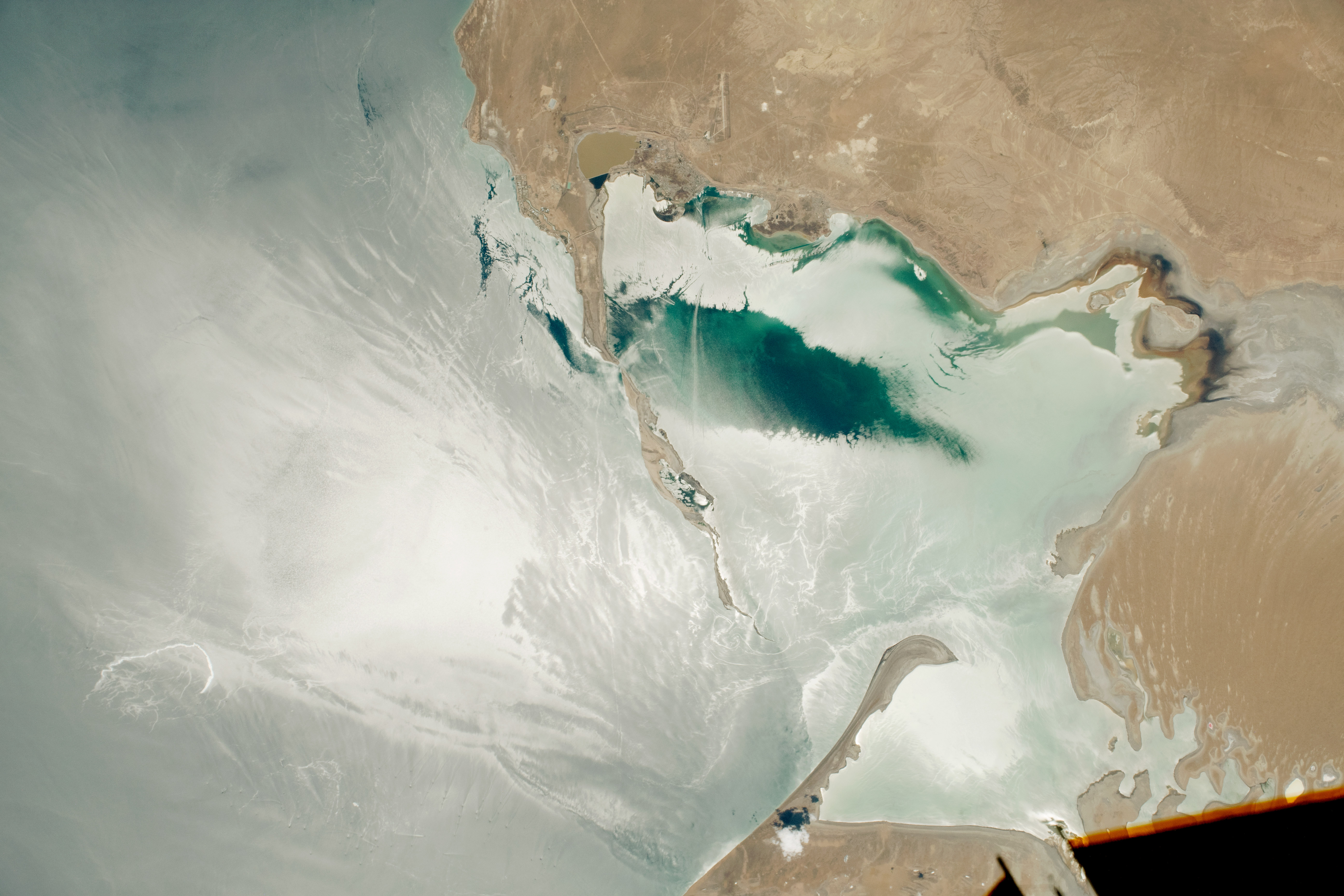

Today’s Image of the Day from NASA Earth Observatory features sunglint reflecting off Turkmenbashi Gulf, an inlet on the southeastern edge of the Caspian Sea. Sunglint lights up the Caspian Sea
Complex glint patterns are caused by waves, wind, boats, and oils. These factors affect the roughness of the surface water.
The Caspian Sea is a large oil-producing region, and the sunglint combines with waves to create traceable lines that lead to dozens of oil drilling platforms. Sunglint lights up the Caspian Sea as shown in the image above.
This image was captured on June 10, 2019 by an astronaut onboard the International Space Station.
The Caspian Sea is the world’s largest inland body of water, variously classed as the world’s largest lake or a full-fledged sea. It is an endorheic basin (a basin without outflows) located between Europe and Asia, to the east of the Caucasus Mountains and to the west of the broad steppe of Central Asia. The sea has a surface area of 371,000 km2 (143,200 sq mi) (excluding the detached lagoon of Garabogazköl) and a volume of 78,200 km3 (18,800 cu mi). It has a salinity of approximately 1.2% (12 g/l), about a third of the salinity of most seawater. It is bounded by Kazakhstan to the northeast, Russia to the northwest, Azerbaijan to the west, Iran to the south, and Turkmenistan to the southeast. The Caspian Sea is home to a wide range of species and may be best known for its caviar and oil industries. Pollution from the oil industry and dams on rivers draining into the Caspian Sea have had negative effects on the organisms living in the sea.
—
By Chrissy Sexton, Earth.com Staff Writer
Image Credit: NASA Earth Observatory


News coming your way
