The coast of Ghana on the Gulf of Guinea
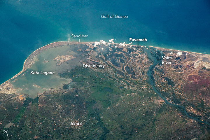
The coast of Ghana on the Gulf of Guinea Today’s Image of the Day from NASA Earth Observatory features the coastal region of Ghana, West Africa. The photograph includes the Volta River Delta, the Keta Lagoon, and the Gulf of Guinea. Situated on the coast of the Gulf of Guinea in western Africa, Ghana is bordered to the northwest and north by Burkina Faso, to the east by Togo, to the south by the Atlantic Ocean, and to the west by Côte d’Ivoire. Physical features of Ghana Encyclopædia Britannica, Inc.
Ghana has a tropical climate with mangrove forests and approximately 90 lagoons that support commercial fishing and help sustain local communities.
The Volta River is one of multiple vast river systems that flow across Ghana. According to ESA, these rivers support the farms that sustain the country’s economy, producing crops such as yams, grains, cocoa, and oil palms.
The coastal communities of Ghana are severely threatened by sea level rise and coastal erosion. The shoreline has been eroding at rates of up to two meters per year.
Along a narrow strip of land between the Gulf of Guinea and the Keta Lagoon, the fishing village of Fuvemeh was essentially swallowed by the sea.
The image was captured on December 26, 2020 by an astronaut onboard the International Space Station (ISS).
Image Credit: NASA Earth Observatory
—
By Chrissy Sexton, Earth.com Staff Writer


News coming your way
