Enormous structures discovered under the North Sea 'defy our geologic understanding'
Deep beneath the North Sea, researchers have mapped giant buried mounds and “sinkites” that turn a basic rule of geology on its head.
A new peer reviewed study shows that heavy, younger sands sank downward while older, lighter layers rose, forming hidden hills under the seafloor.

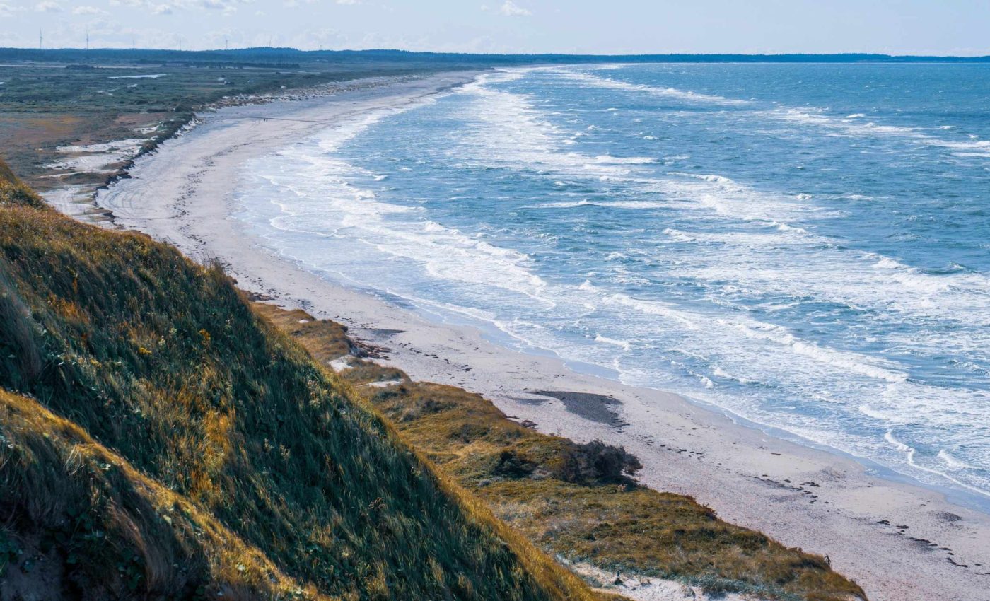
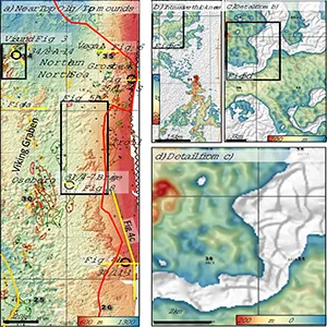
The team stitched together a huge three dimensional seismic dataset with evidence from many wells to show that the mounds occupy an area of roughly 19,000 square miles.
The work points to a process that can scramble the usual order of layers and change how scientists judge the safety of places that might store captured carbon.
Mysterious North Sea mounds
Geologists usually rely on the law that older layers sit below younger ones unless the rocks have been overturned.
In the North Sea case, the rule is broken locally because dense sand pushed downward while lighter material rose.
The lighter layer is a stiff, low density mud known as ooze that grew from the remains of tiny sea life. The heavier layer is younger, loose sand that slumped down through cracks and then spread, propping up rafts of ooze from below.
The result is stratigraphic inversion, a flip in the expected stacking order. The team names the sand bodies that sank sinkites and the ooze blocks that floated up floatites.
These features do not look like simple landslides or standard sand intrusions. Their scale, shape, and relationship to fractures in the ooze point to a different driver.
Basic physics at work
During strong shaking, wet sand can lose strength and move like a fluid, a process called liquefaction. If that liquefied sand rests above a stiffer but lighter layer, the dense slurry tends to sink and the lighter layer tends to rise.
That push and pull creates buoyancy driven instability. The ooze, cut by natural polygon patterns of small faults, breaks into rafts that lift while sand funnels down along the fractures.
Earthquakes in the region millions of years ago likely triggered multiple rounds of movement. Each pulse would have let more sand drop and more ooze lift until the energy died away and the system locked in place.
How scientists spotted the pattern
Seismic reflections reveal sharp boundaries between the ooze and the sand intrusions. The mounded zones are confined to a specific slice of the rock record, while layers above and below remain mostly undisturbed.
In places, thin fractures filled with sand connect the intrusions below to sands above, a sign of downward movement rather than sand injected from great depth.
The chemistry and grain makeup of some buried sands also match nearby overlying sands, backing the same conclusion.
The mounds form ridges and pods that mirror the size and orientation of the surrounding polygonal faults. That map view geometry fits the idea of sand sinking along fracture networks while ooze rafts rise between them.
North Sea mounds and carbon
Engineers are already injecting carbon dioxide into a large North Sea sandstone known as the Utsira, part of the long running Sleipner project.
Any new process that moves fluids or shifts layers underground matters when picking safe, durable storage targets.
Understanding whether sands could move and whether seals remain tight helps planners estimate long term behavior. It also guides where to avoid injecting and where to watch most closely.
The North Sea stores of pore space are huge, but safety depends on the details of the rocks at each site. Findings like these sharpen the checklist used to evaluate storage security.
More tests and answers needed
“This discovery reveals a geological process we haven’t seen before on this scale. This research shows how fluids and sediments can move around in Earth’s crust in unexpected ways,” said Mads Huuse, a geophysicist at the University of Manchester who led the study.
The data favor a model where sand sank as a slurry while ooze rose as rigid rafts. Even so, scientists want to test how often such flipping happens, how large the units can grow, and what levels of shaking are needed to start movement.
Another question is timing. Evidence suggests activity clustered in the late Miocene and Pliocene, but the exact sequence of pulses and pauses varies across the basin.
North Sea mounds and new geology
Geologists mapping buried landscapes use shape, texture, and context to decide whether a body is a channel, a landslide, or an intrusion.
Sinkites add a new category with its own fingerprints, such as serrated edges where sand fills polygonal fractures.
For industry and storage projects, the work adds new cues for spotting zones where density contrasts once rearranged the stack. It also warns against assuming that all thick sands formed where they now sit.
Future surveys can target other continental margins where light biogenic mud sits below younger sand. If similar structures appear elsewhere, the process is not a North Sea quirk but part of a broader pattern.
More lab tests and computer models can explore how liquefied sand moves through fractured layers. That helps turn a striking field observation into rules that predict when and where inversion will occur.
The study is published in Communications Earth and Environment.
—–
Like what you read? Subscribe to our newsletter for engaging articles, exclusive content, and the latest updates.
Check us out on EarthSnap, a free app brought to you by Eric Ralls and Earth.com.
—–


