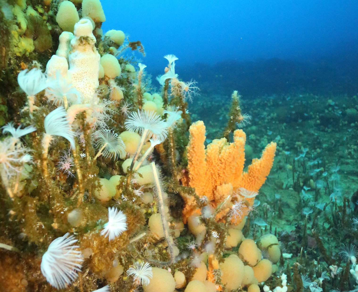
Satellite data reveals vibrant life on the Antarctic seafloor
An international team of scientists has managed to use an ocean model combined with satellite data to describe and project biodiversity on the floor of the Antarctic Ocean. The unprecedented study was conducted by an incredibly diverse group of researchers, including earth scientists, physicists, geologists, and biologists.
Satellite images of phytoplankton color on the sea surface were used with connected models that represent how the microalgae are swept by ocean currents, sink to the seafloor, and are then redistributed across it. Using this system, the team was able to accurately predict life on the seafloor without the need for physical probing.

Jan Jansen from the University of Tasmania Institute for Marine and Antarctic Studies is the study’s lead author. Jansen explained that the breakthrough would support better conservation and management of biodiversity in the Antarctic.
“For the first time, we are able to predict how much food is available to organisms on the Antarctic sea floor, and therefore how much life is supported across the region,” said Jansen.
“Scientists have long known that there was a relationship between organic matter on the surface and life on the seafloor,” he explained. “But until now there hasn’t been a reliable model that not only explained the link but also enabled predictions of biodiversity.”
Jansen said that the “food availability model” brings together analysis of the rate at which organic matter sinks with data about changing ocean currents on and above the seafloor.
“The model’s predictions about how much food there will be in a particular area have been verified by physical sampling of seafloor sediments,” said Jansen. “This system of models allows broad scale predictions of seafloor biodiversity over vast regions of the Antarctic continental shelf that were previously hidden, as well as predictions about how climate change will affect the ecosystem.”
Jansen said the new system will also help to develop improved strategies for the management and conservation of specific parts the ocean.
Study co-author Professor Craig Johnson explained that while the study was based on a region in eastern Antarctica, the new strategy could be used to produce maps of biodiversity around the entire Antarctic continent, including areas where information is currently limited and challenging to obtain.
“This information would be very valuable and is an exciting prospect,” said Professor Johnson. “With further research, this system of models has the potential to provide valuable insights into seafloor biodiversity across other parts of the world’s oceans.”
The study is published in the journal Nature Ecology & Evolution.
—
By Chrissy Sexton, Earth.com Staff Writer
Image Credit: Jonny Stark/Australian Antarctic Division


