Bolivia's forests are burning with little relief in sight
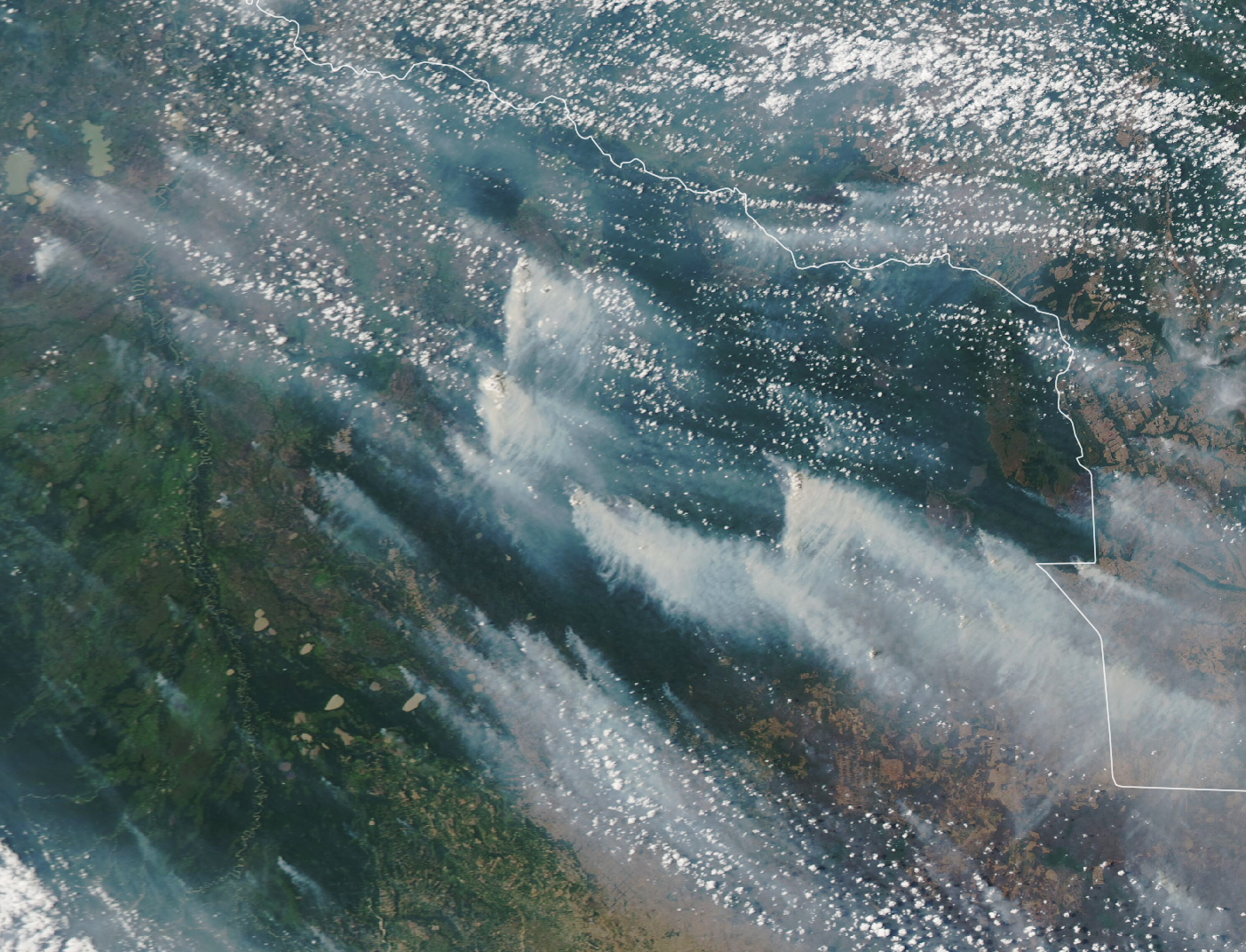

Bolivia’s forests are burning with little relief in sight. Today’s Image of the Day from NASA Earth Observatory shows smoke streaming from destructive wildfires across the Chiquitano forest of eastern Bolivia.
Controlled fires are a common seasonal occurrence in the region, but fires are burning out of control this year after persistent drought and a recent heatwave.
Satellites have observed fires burning throughout August, September, and October, and the government has declared a state of emergency.
More than 1.5 million acres have burned in Bolivia, causing widespread damage to crops and grazing lands. Bolivia’s forests are burning with little relief in sight
According to NASA, fires have destroyed at least 45,000 hectares of crops, 27,000 hectares of grazing land, and 800 head of cattle in Santa Cruz and Chuquisaca.
The fires will be difficult to contain in the next few weeks, as high temperatures and winds are expected with little rain in the forecast.
The image was captured on October 9, 2020 by the Moderate Resolution Imaging Spectroradiometer (MODIS) on NASA’s Aqua satellite
The sovereign state of Bolivia is a constitutionally unitary state, divided into nine departments. Its geography varies from the peaks of the Andes in the West, to the Eastern Lowlands, situated within the Amazon basin. It is bordered to the north and east by Brazil, to the southeast by Paraguay, to the south by Argentina, to the southwest by Chile, and to the northwest by Peru. One-third of the country is within the Andean mountain range. With 1,098,581 km2 (424,164 sq mi) of area, Bolivia is the fifth largest country in South America, after Brazil, Argentina, Peru, and Colombia (and alongside Paraguay,
Image Credit: NASA Earth Observatory
—
By Chrissy Sexton, Earth.com Staff Writer


News coming your way
