Fires in Idaho and Montana
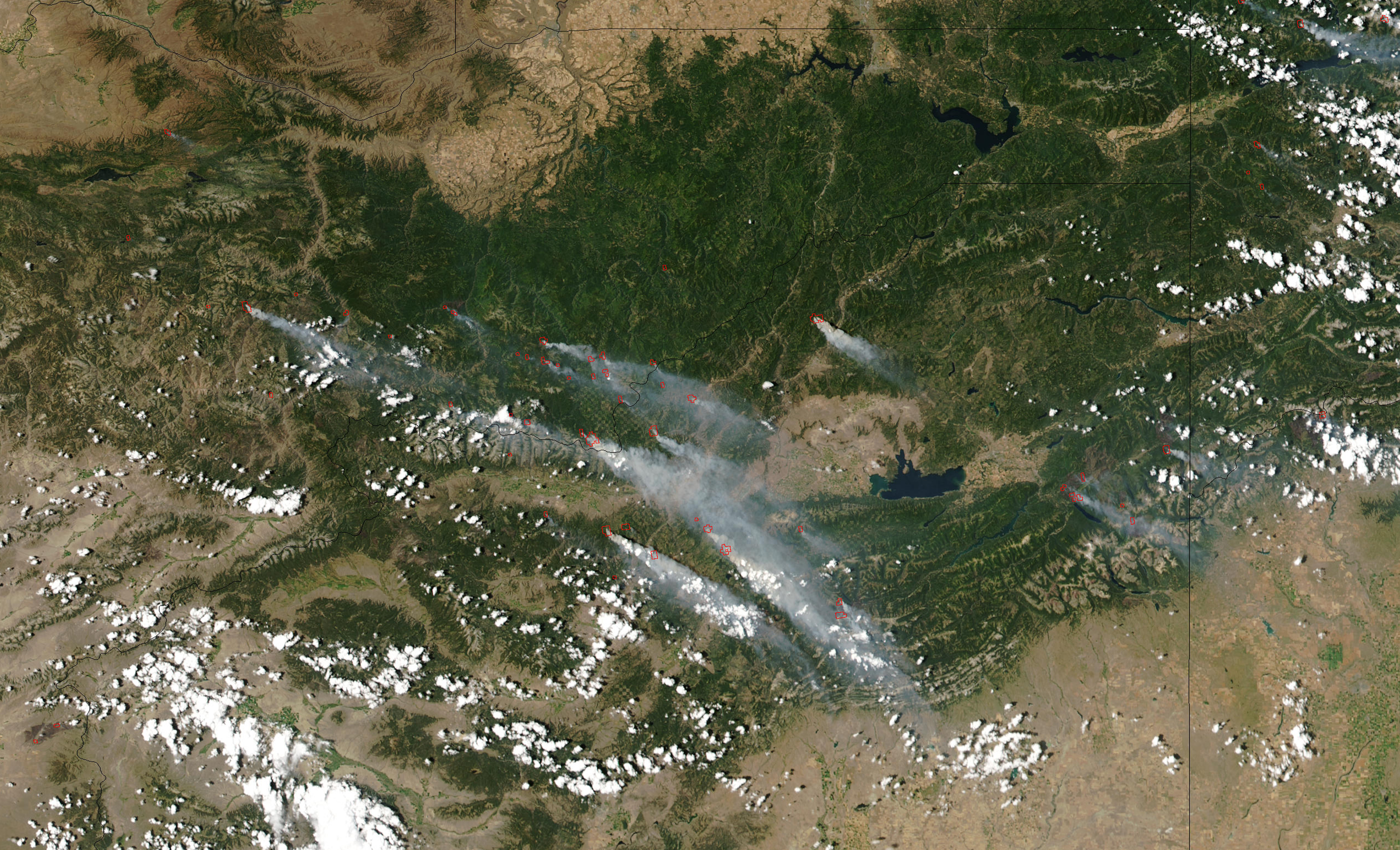

This series of Moderate Resolution Imaging Spectroradiometer (MODIS) images from the Aqua and Terra satellites shows dozens of large fires burning in the Northern Rockies in mid to late August 2003. Most of the images are centered on Montana and show Canada to the north and Idaho to the west. The fires, marked with red dots in the images, have forced hundreds of people from their homes, and put thousands on evacuation alert.
Idaho prior to European settlement was inhabited by Native American peoples, some of whom still live in the area. In the early 19th century, Idaho was considered part of the Oregon Country, an area disputed between the U.S. and the United Kingdom. It officially became U.S. territory with the signing of the Oregon Treaty of 1846, but a separate Idaho Territory was not organized until 1863, instead being included for periods in Oregon Territory and Washington Territory. Idaho was eventually admitted to the Union on July 3, 1890, becoming the 43rd state.
Montana is the fourth-largest in area, the 8th least populous, and the third-least densely populated of the 50 U.S. states. The western half of Montana contains numerous mountain ranges. Smaller island ranges are found throughout the state. In all, 77 named ranges are part of the Rocky Mountains. The eastern half of Montana is characterized by western prairie terrain and badlands. Montana is bordered by Idaho to the west, Wyoming to the south, North Dakota and South Dakota to the east, and the Canadian provinces of British Columbia, Alberta, and Saskatchewan to the north.
Credit: Jacques Descloitres, MODIS Rapid Response Team, NASA/GSFC


News coming your way
