First Global Image from VIIRS
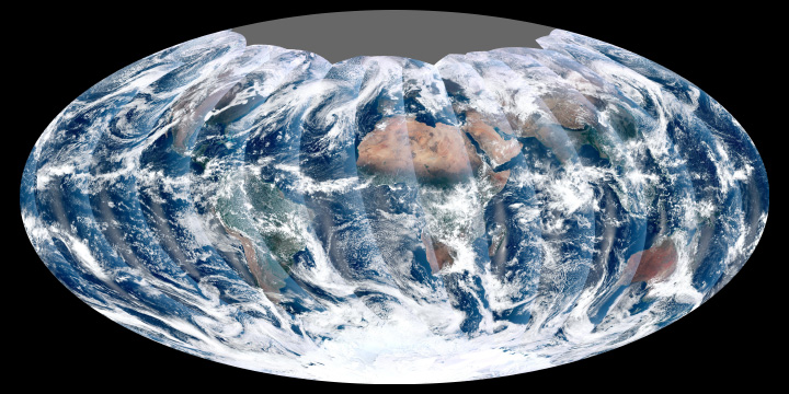
From its vantage 824 kilometers (512 miles) above Earth. And the Visible Infrared Imager Radiometer Suite (VIIRS) on the NPOESS Preparatory Project (NPP) satellite gets a complete view of our planet every day. Therefore This image from November 24, 2011, is the first complete global image from VIIRS.
Also The NPP satellite launched on October 28, 2011. Therefore VIIRS acquired its first measurements on November 21. To date, the images are preliminary, used to gauge the health of the sensor as engineers.
Rising from the south and setting in the north on the daylight side of Earth, VIIRS images the surface in long wedges measuring 3,000 kilometers (1,900 miles) across. The swaths from each successive orbit overlap one another, so that at the end of the day, the sensor has a complete view of the globe. The Arctic is missing because it is too dark to view in visible light during the winter.
shadows and lighting.


News coming your way
