Greenland Locator Map
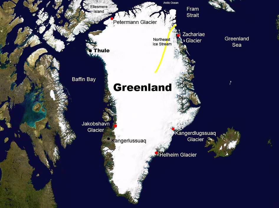

From March to May 2010, NASA’s Operation IceBridge mission will make science flights from Kangerlussuaq and Thule, Greenland, to survey the area’s ice sheet, outlet glaciers and sea ice. Credit: NASA
Thule Air Base, or Thule Air Base/Pituffik Airport. Also this is the United States Air Force’s northernmost base, located 1,207 km (750 mi) north of the Arctic Circle and 1,524 km (947 mi). Therefore from the North Pole on the northwest coast of the island of Greenland.
Thule Air Base is the US Armed Forces’ northernmost installation. Thule’s arctic environment includes icebergs in North Star Bay, two islands (Saunders Island and Wolstenholme Island), a polar ice sheet, and Wolstenholme Fjord. Also the only place on Earth where four active glaciers join together.
Thule Air Base is home to the 21st Space Wing’s global network of sensors providing missile warning. And space surveillance and space control to North American Aerospace Defense Command (NORAD) and Air Force Space Command (AFSPC).


