Lake Victoria reaches record high levels

Lake Victoria reaches record high levels Today’s Image of the Day from NASA Earth Observatory features Lake Victoria, where recent flooding displaced tens of thousands of people.
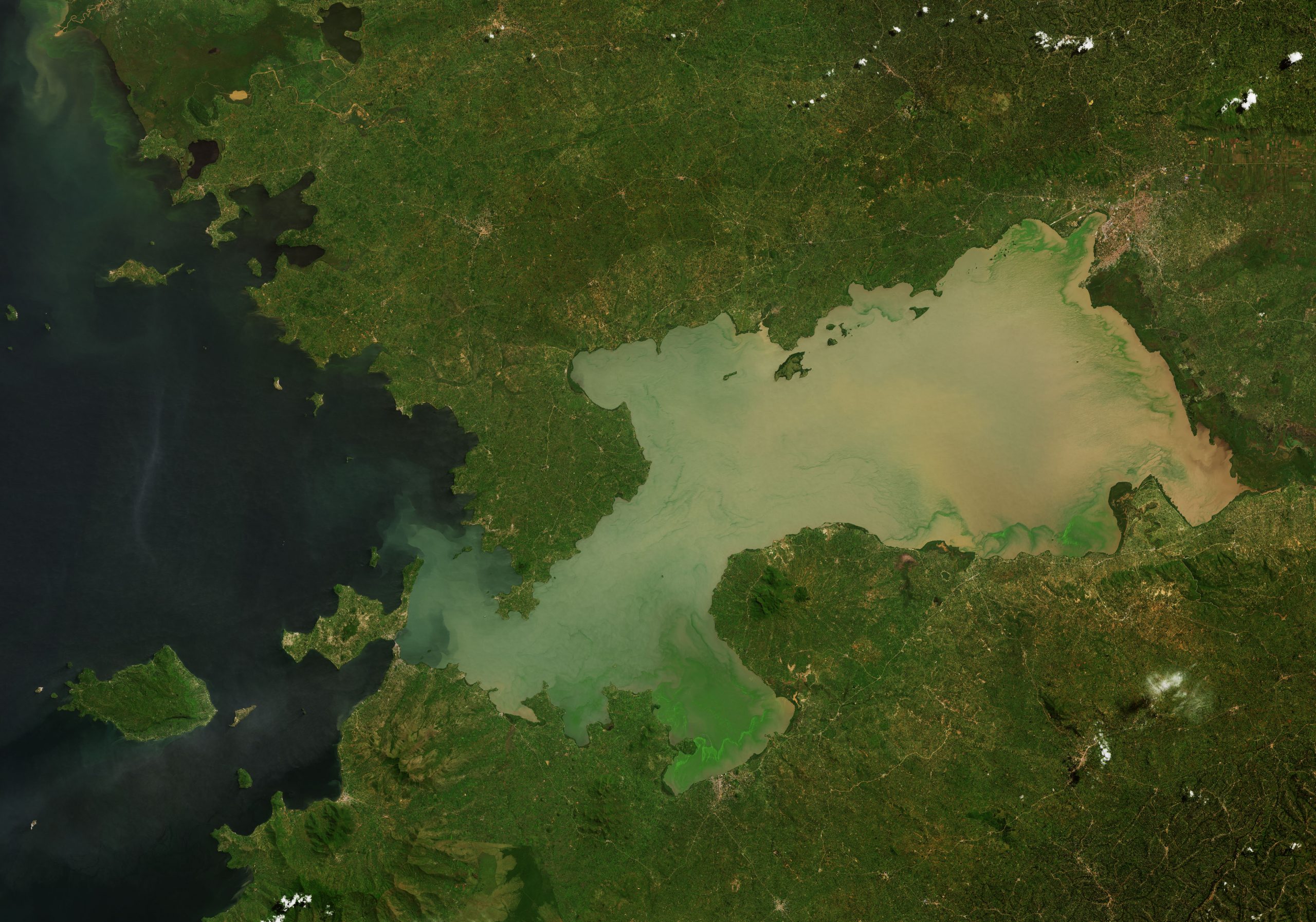
The photograph is focused on Winam Gulf, a shallow northeastern extension of Lake in Kenya.
According to NASA, months of intense rain have swollen Africa’s largest lake to the highest levels observed in decades. Lake Victoria (Dholuo: Nam Lolwe; Luganda: ‘Nnalubaale; Kinyarwanda: Nyanza; also Ukerewe) is one of the African Great Lakes. The lake was renamed after Queen Victoria in the reports of the explorer John Hanning Speke, the first Briton to document it. Speke accomplished this in 1858, while on an expedition with Richard Francis Burton to locate the source of the Nile River. This expedition was financially sponsored by the Royal Geographic Society.
With a surface area of approximately 59,947 km (23,146 sq mi), Lake Victoria is Africa’s largest lake by area, the world’s largest tropical lake, and the world’s second-largest fresh water lake by surface area after Lake Superior in North America. In terms of volume, Lake Victoria is the world’s ninth-largest continental lake, containing about 2,424 km (1.965×10 acre⋅ft) of water. Lake Victoria occupies a shallow depression in Africa. The lake has a maximum depth of between 80 and 84 m (262 and 276 ft) and an average depth of 40 m (130 ft). Its catchment area covers 169,858 km (65,583 sq mi). The lake has a shoreline of 7,142 km (4,438 mi) when digitized at the 1:25,000 level, with islands constituting 3.7% of this length.
The image was captured on May 27, 2021 by the Operational Land Imager (OLI) on Landsat 8, when water levels were near record height.
Image Credit: NASA Earth Observatory
–—
By Chrissy Sexton, Earth.com Staff Writer


News coming your way
