Tropical Storm Andres in the eastern Pacific
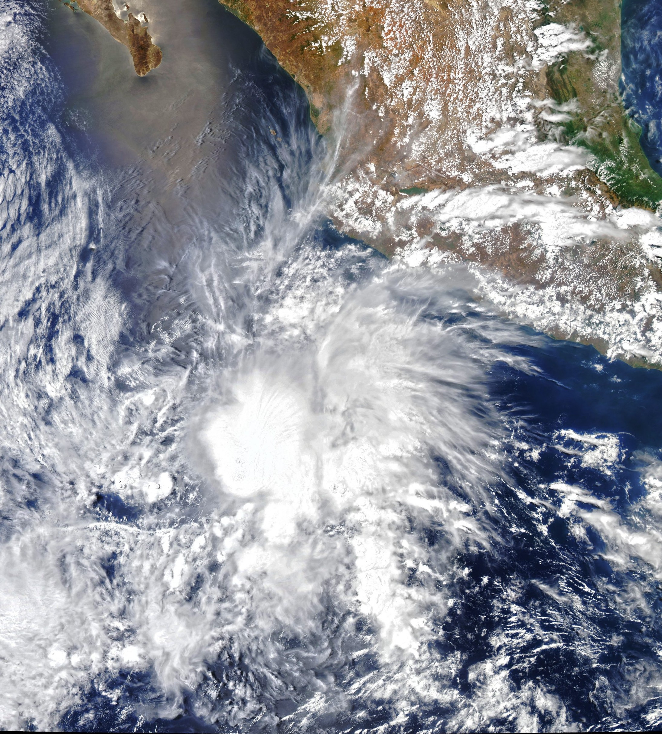

Today’s Image of the Day from NASA Earth Observatory features Tropical Storm Andres, which was this year’s first tropical storm in the Western Hemisphere.
The storm developed on May 8th and 9th, setting a new record for the earliest formation of a tropical storm in the eastern Pacific Ocean.
According to the U.S. National Hurricane Center, the average date for the first named storm in the eastern Pacific is June 10, while the first hurricane usually arrives by June 26. North America is a continent entirely within the Northern Hemisphere and almost all within the Western Hemisphere. It can also be described as the northern subcontinent of the Americas. It is bordered to the north by the Arctic Ocean, to the east by the Atlantic Ocean, to the southeast by South America and the Caribbean Sea, and to the west and south by the Pacific Ocean. Because it is on the North American Tectonic Plate, Greenland is included as part of North America geographically. North America covers an area of about 24,709,000 square kilometers (9,540,000 square miles), about 16.5% of the Earth’s land area and about 4.8% of its total surface. North America is the third-largest continent by area, following Asia and Africa, and the fourth by population after Asia, Africa, and Europe.
The image of Andres was captured on May 9, 2021 by the Moderate Resolution Imaging Spectroradiometer (MODIS) on NASA’s Aqua satellite.
Image Credit: NASA Earth Observatory
—
By Chrissy Sexton, Earth.com Staff Writer


News coming your way
