Typhoon Rai intensified just before landfall in the Philippines
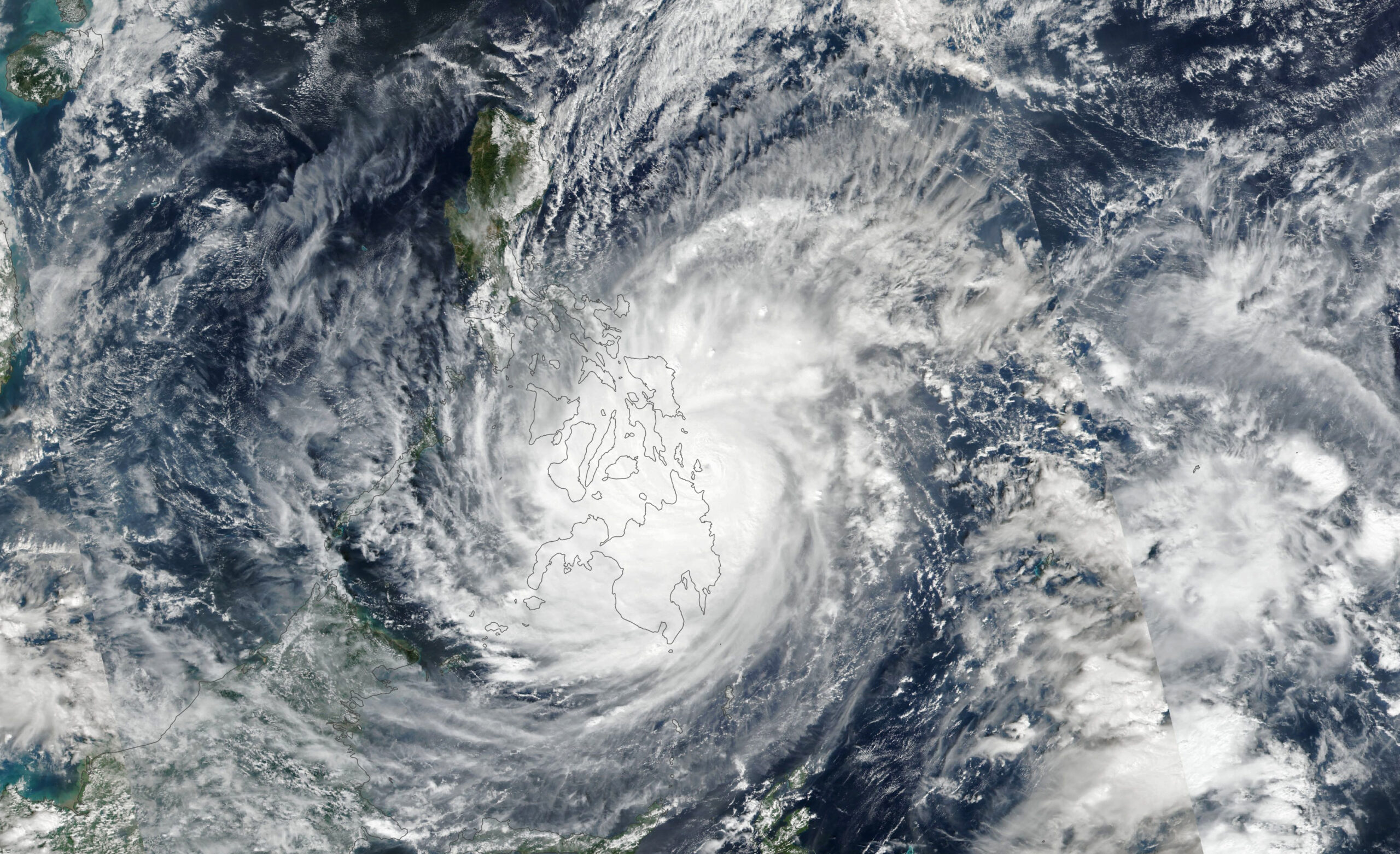

Today’s Image of the Day from NASA Earth Observatory features Typhoon Rai as it crossed the southern and central Philippines, a region that is home to an estimated 30 million people.
The typhoon had intensified to a category 5 storm just hours before making landfall. Search and rescue efforts began on Friday. Dozens of people lost their lives, and many more are missing.
Philippine Senator and Red Cross Chairman Richard Gordon told CNN that there is “an explosion of debris from falling trees and falling buildings.”
When this image was captured in the early afternoon on December 16, Rai had sustained winds of 150 miles per hour.
The super typhoon, which is known locally as Odette, was one of the strongest storms recorded anywhere in the world this year.
Rai is the 15th typhoon to affect the Philippines in 2021. According to NASA, the archipelago typically sees more landfalling storms annually than any other place on Earth.
The image was captured by the Visible Infrared Imaging Radiometer Suite (VIIRS) on the Suomi-NPP satellite.
Image Credit: NASA Earth Observatory
–—
By Chrissy Sexton, Earth.com Staff Writer


