Reef evidence shows rapid changes in sea level from glacial melt
The Last Glacial Maximum (LGM) occurred 27,000 to 20,000 years ago, when continental ice sheets extended deep into the middle latitude regions of North America and Europe. Stable ice sheets were believed to have existed for roughly 10,000 years before the ice slowly began to melt away. Although this period of time is important to our understanding of present day climate change, it is still not well understood. Now, new analysis of the first Great Barrier Reef samples covering the period of time 22,000 years ago to 19,000 years ago has provided some detail to the LGM.
A research team led by Yusuke Yokoyama, a professor at the University of Tokyo, accrued data that now divides the LGM into two distinct periods. In period A (30,000 to 21,500 years ago) the sea level was relatively stable. In period B (21,000 to 17,000 years ago, the sea level was unstable with large, rapid fluctuations. This rapid drop in sea level believed to have occurred 21,000 years ago is of major importance, as it contradicts current understanding of this period.

“This challenges the paradigm that glacier size can only change slowly, because rapid sea level changes mean water must melt or freeze rapidly,” explains Yokoyama.
These findings – published in Nature – could have a major impact on our current understanding of climate change and the associated impacts.
“Current models of glacier dynamics may be too conservative,” says Yokoyama. “The possibility of rapid increases or decreases in sea level should be considered.”
Models predicting future changes in climate are tested on their ability to accurately calculate historic climate parameters that are backed by sample data. “Research teams like ours collect data about how the Earth used to be, and then other research groups use those data to continuously improve their models of the future climate.” Yokoyama explains.
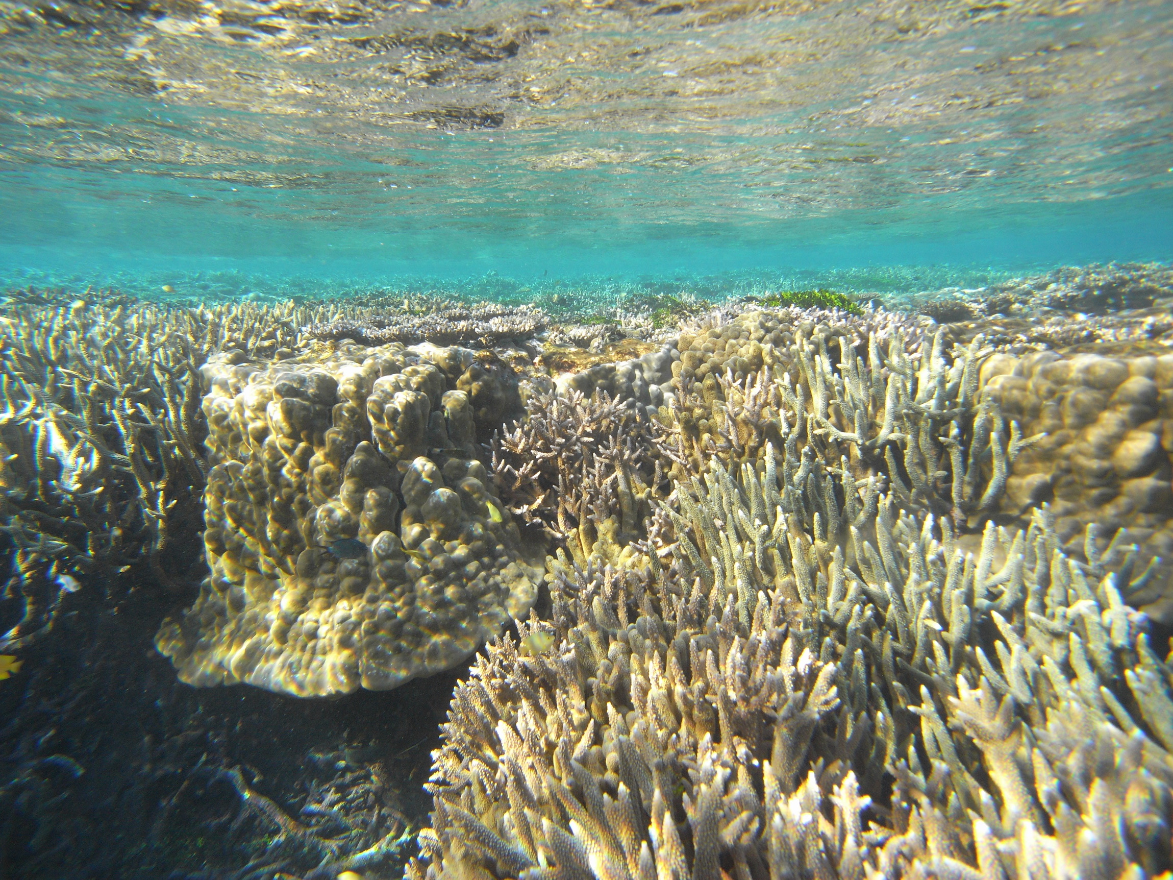
Yokoyama’s team collected data by analyzing fossil coral reef samples that came from two sites on the east coast of Queensland, Australia. The Great Barrier Reef was chosen as the sample site due to its ability to relay a clear picture of past glacier ice sheet behavior. Its position near the equator means it was and still is far from the immediate influence of glacier ice sheets, so sea level changes on the Great Barrier Reef reflect global sea level changes.
The researchers studied coral structure and algae layers within coral core samples in order to determine water depth. They then used radiocarbon and uranium-thorium dating to determine when the water was at certain levels.
“Two death events of reefs are very clear in the coral cores we examined,” says Yokoyama.
When the ice sheets increased in size, the global sea level fell, causing coral to dry out and die – but deep-water corals survived. When the water became too deep, sunlight and nutrients became unavailable to deeper corals, causing the reefs to drown. The two death events the researchers found are consistent with a drop in sea level and a following rise in sea level. Dating suggests that both events happened over a period of only 4,000 years – which the study’s authors say is very quick.
Sea level rise and fall has a wide range of impacts beyond just affecting coral reefs.
“It’s really important to understand the size and location of ice sheets because large bodies of ice act like a freezer for the local environment – glaciers change ocean temperature and salinity, which affect ocean conditions,” says Yokoyama. “Understanding ancient sea levels can reveal geological structures, such as land bridges, that could have been important for migration routes or species separation.”
—
By Connor Ertz, Earth.com Staff Writer
Image Credit: Hironobu Kan


