1,000-foot mega-tsunami could erase parts of the U.S., scientists say it has happened before
A 1,000-foot tsunami striking the U.S. sounds like the plotline from a Hollywood action thriller. However, as we saw just last year with the mega-tsunami in Greenland, such a monstrous event is definitely a possibility.
Studying the causes and warning signs of mega-tsunamis is a science niche drawing interest from people around the world who monitor seismic activity.

Christopher Adams, a geophysicist affiliated with GNS Science in Lower Hutt, New Zealand, has expertise in tectonic fault analysis.
He notes that increased understanding of earthquakes in unexpected parts of the world is adding to the broader conversation about large-scale hazards.
Adams points out that developing greater awareness and understanding of smaller quakes can give scientists much better insight into how seismic forces gather and shift deep below the surface.
Even small earthquakes trigger tsunamis
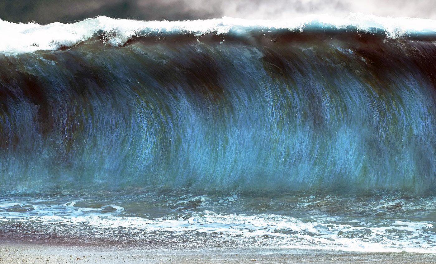
Many researchers believe that certain conditions, such as a severe underwater landslide or a major disturbance along a subduction zone, could generate a fast-moving wall of water close to 1,000 feet high.
One historical event often cited, is the 1958 surge at Lituya Bay, Alaska, which topped 1,700 feet and reshaped the local shoreline.
Scientists studying large earthquakes that spawn tsunamis have discovered that even areas not typically known for big seismic shocks can experience them.
Current work from Dr. Tiffany Dura from the Department of Geosciences at Virginia Tech in Blacksburg, Virginia, shows that coastal zones in the Pacific Northwest could sink up to several feet in minutes when major tectonic plates suddenly slip.
Possible under the right conditions
While it may sound like a myth, there is scientific precedent for such extreme wave heights under rare but plausible conditions.
The 1958 Lituya Bay mega-tsunami was triggered by a massive landslide into a narrow Alaskan fjord, which instantly displaced enough water to send a wave 1,720 feet up the opposite shore.
Researchers caution that if a similar volume of rock or sediment slid into the ocean basin after a Cascadia rupture (especially in confined coastal inlets) it could produce waves on a comparable scale.
These events are difficult to model, but under the right conditions, a 1,000-foot surge is not outside the realm of physical possibility.
Earthquakes have long ripple effects
Regional quakes sometimes appear far away from large ocean basins, yet their effects can link to coastal vulnerabilities.
Data from the U.S. Geological Survey indicates that over 3,900 earthquakes have been recorded in Texas since 1900.
One of the most significant happened on August 16, 1931, near Valentine in Presidio County with a magnitude of 5.8.
“The most severe damage was reported at Valentine, where all buildings except wood-frame houses were damaged severely and all brick chimneys toppled or were damaged,” recounted the agency at the time.
The shake was intense enough to crack walls, dismantle chimneys, and rotate certain structures.
Tsunamis from Cascadia earthquakes
While Texas quakes may not directly produce a 1,000-foot wall of water, seismic events in coastal zones might.
The Cascadia subduction zone, stretching from Northern California to Canada, is a place of intense scrutiny.
Experts studying that region have warned that if a massive quake ruptures there, it could displace enough water to form a towering tsunami wave.
The research highlights how sudden land subsidence up to two meters could coincide with this type of quake.
If that subsidence were to combine with a significant undersea landslide, the chance of an extreme wave would multiply.
Past quakes shape disaster planning
Historic subduction-zone quakes have offered glimpses into what might happen along the Cascadia coast.
The 2011 Tōhoku earthquake in Japan caused land to drop by up to 3 feet in some areas, triggering a tsunami that killed over 15,000 people and caused extensive damage to nuclear infrastructure and transportation networks.
Events like these help shape emergency response plans in the U.S. The National Tsunami Hazard Mitigation Program and other groups use this data to simulate what coastal towns should expect. T
hey test everything from evacuation times to post-disaster housing needs based on real quake-and-wave combinations seen around the world.
Inland communities also impacted
Concerns about large tsunamis go beyond the immediate coastline. Infrastructure, roads, farms, and broader communities may also feel the long-term effects of sudden land shifts.
This is particularly vital for people living in low-lying regions, where any rapid rise in ocean levels might lead to property damage or permanent loss of habitable land.
Scientists behind the work on coastal risk emphasize the financial ramifications too.
Livelihoods, agriculture, and tourism could face massive setbacks if coastal erosion and flooding become more common after a big quake. Overwhelmed roadways, submerged farmland, and displaced families might follow.
Earthquakes, tsunamis, and the future
Tsunamis of extraordinary heights remain rare events, yet past examples remind everyone to remain observant.
Oceanographic and seismic monitoring, geologic surveys, and improved public education are crucial for communities that could one day find themselves dealing with a colossal surge.
Cities in seismically active regions have bolstered early-warning systems, ensuring that any large tremor triggers immediate alerts.
Communities outside traditional hazard zones can also learn from states already working on preparedness. This cautionary approach may reduce harm if a huge wave strikes.
The study is published in Proceedings of the National Academy of Sciences.
—–
Like what you read? Subscribe to our newsletter for engaging articles, exclusive content, and the latest updates.
Check us out on EarthSnap, a free app brought to you by Eric Ralls and Earth.com.
—–


