Thousands of enormous holes discovered on the seafloor, evenly-spaced with "eerie regularity"
The central California coast hides a dimpled and pockmarked seafloor region that is roughly the size of Los Angeles – five hundred square miles of soft‑edged pits stretching from Big Sur to Morro Bay.
For decades ocean scientists assumed these round depressions – a whopping six‑football‑field stretch from rim to rim and about 16 feet deep – were scars left by bubbles of methane burping up through the mud.

That tidy explanation raised eyebrows once plans for an offshore wind farm landed on the same patch of continental slope between 1,600 and 5,200 feet below the waves. If methane were still leaking, could turbine anchors stay put?
Curiosity turned urgent when more than 5,200 of the formations, known as pockmarks, appeared to be distributed with “eerie regularity.”
The pattern suggested an active force was sculpting and preserving the craters even today.
To settle the debate, a research team rolled out a fleet of high‑tech robots and a mountain of sensors – and overturned a favorite myth about how the seafloor breathes.
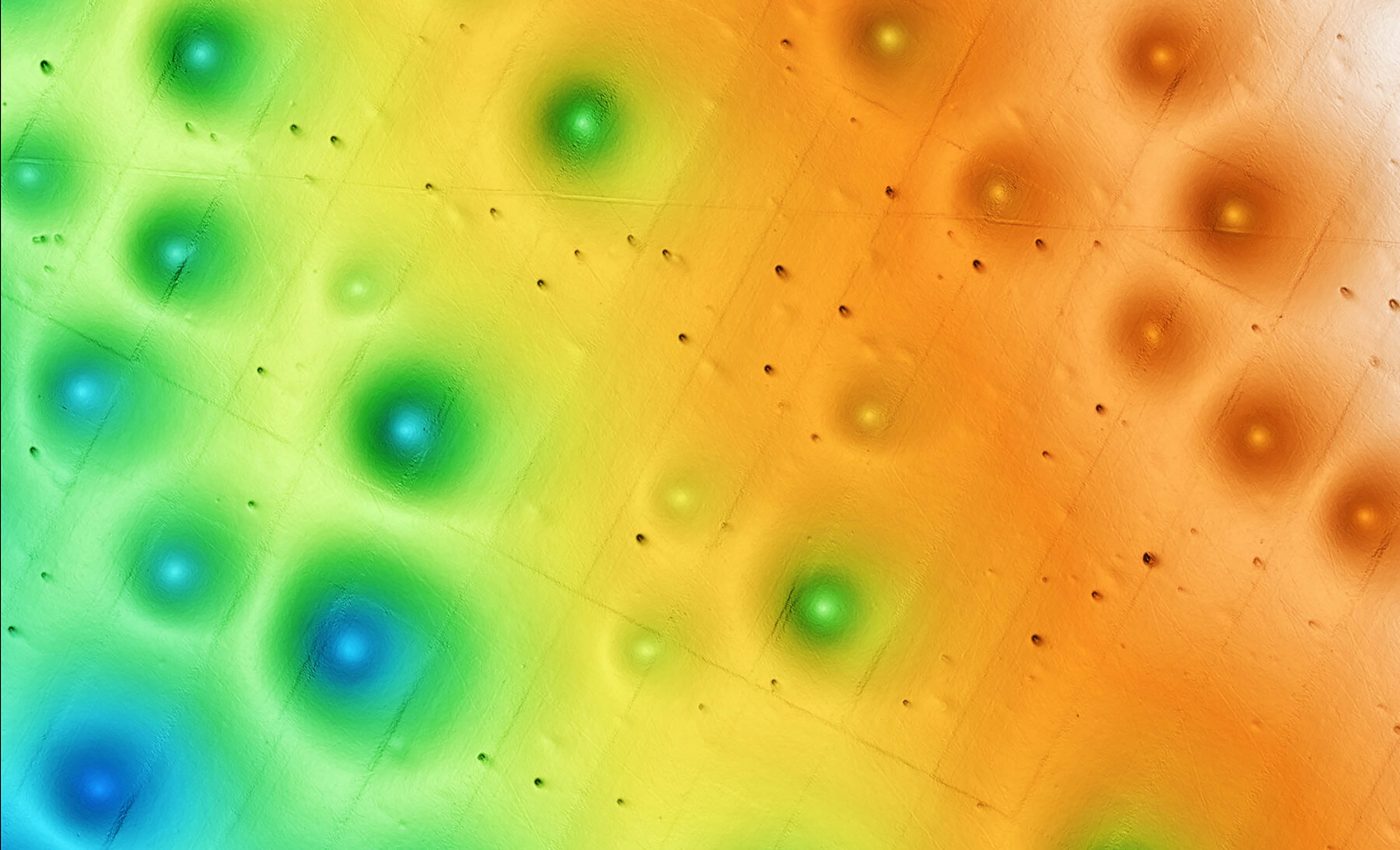
Seafloor full of large pockmarks
Autonomous underwater vehicles zipped barely yards above the bottom, beaming back sonar so sharp it mapped individual ripples of sand.
The survey refined ship‑based maps and revealed that most pockmarks sit almost perfectly spaced apart, each nearly circular and averaging 656 feet across.
Back at mission control aboard the research vessel, experts from the Monterey Bay Aquarium Research Institute (MBARI), the U.S. Geological Survey (USGS), and Stanford University watched the topography scroll across their monitors at one‑foot resolution.
The robots also carried a CHIRP sub‑bottom profiler, a sound cannon that peeks some 25 feet beneath the mud.
Instead of pockets of gas, profiles showed neat layers: thin bands of fine silt interrupted by coarser sand sheets. Those buried sand sheets hinted at something far more dramatic than gentle gas seepage.
Sending in the robots
Guided by the maps, MBARI’s remotely operated vehicle Doc Ricketts descended for 30 dives, clocking 185 hours of video and punching 107 vibracores and 433 shallow pushcores into the pockmark floors.
An additional cruise brought up piston cores nearly 25 feet long for comparison outside the craters. Not a whiff – chemical or acoustic – of methane turned up in any sample.
“There are many unanswered questions about the seafloor and its processes,” said MBARI Senior Research Technician Eve Lundsten.
“This research provides important data about the seafloor for resource managers and others considering potential offshore sites for underwater infrastructure to guide their decision‑making.”
Seafloor avalanches and pockmarks
Each core carried a timeline of turmoil. Fine mud settled quietly for millennia, then a blanket of gritty sand crashed in, marking a colossal underwater avalanche called a sediment gravity flow.
The team counted turbidite layers back at least 280,000 years, with the most recent flow sweeping through roughly 14,000 years ago.
When such a slurry roars downslope, it scours the center of every pockmark in its path and drops a fresh sand layer across the field in one go – resetting the craters like simultaneous footprints.

“We collected a massive amount of data, allowing us to make a surprising link between pockmarks and sediment gravity flows,” Lundsten explained.
“We were unable to determine exactly how these pockmarks were initially formed, but with MBARI’s advanced underwater technology, we’ve gained new insight into how and why these features have persisted on the seafloor for hundreds of thousands of years.”
Clean energy from seafloor pockmarks
Undersea avalanches strike tens of thousands of years apart, yet their legacy shapes today’s renewable energy blueprint.
Turbine foundations must grip rock‑steady ground for decades; a bubbling gas pocket could undermine that. The new findings relieve a major worry.
Instead of methane, the main architect here is long‑dormant sediment flow, meaning the crust has remained effectively quiet since well before humans started farming California’s Central Valley.
“Expanding renewable energy is critical to achieving the dramatic cuts in carbon dioxide emissions needed to prevent further irreversible climate change,” noted MBARI President and CEO Chris Scholin.
“However, there are still many unanswered questions about the possible environmental impacts of offshore wind energy development,”
Many questions still need answers
Although the study pinned down how the craters stay fresh, their birth story remains elusive.
Did an ancient mega‑flow carve the first depressions, or did subtle currents gradually nudge sediment aside until a small hollow invited bigger scours?
Computer models will test whether an unconfined flow racing over the dimpled plain can muster enough force to keep those bowls tidy without help from escaping gas.
Future research will also track how water and sediment swirl through the neighboring Lucia Chica and San Simeon Channels – twin conduits that may funnel slurries into the field.
For now, the Sur Pockmark Field stands as the best‑charted seafloor province on North America’s west coast, a natural laboratory where wind‑farm planners, geologists, and marine ecologists share common ground.
What they’ll find next is anyone’s guess.
The full study was published in the Journal of Geophysical Research Earth Surface.
—–
Like what you read? Subscribe to our newsletter for engaging articles, exclusive content, and the latest updates.
Check us out on EarthSnap, a free app brought to you by Eric Ralls and Earth.com.
—–


