Tropical Depression Kay losing strength
At 11 a.m. EDT (1500 UTC), the center of Tropical Depression Kay was located near 22.7 degrees north latitude and 120.1 degrees west longitude. That’s about 650 miles (1,045 km) west of the southern tip of Baja California, Mexico.
The depression was moving toward the west-northwest near 8 mph (13 kph) and the National Hurricane Center (NHC) said a gradual turn toward the west is forecast during the next 36 hours. Maximum sustained winds are near 35 mph (55 kph) with higher gusts. Tropical Depression Kay losing strength
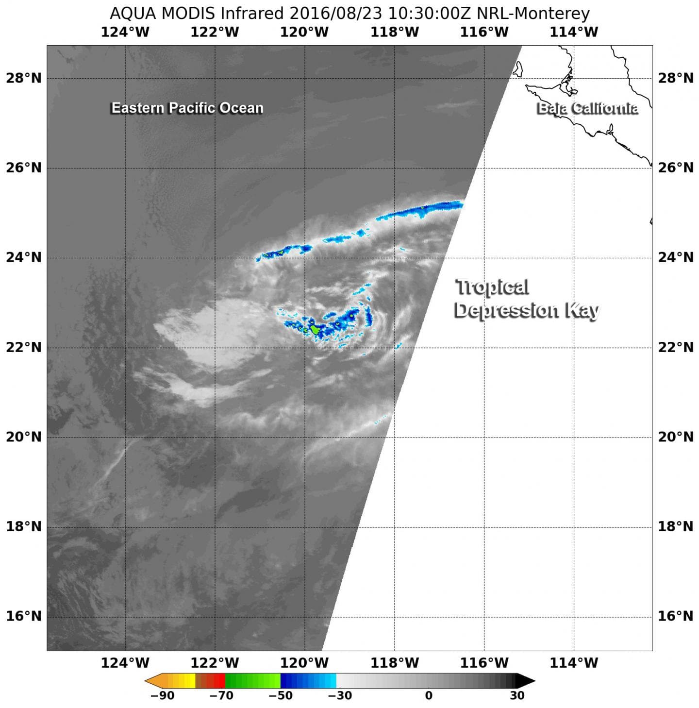
The Moderate Resolution Imaging Spectroradiometer or MODIS instrument aboard NASA’s Aqua satellite provided an infrared look at Tropical Depression Kay on Aug. 23 at 6:30 a.m. EDT (10:30 UTC). Kay had moved over cool waters near 77 degrees Fahrenheit (25 degrees Celsius) that sapped the convection (rising air that forms the thunderstorms that make up a tropical cyclone) and thunderstorm development. The MODIS image showed that Kay does not have any developing or existing thunderstorms. It just appears as swirl of low clouds. Tropical Storm Kay was the 15th tropical cyclone and 11th named storm of the 2004 Pacific hurricane season. Kay developed was a tropical depression on October 4 from an area of disturbed weather. Affected by persistent wind shear throughout its entire duration, Kay peaked
The NHC said that unless the convection makes an unexpected return, the cyclone should degenerate to a remnant low pressure area later today. A turn back toward the west is likely before the system dissipates completely in two days.


