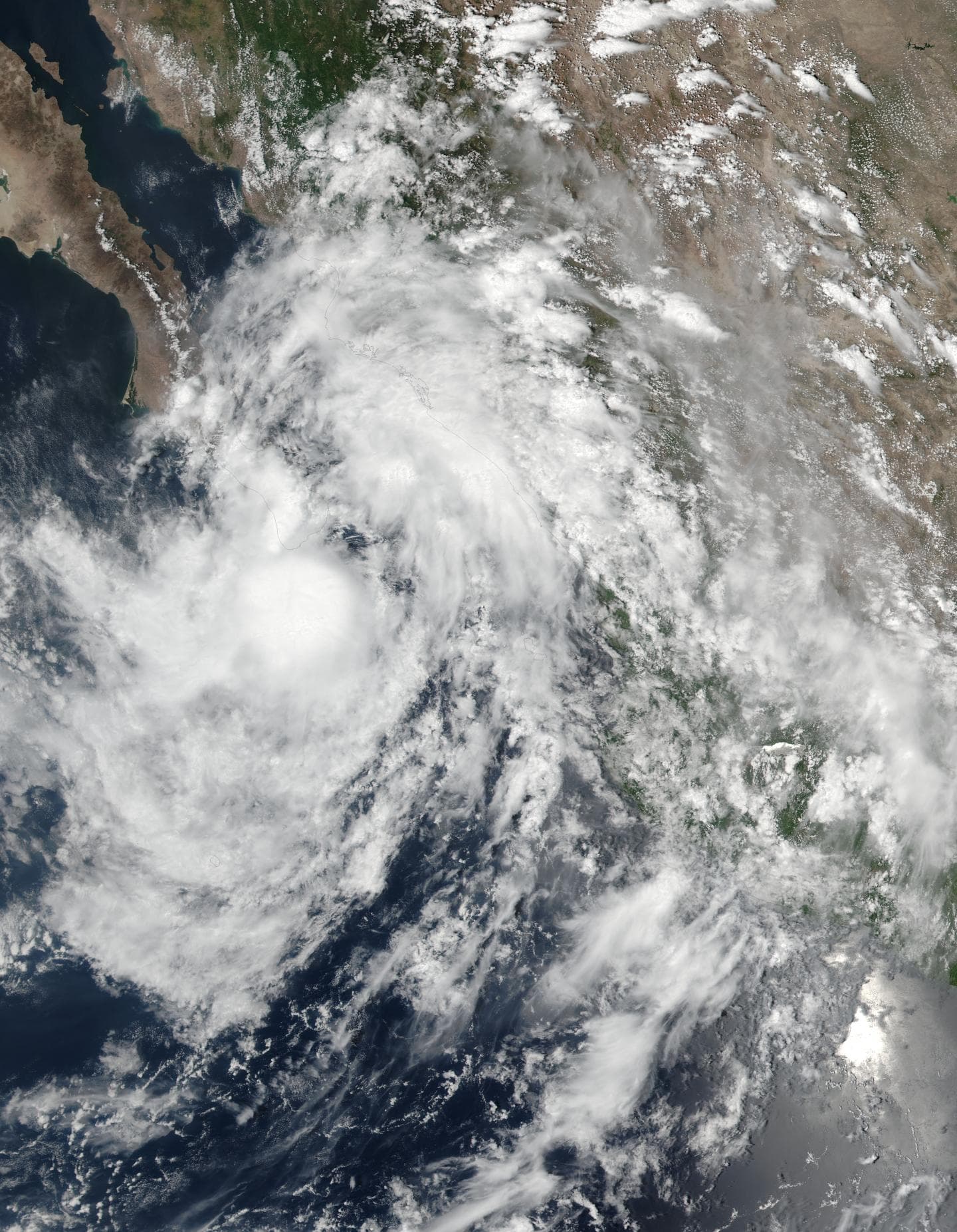
Tropical Storm Javier skims Baja California
On Aug. 8 at 4 p.m. EDT (20:00 UTC) the Visible Infrared Imaging Radiometer Suite (VIIRS) instrument aboard NASA-NOAA’s Suomi NPP satellite captured this visible light image of Tropical Storm Javier near the southern tip of Baja California, Mexico. The image showed the center of Javier just southeast of the Baja, while a fragmented band of thunderstorms were dropping heavy rainfall over land.
By Aug. 9 at 8 a.m. EDT (1200 UTC), the government of Mexico discontinued the tropical storm warning and tropical storm watch for the Baja California peninsula as Javier moved to the northwest and away from land. Also Tropical Storm Javier skims Baja California
At 8 a.m. EDT (1200 UTC) the center of Tropical Depression Javier was located near 23.4 degrees north latitude and 110.6 degrees west longitude. That’s about 50 miles (85 km) northwest of Cabo San Lucas, Mexico. Javier is moving toward the northwest near 6 mph (9 kph), and the National Hurricane Center (NHC) said this general motion is expected to continue through Wednesday.
Maximum sustained winds have decreased to near 35 mph (55 kph) with higher gusts. Tropical-storm-force winds extend outward up to 45 miles (75 km) from the center.
On the forecast track, the center of Javier is expected to move near or over Baja California Sur through Wednesday. Additional weakening is expected during the next couple of days, and Javier is forecast to become a remnant low within the next day or so.


