Tropical Storm Omais seen in infrared light
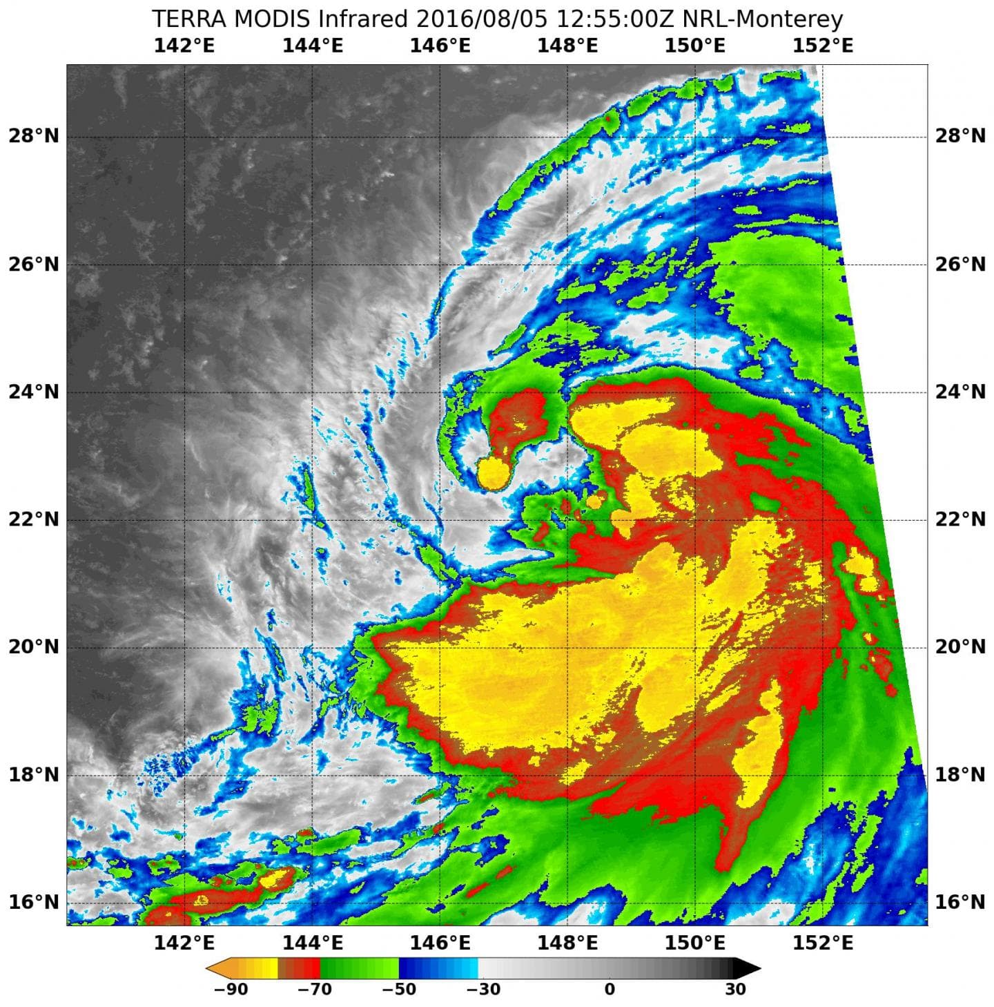
The Moderate Resolution Imaging Spectroradiometer, or MODIS, instrument that flies aboard NASA’s Aqua satellite captured infrared temperature data of the newly developed tropical storm on Aug. 4, 2016, at 8:10 a.m. EDT (12:10 p.m. UTC). The MODIS data showed cloud top temperatures as cold as minus 80 F (minus 62.2 C) in strong thunderstorms wrapped around the center of circulation. The largest area of thunderstorms stretches from the eastern to the southern quadrants of the storm. Temperatures that cold indicate strong uplift in the storm and cloud tops high into the troposphere. NASA research has shown that storms with cloud tops that cold have the ability to generate heavy rain.
At 11 a.m. EDT (3 p.m. UTC) on Aug. 5, Tropical Storm Omais’ maximum sustained winds increased to near 57 mph (50 knots/92 kph). The storm developed quickly from a low pressure area into a tropical storm. Omais was centered near 22.8 degrees north latitude and 147.5 degrees east longitude, about 367 nautical miles east-southeast of Iwo To island, Japan. Omais has tracked north-northeastward at 14.9 mph (13 knots/24.05.5 kph) and is expected to continue in a northerly direction. Tropical Storm Omais seen in infrared light
Omais is exptected to move on a northerly track and strengthen to a typhoon by Aug. 6 after passing far to the east of the island of Iwo To, Japan. It is then expected to continue tracking in a northerly direction through the northwestern Pacific Ocean.


