Fires in Ontario
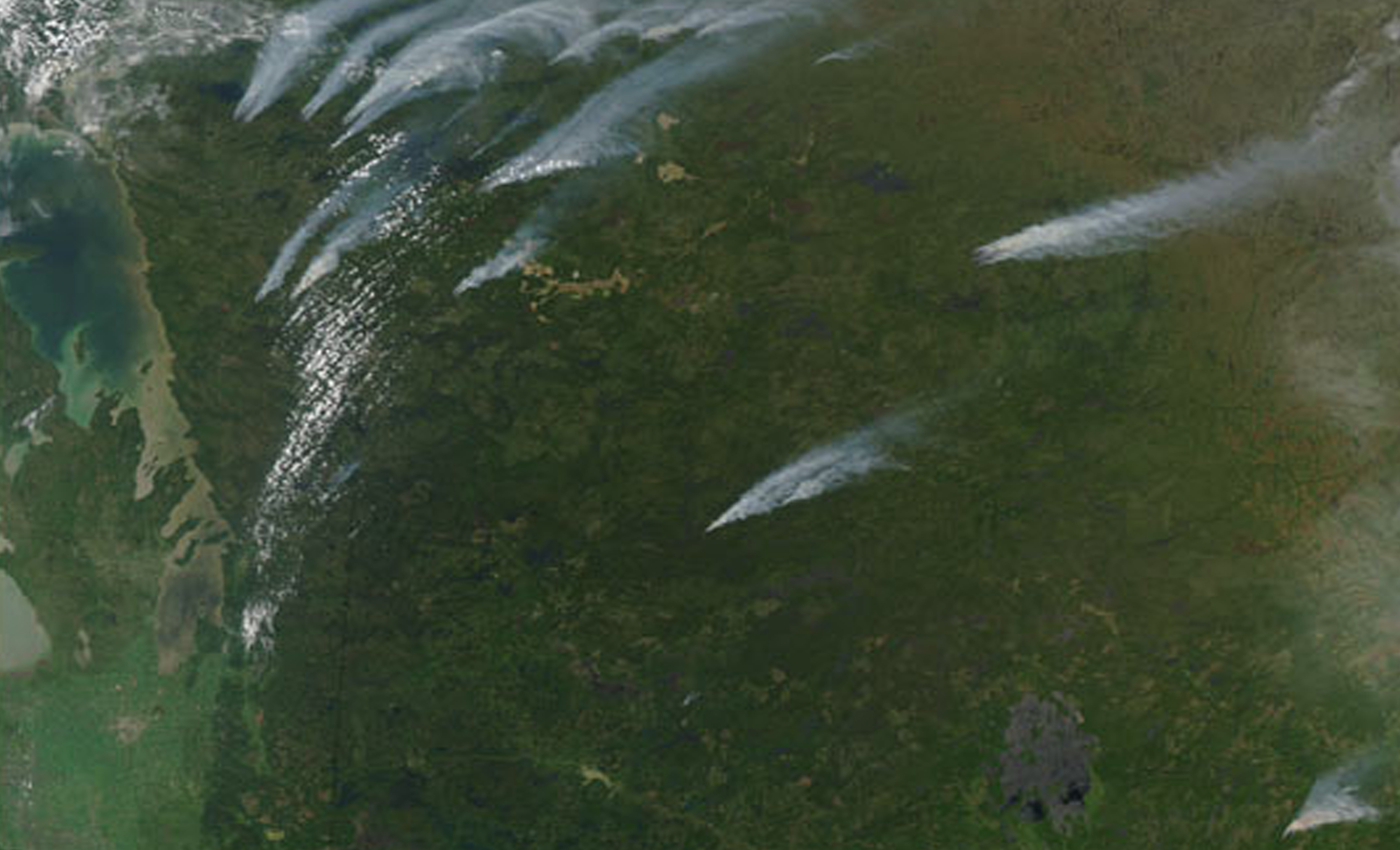

Fires in Ontario Summer wildfires were burning across Manitoba (far left) and Ontario (center and right) on June 20, 2003. This image of the region was captured by the Moderate Resolution Imaging Spectroradiometer (MODIS) on the Aqua satellite, and it shows numerous thick plumes of smoke drifting away from multiple fires. Hundreds of people have been forced from their homes by the smoke, including more than 700 people who had to be airlifted out of their remote town.
Ontario is bordered by the province of Manitoba to the west, Hudson Bay and James Bay to the north, and Quebec to the east and northeast, and to the south by the U.S. states of (from west to east) Minnesota, Michigan, Ohio, Pennsylvania, and New York. Almost all of Ontario’s 2,700 km (1,678 mi) border with the United States follows inland waterways: from the westerly Lake of the Woods, eastward along the major rivers and lakes of the Great Lakes/Saint Lawrence River drainage system. These include Rainy River, Pigeon River, Lake Superior, St. Marys River, Lake Huron, St. Clair River, Lake St. Clair, Detroit River, Lake Erie, Niagara River, Lake Ontario and the St. Lawrence River from Kingston, to the Quebec boundary just east of Cornwall. There is only about 1 km (0.6 mi) of land border, made up of portages including Height of Land Portage on the Minnesota borde
Credit: Image courtesy Liam Gumley, Space Science and Engineering Center, University of Wisconsin-Madison


