Flooding in Azerbaijan
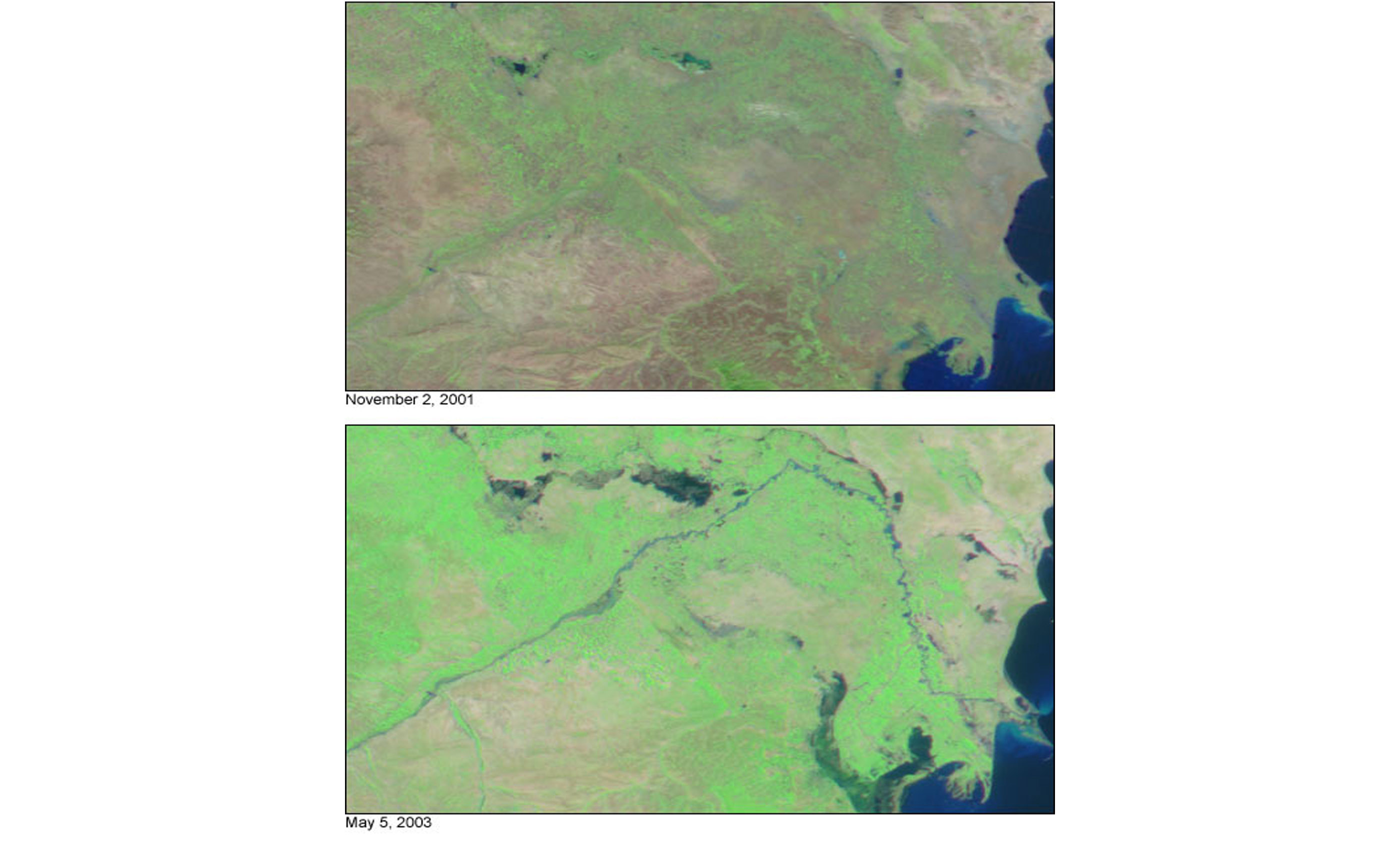

In early May 2003, Flooding in Azerbaijan and snowmelt from the Cacaucus Mountains combined with heavy rains led to flooding in Azerbaijan. The floods displaced thousands of people along the Araks and Kura rivers and caused over $50 million in damage.
The floodwaters can be seen in this false-color image (bottom) acquired on May 5, 2003. Also by the Moderate Resolution Imaging Spectroradiometer (MODIS) aboard NASAs Terra spacecraft. The Araks and Kura rivers can be seen streaming through the center of the image. Normally, these rivers would not even be visible in MODIS imagery (top, acquired on November 2, 2001).
In the above imagery, land is green and brown, water is blue and black, and clouds are light blue and white.
officially the Republic of Azerbaijan is a country in the South Caucasus region of Eurasia at the crossroads of Eastern Europe and Western Asia. It is bounded by the Caspian Sea to the east, Russia to the north, Georgia to the northwest, Armenia to the west and Iran to the south. The exclave of Nakhchivan is bounded by Armenia to the north and east, Iran to the south and west, and has an 11 km (6.8 mi) long border with Turkey in the northwest.
Credit: Image by Jesse Allen, based on data from the MODIS Rapid Response Team at NASA-GSFC


News coming your way
