Remnants Of Tropical Storm Bill

Tropical Storm Bill, the second named storm of the 2015 Atlantic Hurricane Season, proved to be a super-soaker, dropping over a foot of rain in some locations as it slowly made its way across the United States mainland.
The storm first formed near Honduras as a disorganized but rain-filled group of thunderstorms on June 12. By June 15, the system had moved into the Gulf of Mexico and developed a center of circulation. It was named Tropical Storm Bill later that evening. By the morning of June 16, Tropical Storm Bill made landfall on Matagorda Island, Texas. Near the time of landfall, tropical-storm-force winds extended outward up to 150 miles (240 km) from the center. NASA view.
Once ashore, Tropical Storm Bill quickly weakened. However, despite becoming only remnants within just a few days Bill’s soaking capacity remained strong until it moved off the northeastern seaboard and over the Atlantic Ocean on June 22.
According to the National Weather Service, at least 14 states plus Washington, DC received substantial rain from this storm. Some of the highest totals listed included Fordland, Missouri with 8.25 inches, several towns in Oklahoma, with Healdton the highest at 12.53 inches and several cities in Texas, with Montague leading at 12.50 inches. The Weather Channel reported that record flooding was reported at the Washita River at Dickson, Oklahoma with a new record level of 48.7 feet on June 19, breaking the record set in 1987 by more than 3 feet. Record flooding was also reported on West Mustang Creek near Ganado, Texas, the Lavaca River near Edna, Texas, and the James River near Springfield, Missouri.
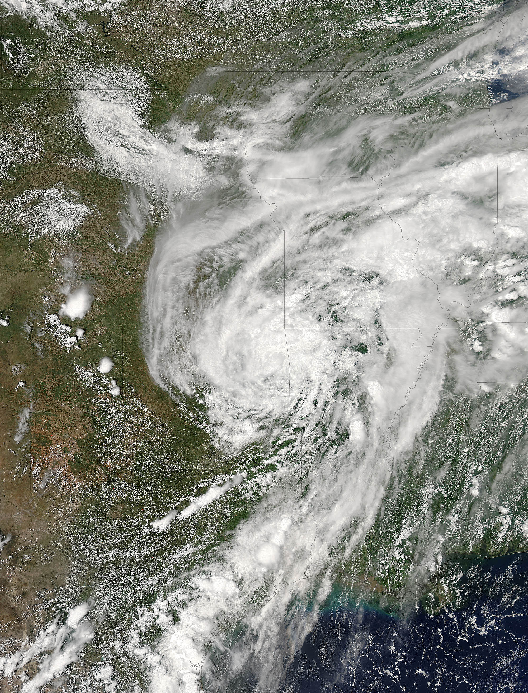
The Moderate Resolution Imaging Spectroradiometer (MODIS) aboard the Aqua satellite captured this true-color image of Tropical Depression Bill’s remnants over the central United States on June 18 at 19:45 UTC (3:45 p.m. EDT). At that time, Bill’s center was located in northeastern Oklahoma. The image showed that moisture from the Gulf of Mexico continued to stream into the center of circulation from the south and the east of the center.
—


