The Black Sea Basin
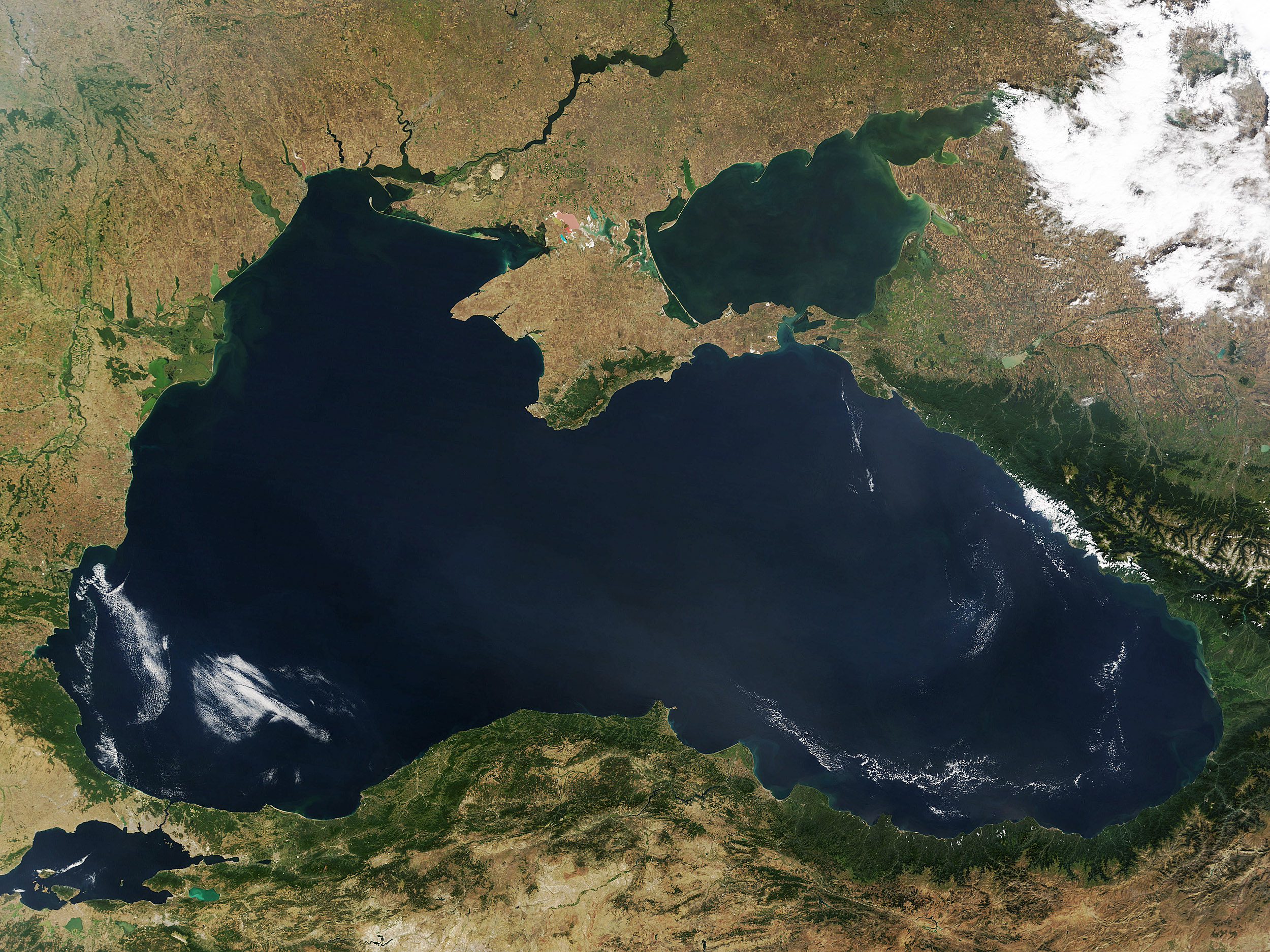

The Black Sea Basin Skies were clear and nearly cloudless over the Black Sea basin on September 2, 2015. The Moderate Resolution Imaging Spectroradiometer (MODIS) aboard NASA’s Terra satellite captured this true-color image at 08:35 UTC (4:35 am EDT) that same day.
A bright white cloud bank lies over Russia, and smaller, thinner clouds are scattered over the southwest Black Sea as well as paralleling the shore in the eastern section of the Sea. Tan color represents dry, relatively unvegetated land while green marks forests and grasslands. The water of the Black Sea appears dark blue, with swirls of sediment and possibly some phytoplankton visible.
The Black Sea spans an area of 168,495 sq. mi. (436, 000 sq. km.) and has a maximum depth of over 7.200 feet (2,200 meters). The Black Sea Basin is home to more than 160 million people, with several major cities along its banks, such as Istanbul, Turkey; Sochi, Russia; Poli, Georgia; Burgas, Bulgaria, Constanta, Romania; and Odessa, Ukraine. Therefore the Black sea basin has many dark blue sediments surrounding it, as seen in the image. Also you can see the white cloud overlaying the top of Russia and surrounding areas. The eastern part have thinner clouds.
—


News coming your way
