The Sinai Peninsula in Egypt
The Sinai Peninsula in Egypt Today’s Image of the Day from NASA Earth Observatory features the southwestern region of the Sinai Peninsula in Egypt. The peninsula serves as a land bridge between Asia and Africa.
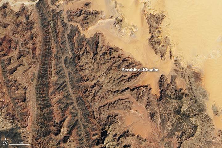
According to NASA, humans have inhabited Egypt’s Sinai Peninsula since prehistoric times and there are still traces of some of the peninsula’s earliest inhabitants, from fragments of an ancient alphabet to remnants of turquoise mines.
The Sinai Peninsula has a dry desert climate, yet is a mountainous region with a relatively high elevation, which makes it one of the cooler parts of Egypt. Its modern Arabic name is سِينَاء Sīnāʼ (Egyptian Arabic سينا Sīna; IPA: . The modern Arabic is an adoption of the biblical name, the 19th-century Arabic designation of Sinai was Jebel el-Tūr, which the name of the mountain is derived from a small town called El-Tor
The image was captured on March 11, 2021 by the Operational Land Imager (OLI) on Landsat 8. The Sinai Peninsula, or simply Sinai, is a peninsula in Egypt, and the only part of the country located in Asia. It is between the Mediterranean Sea to the north and the Red Sea to the south, and is a land bridge between Asia and Africa. Sinai has a land area of about 60,000 km² and a population of approximately 600,000 people. Administratively, the vast majority of the area of the Sinai Peninsula is divided into two governorates: the South Sinai Governorate and the North Sinai Governorate. Three other governorates span the Suez Canal, crossing into African Egypt: Suez Governorate on the southern end of the Suez Canal, Ismailia Governorate in the center, and Port Said Governorate in the north.
Image Credit: NASA Earth Observatory
–—
By Chrissy Sexton, Earth.com Staff Writer


News coming your way
