Tropical Cyclone Guambe approaches Mozambique
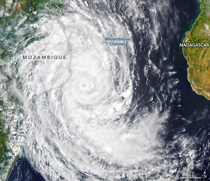
Today’s Image of the Day from NASA Earth Observatory shows Tropical Cyclone Guambe headed for Mozambique. The storm is approaching the southeastern coast of Africa less than a month after Tropical Cyclone Eloise brought widespread damage and severe flooding to this region.
The photo of Guambe was captured in the early afternoon on February 19, 2021 by the Moderate Resolution Imaging Spectroradiometer (MODIS) on NASA’s Aqua satellite. At this time, the storm had maximum sustained winds of about 100 miles per hour.
Guambe is the fourth tropical cyclone of the 2020–2021 South Indian Ocean season.Tropical Cyclone Guambe is a currently an active post-tropical cyclone in the Mozambique Channel. The eleventh tropical depression, eighth named storm, and the fourth tropical cyclone of the 2020–21 South-West Indian Ocean cyclone season, Guambe originated from a tropical disturbance in the Mozambique Channel on 10 February. Two days later, the system developed into a subtropical depression and made landfall in Mozambique. The storm proceeded to make a clockwise loop over the country for the next several days, while dumping prolific amounts of rainfall in the region, before re-emerging into the Mozambique Channel on 16 February. Soon afterward, the system strengthened into a moderate tropical storm and was named Guambe. A couple of days later, Guambe began undergoing rapid intensification, reaching tropical cyclone status on 19 February, and peaking as a Category 2-equivalent tropical cyclone shortly afterward. Afterward, Guambe underwent an eyewall replacement cycle and weakened back into a severe tropical storm on 20 February.
Image Credit: NASA Earth Observatory
—
By Chrissy Sexton, Earth.com Staff Writer


News coming your way
