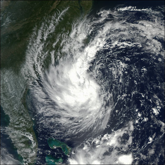
Tropical Storm Gustav

Tropical Storm Gustav. Tropical Storm Gustav is hovering off the coast of Georgia and the Carolinas in this true-color Moderate Resolution Imaging Spectroradiometer (MODIS) image from September 9, 2002. The image was acquired by the MODIS instrument on the Aqua satellite. Gustav kicked up heavy surf along the North Carolina coast and brought heavy rains to the region, but did not make landfall. Instead, the storm began to track northeast on September 10 and 11. With maximum sustained winds up to 70 miles per hour, it was still possible that Gustav might reach Category 1 hurricane status before moving northward into cooler waters that will cause the storm to weaken. Strike trajectories from Wednesday morning, September 11, indicate the storm could make landfall near Maine, New Brunswick, and Nova Scotia in about 24 hours.
Hurricane Gustav was the second most destructive hurricane of the 2008 Atlantic hurricane season. The seventh tropical cyclone, third hurricane, and second major hurricane of the season, Gustav caused serious damage and casualties in Haiti, the Dominican Republic, Jamaica, the Cayman Islands, Cuba and the United States. Gustav caused at least $8.31 billion in damages.
Credit: Image by Jesse Allen, based on data from the MODIS Rapid Response Team at NASA-GSFC


