Extensive survey of highway animal deaths reveal 'remarkable carnage'
A year of weekday surveys on two highways cutting across Alligator River National Wildlife Refuge turned up 5,044 dead vertebrates. The public year one report from conservation scientists documents what died, where, and when.
The count spans U.S. 64 and 264 in Tyrrell and Dare counties in northeastern North Carolina. The work is meant to guide how, and where, to keep animals off the asphalt and drivers out of danger.
Counting highway animal deaths

The team found 144 species across the route. That tally includes 1,050 snakes, 1,186 turtles, 1,529 frogs, 801 birds, and 450 mammals.
Warm months brought more reptiles and amphibians, while winter produced a surge of small songbirds. The survey provides a baseline, a starting dataset for later comparison, to judge whether fixes actually work.
“It’s pretty remarkable carnage, and we’re sure that’s an underestimate, because some things get removed by vultures,” said Ron Sutherland, the conservation group’s chief scientist.
The federal government’s landmark study estimates 1 to 2 million crashes with large animals each year in the United States. That report also puts the nationwide price tag for these collisions in the billions.
The same analysis finds a strong fix when it is done right. Pairing wildlife fencing, barrier that guides animals along roads, with dedicated crossings can cut collisions by about 80 percent or more.
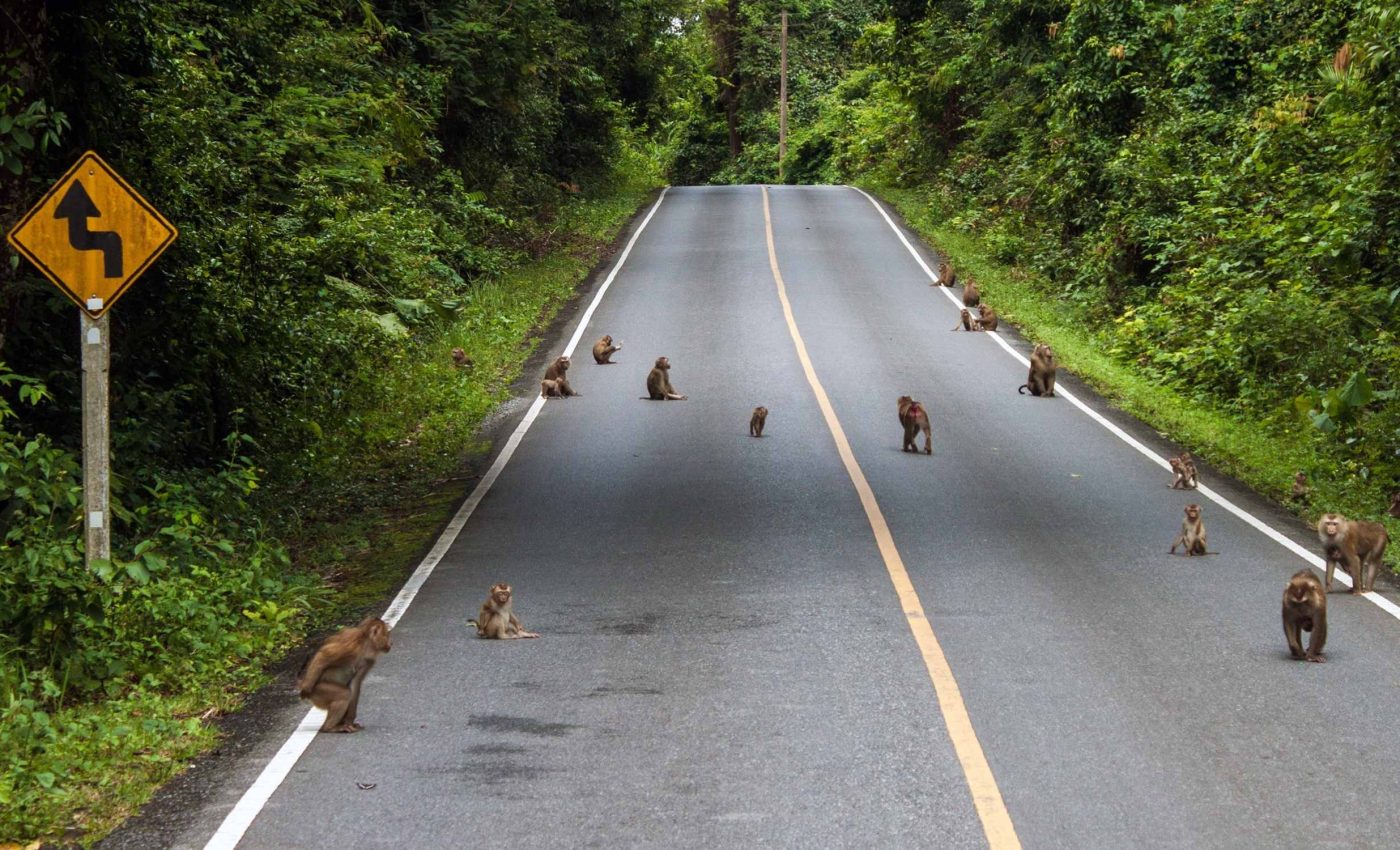
Animals on highway 64
A federal grant will put that approach to the test on the Outer Banks gateway. The official FHWA grant selections earmark $25 million to install multiple underpasses and fencing on U.S. 64 inside Alligator River National Wildlife Refuge.
Each underpass only works when fencing funnels wildlife to it. The structures are also designed to protect drivers who now encounter bears, deer, and other large animals at highway speeds.
The red wolf’s precarious status raises the stakes along this corridor. A USFWS-commissioned analysis documented 91 red wolves killed on roads from 1987 to 2022, including 19 along U.S. 64.
“One happy surprise is we didn’t see any red wolves,” said Sutherland, confirming they did not record a wolf fatality during the first year of daily removals of carcasses along the route.
Hidden toll on ecosystems
Each animal carcass along highway shoulders represents more than an individual loss. When amphibians, snakes, and small mammals vanish in large numbers, predators like hawks, foxes, and even red wolves lose crucial food sources.
Roadkill isn’t just an accident, it subtly reshapes local food webs and reduces the genetic exchange that healthy populations depend on.
Ecologists warn that these fragmented habitats can accelerate population decline. As roads carve through wetlands and forests, isolated pockets of wildlife struggle to recover from the daily attrition.
In that sense, the survey’s numbers may reveal not only what’s dying, but what could soon disappear from the landscape altogether.
Rethinking road ecology
Rising seas and stronger storms are already reshaping the low-lying coastal plain that these highways cross.
Saltwater intrusion is creeping inland, altering canals and wetlands that once supported amphibians and reptiles, species now found less often as roadkill.
Researchers suspect that shifts in canal salinity, drainage, and vegetation are quietly redefining which animals still move through the corridor and when they do so.
Climate resilience has therefore become part of the design conversation. The planned underpasses will double as drainage routes, keeping floodwaters from trapping wildlife on the asphalt during storms.
Elevating portions of U.S. 64 also gives the highway a longer future, protecting both travelers and the ecosystems it bisects.
What changed since the old surveys
Earlier work on nearby stretches of U.S. 64 found even higher amphibian death tolls. A University of Central Florida report logged 27,886 road-killed animals over a little more than two years, mostly frogs, during 2009 to 2011.
Method and weather can shape what observers see, so year two data will help sort signal from noise. Salty roadside canals may also matter for reptiles and amphibians, so the team is watching salinity, the amount of salt dissolved in water, along the shoulders.
Animals, highways, and next steps
North Carolina’s project aims to steer animals to safe passages and measure the outcome. With year one complete, the baseline, starting dataset for later comparison, will let researchers test whether crossing structures deliver the promised reductions.
Hotspots will guide where to place each structure for the most benefit. A hotspot, location with unusually frequent incidents, is where a crossing can save both wildlife and people.
The structure plan favors the species that collide most often with cars. That includes deer and bears, but also smaller species that move through roadside ditches and canals at night.
—–
Like what you read? Subscribe to our newsletter for engaging articles, exclusive content, and the latest updates.
Check us out on EarthSnap, a free app brought to you by Eric Ralls and Earth.com.
—–


