Incredibly valuable deposit of 'white gold' discovered in the U.S.
Batteries run our phones, cars, and a growing slice of the electric grid. Lithium, also known as “white gold,” keeps those batteries humming, yet the U.S. still leans on imports.
Finding domestic sources that make sense – geologically, economically, and environmentally – could steady supply and create jobs.

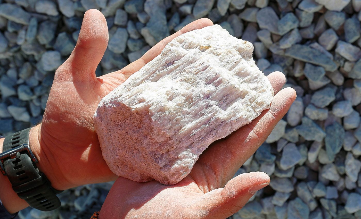
Saltwater trapped in deep rocks – called brine – is one candidate. In southern Arkansas, that brine carries tiny amounts of lithium.
A U.S. Geological Survey-led study discovered a very promising deposit – between 5 and 19 million tons of lithium reserves are located beneath southwestern Arkansas.
“Lithium is a critical mineral for the energy transition, and the potential for increased U.S. production to replace imports has implications for employment, manufacturing and supply-chain resilience,” explained David Applegate, USGS Director.
Studying the Arkansas lithium deposit?
The core question is simple: how much lithium might be down there, and where is it likely to sit?
A recent analysis set out to estimate how much dissolved lithium is present in the brine of a well-known rock layer, and to map where concentrations are probably higher or lower across the region.
The goal wasn’t to design an extraction facility. It was to turn scattered measurements into a clear regional picture.
After building that picture, the team translated concentrations into a rough total quantity – an in-place estimate.
“Our research was able to estimate total lithium present in the southwestern portion of the Smackover in Arkansas for the first time,” said Katherine Knierim, a hydrologist and the study’s principal researcher.
“We estimate there is enough dissolved lithium present in that region to replace U.S. imports of lithium and more.”
Rocks, brine, and lithium
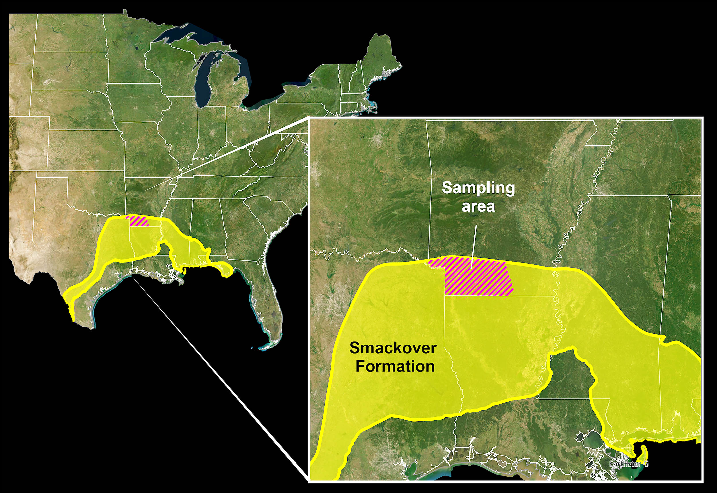
The focus is the Smackover Formation, a Jurassic-age layer that stretches under parts of the Gulf Coast, including southern Arkansas.
Over millions of years, water moved through its pores, picked up minerals from the rock, and turned into brine.
Some wells in this formation have shown especially high lithium concentrations – over 100 milligrams per liter in several places – so the formation has been on scientists’ radar as a promising target.
The team pulled lithium measurements from older studies and added new samples collected in 2022. Those numbers span a wide range, from trace levels to as much as 477 milligrams per liter.
To fill gaps between wells, the researchers used a random forest model trained on the well data along with geologic and geochemical clues.
The resulting prediction grid shows broad patterns across southern Arkansas, with each predicted cell covering about two square miles.
Running the numbers
Concentration alone doesn’t tell you the total resource. You also need to know how much brine the rock can hold.
The team tested several reasonable porosity scenarios – 10 percent, 20 percent, and 30 percent – then combined those with the predicted concentrations across the map.
The calculations yield an in-place range in the millions of metric tons for southern Arkansas.
In-place is not the same as recoverable. It’s a snapshot of what might exist underground before you account for technology, costs, or environmental limits.
The study does not estimate what current or emerging extraction methods could actually produce.
“It is important to caution that these estimates are an in-place assessment. We have not estimated what is technically recoverable based on newer methods to extract lithium from brines,” Knierim explained.
The region already moves brine for oil, gas, and bromine production. In 2022, those operations brought large brine volumes to the surface.
Based on the model’s concentrations, the team found that existing operations likely carried thousands of metric tons of dissolved lithium to the surface in waste streams.
High-tech lithium brine extraction
Direct lithium extraction methods aim to pull lithium from brine with smaller surface footprints than hard-rock mining.
Whether these approaches can work here at scale depends on engineering performance, water handling, power use, and costs.
Pairing any future recovery steps with facilities that already handle brine could reduce new infrastructure needs, if the economics work.
Predictions carry uncertainty, and the authors make that clear. They report low, middle, and high cases and carry that bracket through to the total resource range.
The map is regional by design, meant to guide broader decisions rather than pinpoint a single well site.
Next steps at the Smackover Formation
Work like this blends field sampling, lab chemistry, geological interpretation, and data science. Geologists gather cores and fluids.
Chemists measure what’s dissolved. Modelers connect the dots where no wells exist. Engineers – from process to environmental – evaluate what could be built, if anything, and how to do so responsibly.
To sum it all up, this is all very good news for the U.S. tech sector. Southern Arkansas’s Smackover Formation likely holds a sizable in-place lithium resource in brine.
The numbers are legit – they come from real measurements made by a team from the USGS, expanded with AI machine learning, and reported with clear limits.
The full study was published in the journal Science Advances.
—–
Like what you read? Subscribe to our newsletter for engaging articles, exclusive content, and the latest updates.
Check us out on EarthSnap, a free app brought to you by Eric Ralls and Earth.com.
—–


