NASA sees Hurricane Darby's clouded eye
NASA sees Hurricane Darby’s clouded eye. The Suomi NPP satellite passed over Hurricane Darby and saw clouds in its eye as the storm continued tracking west in the Eastern Pacific Ocean.
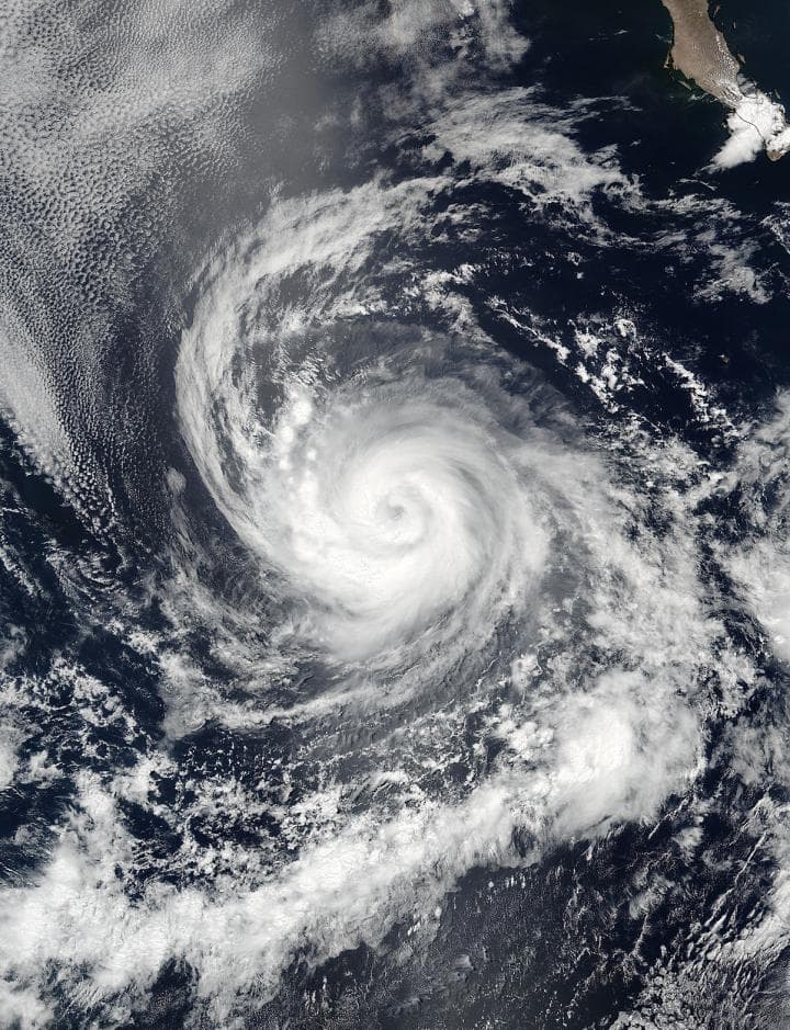
On July 14 at 21:05 UTC (5:05 p.m. EDT the Visible Infrared Imaging Radiometer Suite (VIIRS) instrument aboard the NASA-NOAA-DOD Suomi NPP satellite captured a visible light image of Hurricane Darby in the Eastern Pacific Ocean. The VIIRS image revealed an eye with bands of powerful thunderstorms wrapping into the low level center of circulation.NASA sees Hurricane Darby’s clouded eye
Forecaster Beven at the National Hurricane Center in Miami, Florida noted that Darby has changed little in organization during the early morning hours on July 14, with satellite imagery showing a ragged 25 nautical mile-wide eye embedded in the central dense overcast. Central dense overcast is the large central area of thunderstorms surrounding its circulation center, caused by the formation of its eye wall. It can be round, angular, oval, or irregular in shape. Sometimes finding the center of circulation can be difficult and in those cases, forecasters use microwave imagery.
VIIRS collects visible and infrared imagery and global observations of land, atmosphere, cryosphere and oceans.
At 5 a.m. EDT (0900 UTC) on July 14 the center of Hurricane Darby was located near latitude 16.1 North, longitude 120.0 West. That puts Darby’s center about 805 miles (1,300 km) southwest of the southern tip of Baja California, Mexico.
The National Hurricane Center (NHC) said that maximum sustained winds are near 90 mph (150 kph) with higher gusts. Some strengthening is possible today, with weakening expected tonight and Saturday. Darby is moving toward the west near 12 mph (19 kph) and the NHC expects a turn toward the west-northwest later today and this motion should continue through Saturday. The estimated minimum central pressure is 982 millibars.
The NHC noted that some strengthening is possible today, July 14 while the center of Darby remains over relatively warm water. After that, the forecast track takes the cyclone over decreasing sea surface temperatures through 72 to 96 hours, possibly as cold as 24 degrees Celsius (75.2 degrees Fahrenheit). Because Tropical cyclones need sea surface temperatures of at last 26.6 degrees Celsius (80 degrees Fahrenheit) to maintain intensity, Darby is expected to weaken after today.


