Operation IceBridge completes 2016 Arctic spring campaign
Operation IceBridge completes 2016 Arctic spring campaign. Operation IceBridge, NASA’s airborne survey of polar ice, ended its eighth spring Arctic campaign on May 21. During their five weeks of operations, mission scientists carried out six research flights over sea ice and ten over land ice.
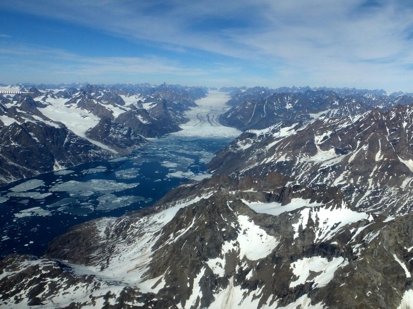
“We collected data over key portions of the Greenland Ice Sheet, like the fast-changing Zachariae Isstrom Glacier, and we got the broad geographic coverage of Arctic sea ice we needed,” said Nathan Kurtz, IceBridge’s project scientist and a sea ice researcher at NASA’s Goddard Space Flight Center in Greenbelt, Maryland. “This is an important continuation of the time series for Arctic ice, particularly with the very warm Arctic winter noticeably impacting sea ice retreat and ice sheet melt onset this year.” Operation IceBridge completes 2016 Arctic spring campaign
The 2016 Arctic campaign’s inaugural research flight took place April 19 aboard one of the National Oceanic and Atmospheric Administration’s Hurricane Hunter planes, a P-3 Orion. This year’s deployment was shorter than normal due to aircraft maintenance issues and persistent bad weather in the north of Greenland. The first part of the campaign –based out of Thule Air Base in northwest Greenland and also out of Fairbanks, Alaska– focused on sea ice.
“The good news is that we covered the entire western Arctic basin,” said Jackie Richter-Menge, IceBridge science team co-lead and sea ice researcher with the U.S. Army Corps of Engineers Cold Regions Research and Engineering Laboratory in Hanover, New Hampshire.
In the coming weeks, IceBridge scientists will be releasing a dataset of sea ice measurements that were collected during this deployment. Modelers will use the data –together with other measurements, such as those of the European Space Agency’s (ESA) CryoSat-2 satellite– to try to forecast how the upcoming melt season will evolve.
“This year we’re looking at the potential of an extremely low sea ice extent, so IceBridge’s measurements of sea ice will be particularly relevant,” Richter-Menge said.
During this campaign the IceBridge aircraft flew under the path of Sentinel-3A, a recently launched ESA satellite that carries a radar altimeter that gauges sea ice thickness. Scientists will compare the Sentinel-3A measurements to the data IceBridge collected over the same spots with its radar and laser altimeters. This comparison will help validate and refine Sentinel-3A’s data gathering.
The last leg of this year’s springtime Arctic deployment was based out of Kangerlussuaq, Greenland, and focused on measuring changes in the elevation of the ice sheet.
“Unlike with the sea ice portion of the campaign, we had a streak of good weather in Kangerlussuaq and the science flights picked up — we flew 10 out of 11 possible flight days,” said John Sonntag, IceBridge mission scientist. “It was a very positive way to end our deployment.”
This summer, IceBridge will conduct two additional campaigns to measure the impact of the melt season on Arctic sea and land ice. The first one will take place in late July and will be based out of Barrow, Alaska, focusing on the sea ice cover in the Beaufort Sea. The second one, planned for late August to early September, will be based in Kangerlussuaq, Greenland, and repeat land ice missions that IceBridge completed in May, to measure how fast ice thins during the upcoming melt season. The Barrow campaign will last about two weeks, while the Kangerlussuaq deployment will go on for three weeks.
While in Kangerlussuaq, Operation IceBridge hosted several visitors: a TV crew from Spain working on a documentary about climate change in the Arctic; a freelance photographer; four IceBridge-affiliated scientists; and Kelly McCarthy, a science and math teacher from Coal Township, Pennsylvania, who visited IceBridge through the National Science Foundation’s PolarTREC educational program.
Also new to the flights was Joe MacGregor, the recently-appointed IceBridge deputy project scientist and a land ice researcher with Goddard.
“It was a fantastic experience,” MacGregor said. “It was nice to experience the raw challenges of collecting data and the decision-making process involved in moving forward with the campaign.”
The mission of Operation IceBridge is to collect data on changing polar land and sea ice and maintain continuity of measurements between ICESat missions. The original ICESat mission ended in 2009, and its successor, ICESat-2, is scheduled for launch in 2018. Operation IceBridge is currently funded until 2019. The planned overlap with ICESat-2 will help scientists validate the satellite’s measurements.
During its eight years of operations in the Arctic, IceBridge has gathered large volumes of data on changes in the elevation of the ice sheet and its internal structure. Measurements from IceBridge have revealed a 460-mile-long (740 kilometers) canyon hiding under a mile of ice and mapped the extent of a vast liquid water aquifer beneath the snow in southern Greenland. IceBridge’s readings of the thickness of sea ice and its snow cover have helped scientists improve forecasts for the summer melt season and have enhanced the understanding of variations in ice thickness distribution from year to year.
###
NASA’s Wallops Flight Facility in Virginia provided the laser altimeter and one of the infrared cameras that were used during IceBridge’s 2016 Arctic spring campaign. IceBridge’s three radar instruments came from the Center for Remote Sensing of Ice Sheets at the University of Kansas, while NASA’s Ames Research Center at Moffett Field, California, provided the Digital Mapping System, and the University of Colorado loaned the second infrared camera.
For more about Operation IceBridge, visit: http://www. nasa. gov/ icebridge


