Satellite captures image of Tropical Storm Conson
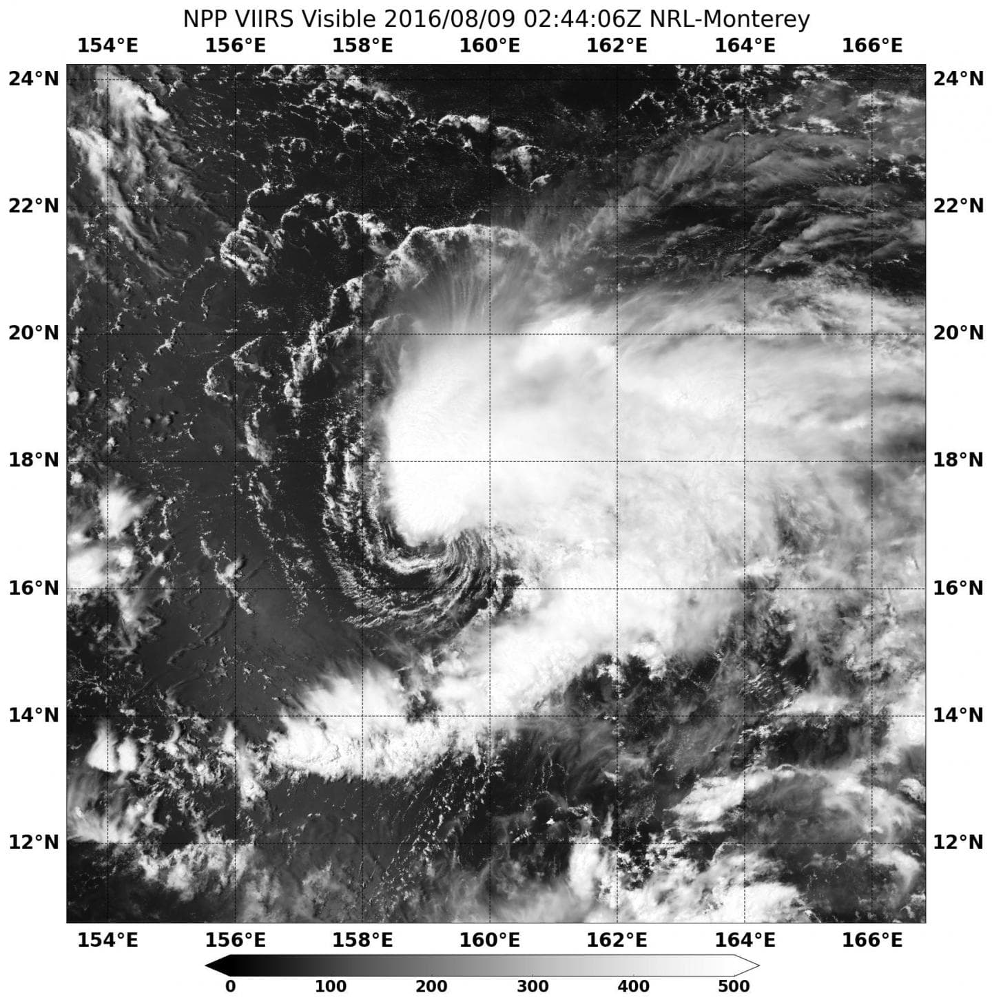
On August 8 at 10:44 p.m. EDT (Aug. 9 at 02:44 UTC) the Visible Infrared Imaging Radiometer Suite (VIIRS) instrument aboard NASA-NOAA’s Suomi NPP satellite captured a visible light image of Tropical Storm Conson. Southwesterly wind shear has pushed the bulk of clouds and showers to the northeast of the storm’s center. Fragmented bands of thunderstorms over the southern semi-circle were seen wrapping into the north quadrant of the exposed low-level center.
At 5 a.m. EDT (0900 UTC) on August 9, 2016 Tropical storm Conson was centered near 17.0 degrees north latitude and 158.7 degrees east longitude, about 382 nautical miles northwest of the Enewetak Atoll. The Enewetak Atoll is a large coral atoll of 40 islands and forms a legislative district of the Ralik Chain of the Marshall Islands.
Conson was moving to the west at 7 knots (8 mph/12.9 kph) and had maximum sustained winds near 35 knots (40 mph/62 kph).
Conson is expected to move into a more favorable environment that will allow it to intensify to typhoon strength over the open waters of the Northwestern Pacific Ocean on August 12, before weakening commences. The storm is expected to continue tracking in a northerly direction over the open ocean.


