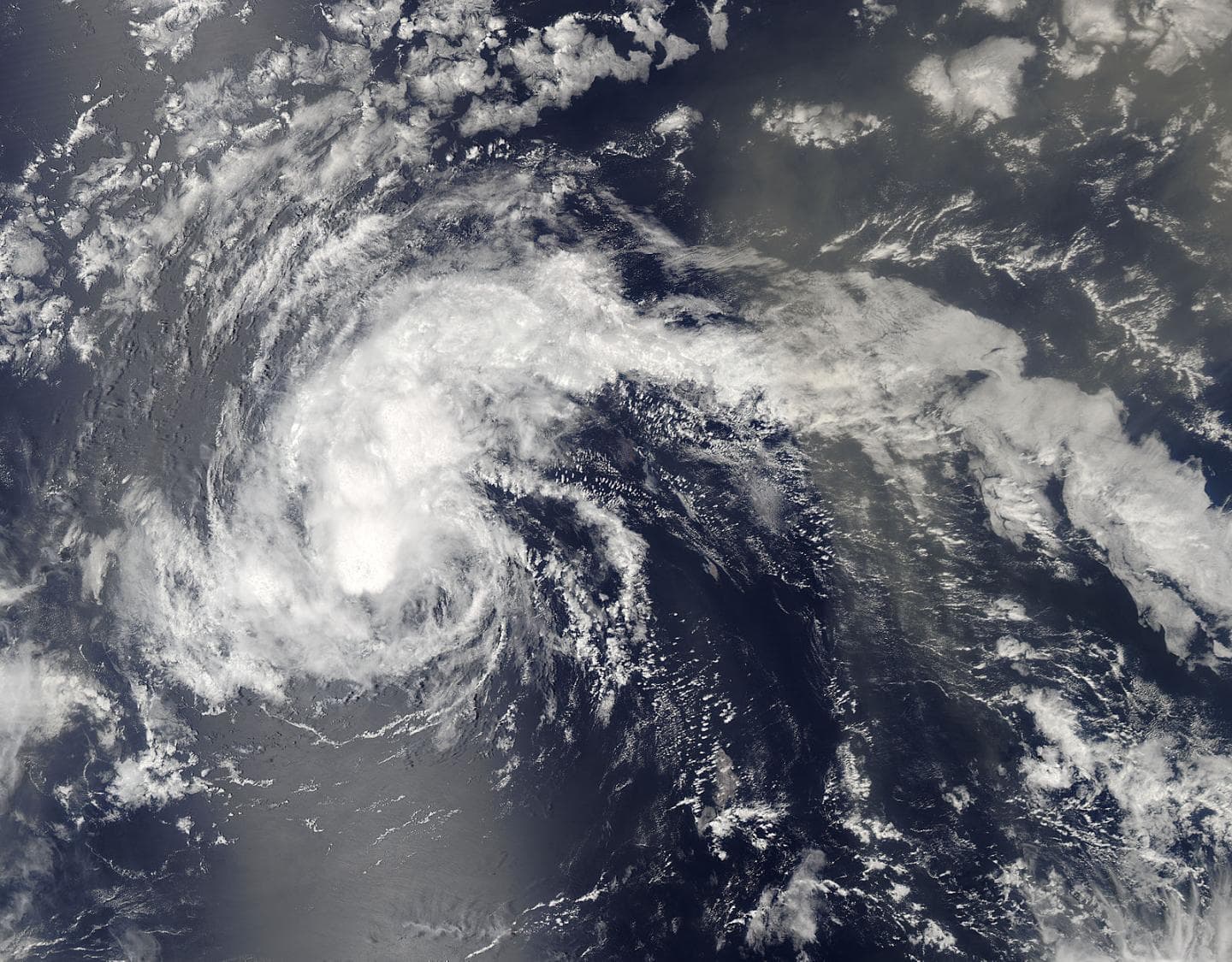
Southwesterly wind shear was affecting Tropical Storm Fiona
On August 18 at 12:05 p.m. EDT (16:05 UTC) the Moderate Resolution Imaging Spectroradiometer or MODIS instrument that flies aboard NASA’s Aqua satellite provided a visible light image Fiona. The image showed that strong thunderstorms and deep convection (rising air that forms them) circled the center and were being pushed to the northeast of the center. Also Southwesterly wind shear was affecting Tropical Storm Fiona causing massive damage.
The National Hurricane Center (NHC) reported microwave data suggest the center is near or south of the main area of thunderstorms, which is a sign of the ongoing southwesterly shear.
At 5 a.m. EDT (0900 UTC) on Aug. 19 the center of Tropical Storm Fiona was located near 17.6 degrees north latitude and 42.7 degrees west longitude. That’s about 1,240 miles (1,995 km) west of the Cape Verde Islands. Also you can see these strong storms causing a lot of damage due to strong winds and excessive amounts of rain.
Fiona was moving toward the west-northwest near 10 mph (17 kph), and this general motion with some increase in forward speed is expected over the next couple of days. Maximum sustained winds are near 45 mph (75 kph) with higher gusts. The estimated minimum central pressure is 1006 millibars.
NHC forecaster Blake said that “Little significant change is expected with Fiona’s intensity today due to gradually increasing shear. The storm should weaken over the weekend as the shear further increases, along with the likely entrainment of drier mid-level air.”


