Tropical Storm Celia move into central Pacific
Tropical Storm Celia move into central Pacific and has crossed 140 degrees west longitude line, which means the storm has moved from the Eastern into the Central Pacific Ocean. Infrared imagery from NASA’s Aqua satellite showed Celia had lost most of its punch.
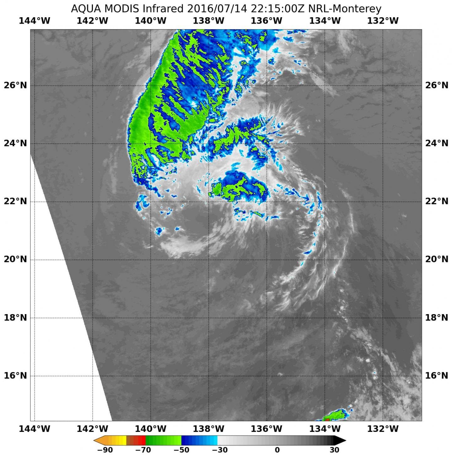
Enhanced infrared imagery from the MODIS instrument that flies aboard NASA’s Aqua satellite on July 14 at 22:15 UTC (6:15 p.m. EDT) and microwave imagery showed all that remains of Celia’s thunderstorms was a fragmented curved band storms about 60 nautical miles north-northeast of the exposed circulation center.
As of July 14, NOAA’s Central Pacific Hurricane Center (CPHC) was issuing advisories on Celia. At 5 a.m. EDT (0900 UTC), the center of Tropical Storm Celia was located near 22.0 degrees north latitude and 140.2 degrees west longitude. That’s about 975 miles (1,570 km) east-northeast of Hilo, Hawaii. Maximum sustained winds have decreased to near 45 mph (75 kph).
Celia is moving toward the west-northwest near 13 mph (20 kph). The system is expected to turn toward the west at about the same forward speed later today and continue in this general motion during the next couple of days.Tropical Storm Celia move into central Pacific
NOAA’s CPHC said that Celia should continue to gradually spin down, due to the sea surface temperatures below 24 degrees Celsius and the surrounding stable air mass, and become a post-tropical cyclone by tonight. Tropical cyclones need sea surface temperatures of at least 26 degrees Celsius (80 degrees Fahrenheit) to maintain intensity.
NOAA’s Central Pacific Hurricane Center noted that Celia will likely become a post-tropical cyclone today and a remnant low on Saturday.


